Maps of the Wollangambe Wilderness
Major Mitchell's Map -
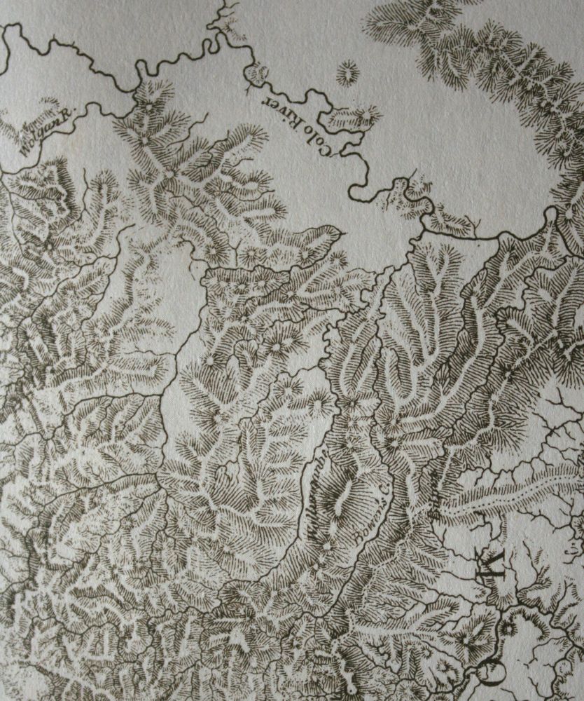
A small section of Major Mitchell's map of the Colony of NSW (1884) of
the Wollangambe - Colo country. Note the drainage pattern.
Assumed Drainage Pattern -
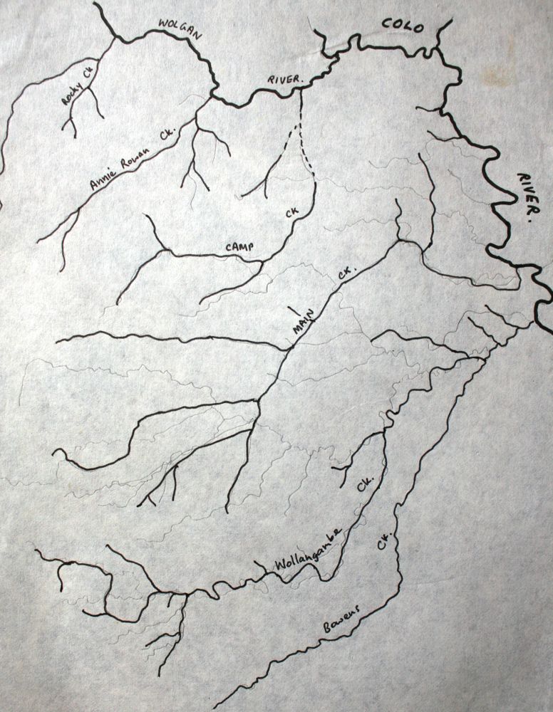
Above - For many years it was assumed that Main Creek was a major creek
(ie a "main creek" - hence its name) that drained a large part of the
country north of Mt Wilson. This assumption was based on observations
and plane table
surveying from high points that overlooked the country. One person
who realized that this may not be the case was Lt Col H G P Clews of
the Royal Australian Survey Corps, who was charged with mapping the
country around the Colo (1920's and 30's). Clews was one of a small
number of people who tried to penetrate this rough country. His
attempts to cross the Colo from trips starting near Colo Heights were
fraught with great difficulty. His story has been recorded in the
Waysider Magazine (Catholic Bushwalking Club). It was not till aerial
photos became available that the correct drainage pattern was
determined and the missing bits on the maps could be added.
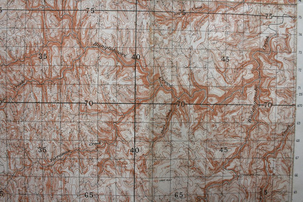
Actual Drainage Pattern -

It was then that the Wallerawang 1:63,360 Map (1 inch to the mile)
sheet was produced (1935) - here is part of it and some closer views -
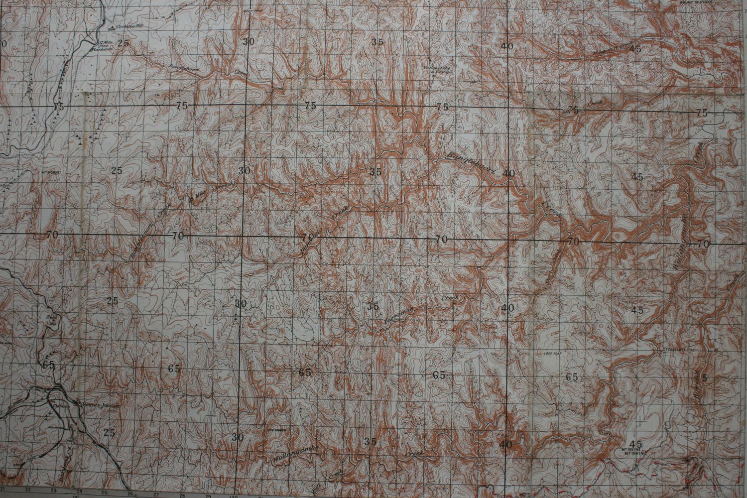
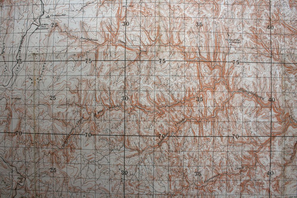
It was common to see the wrong drainage pattern on maps (eg general
road maps) as late as the 1960's and 70's.
On my first trips into the Wollangambe Wilderness we used the
Wallerawang sheet. Later in the late 70's 1:25,000 maps became
available.
Return to Greater Blue Mountains
Menu Page
Return to david-noble.net