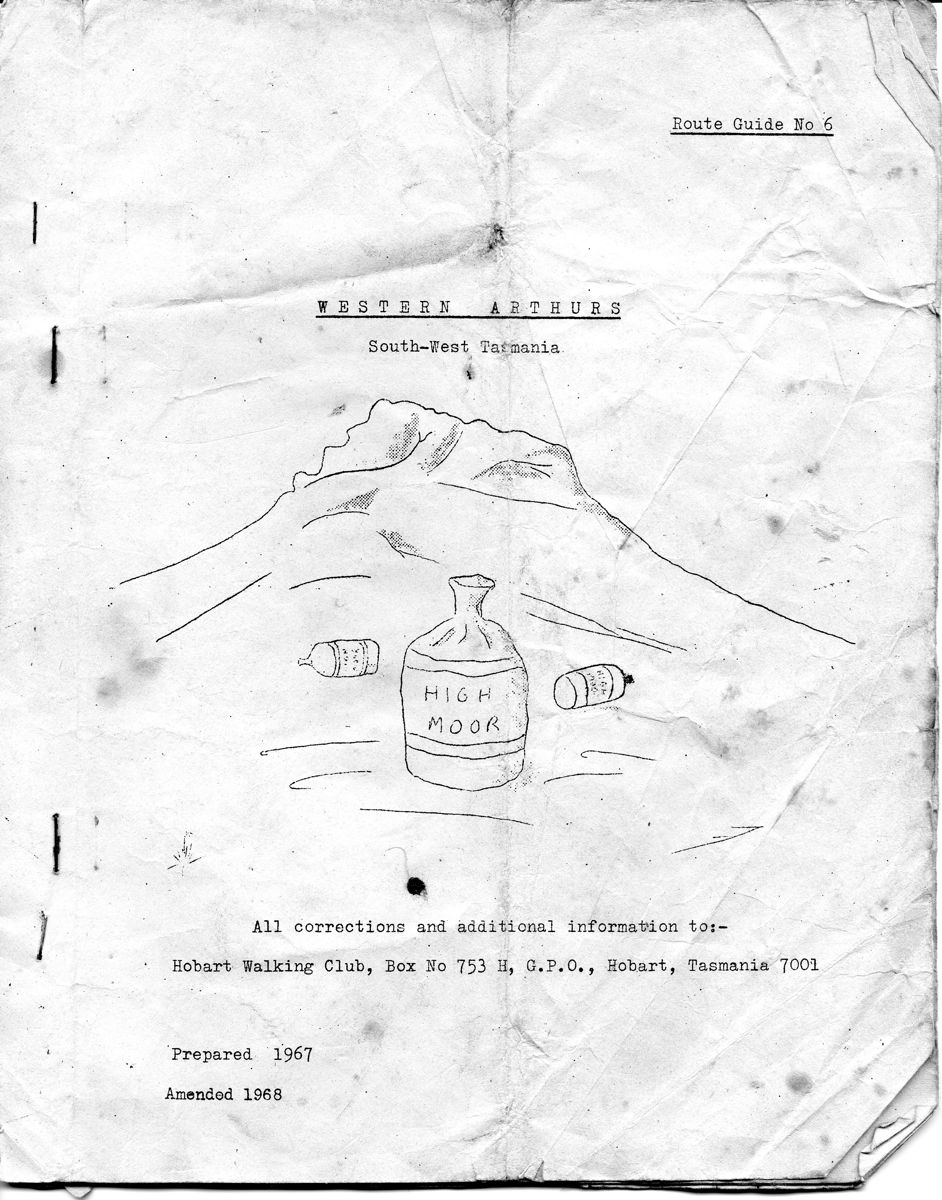
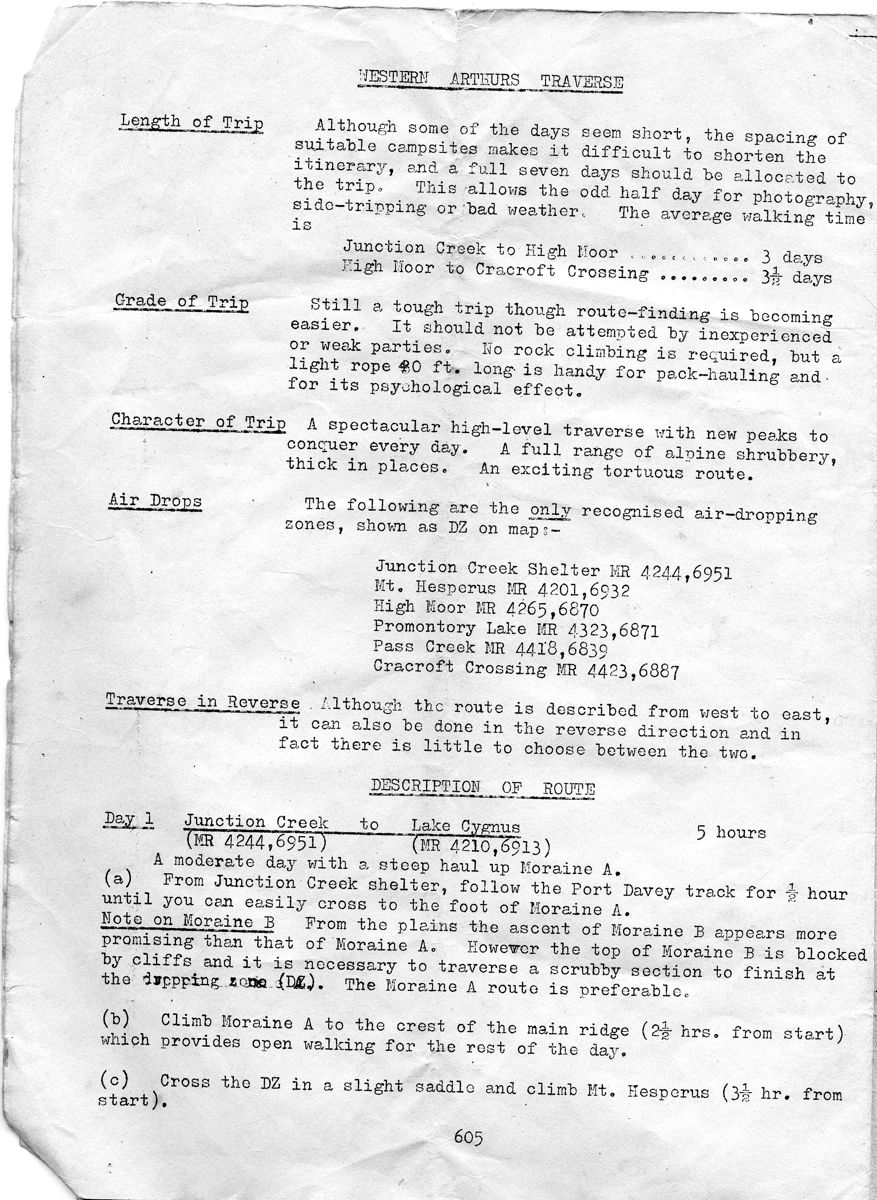
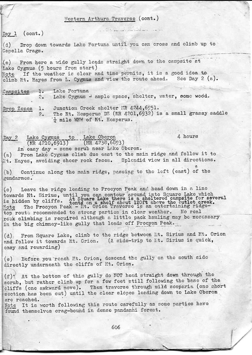
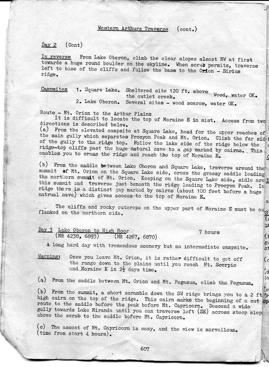
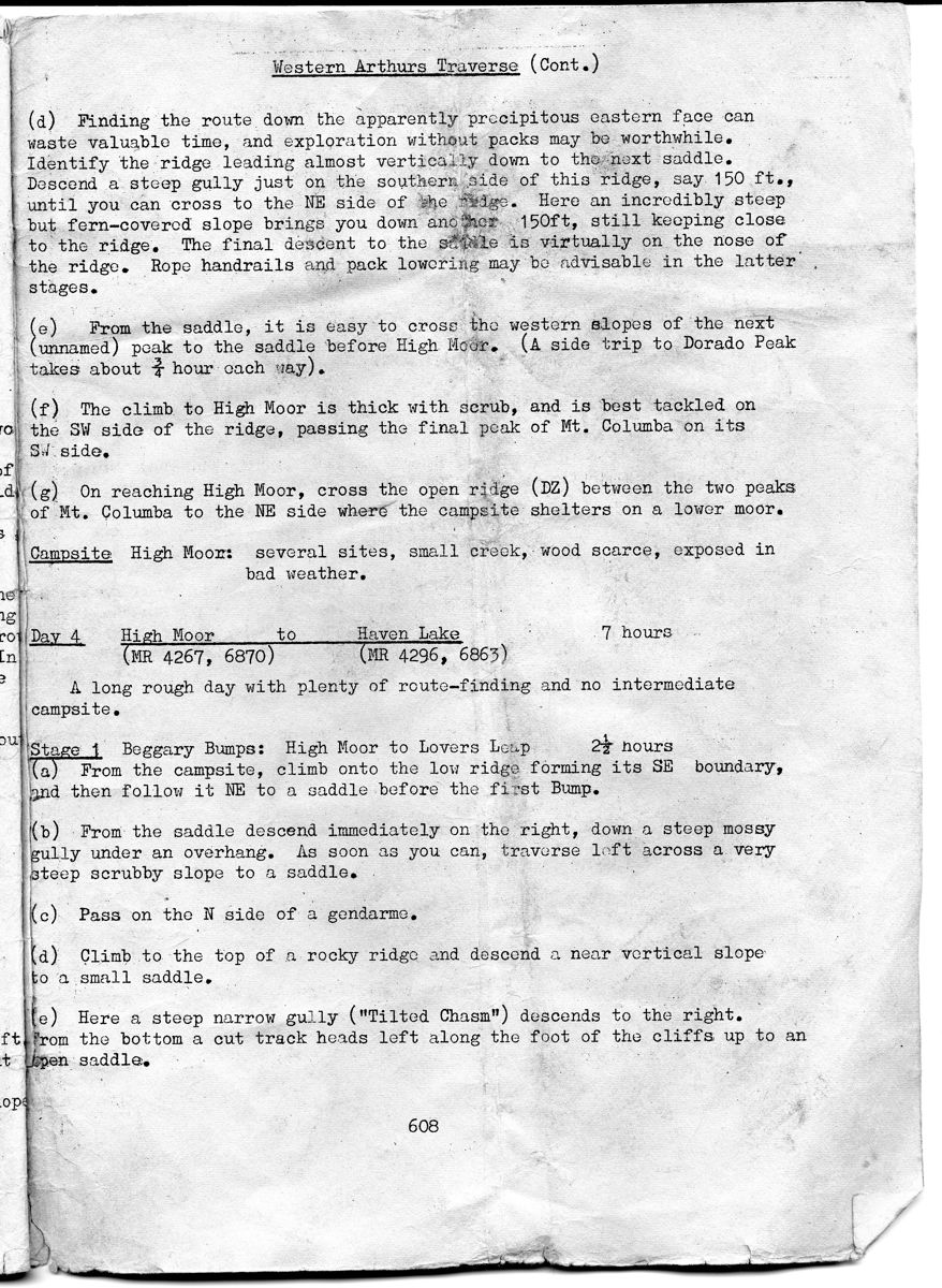
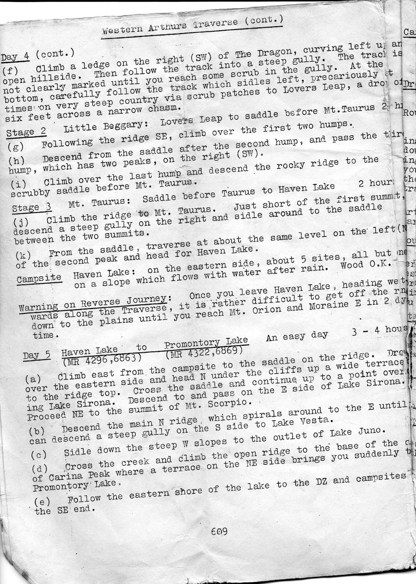
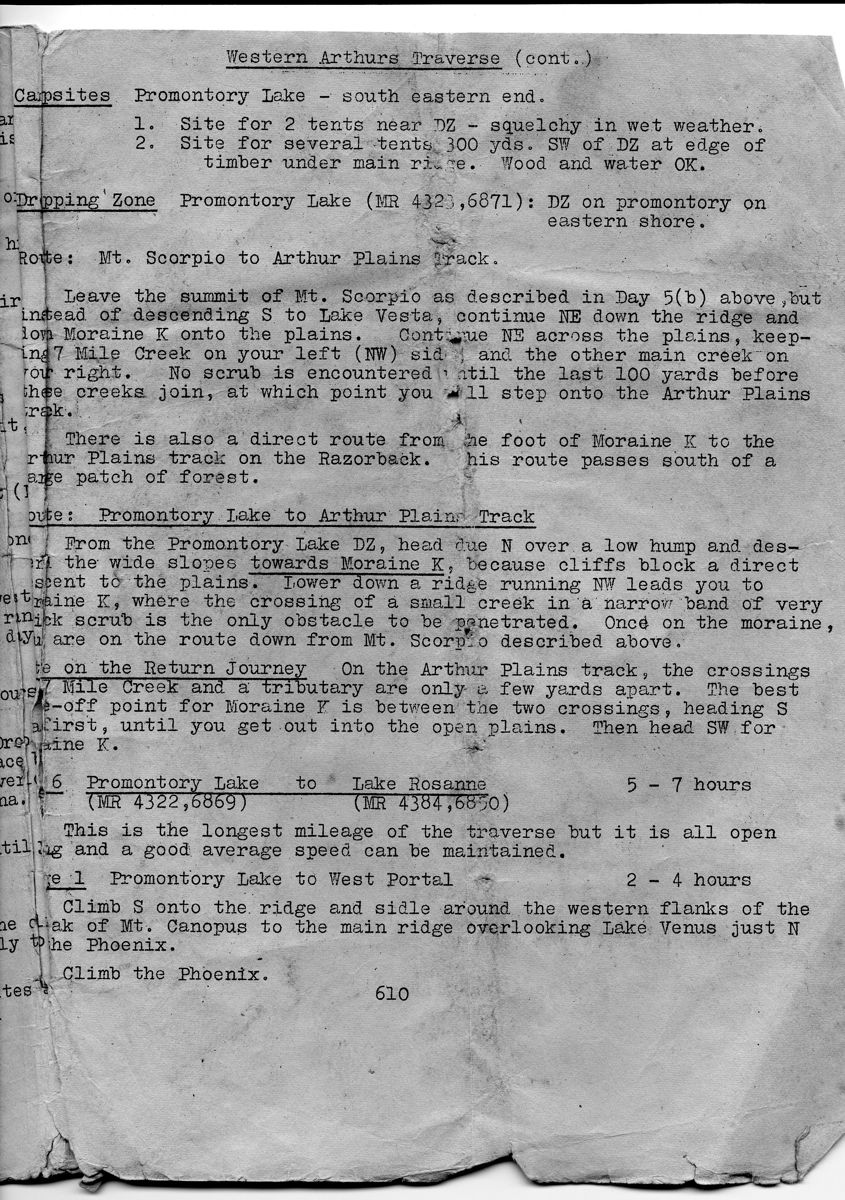
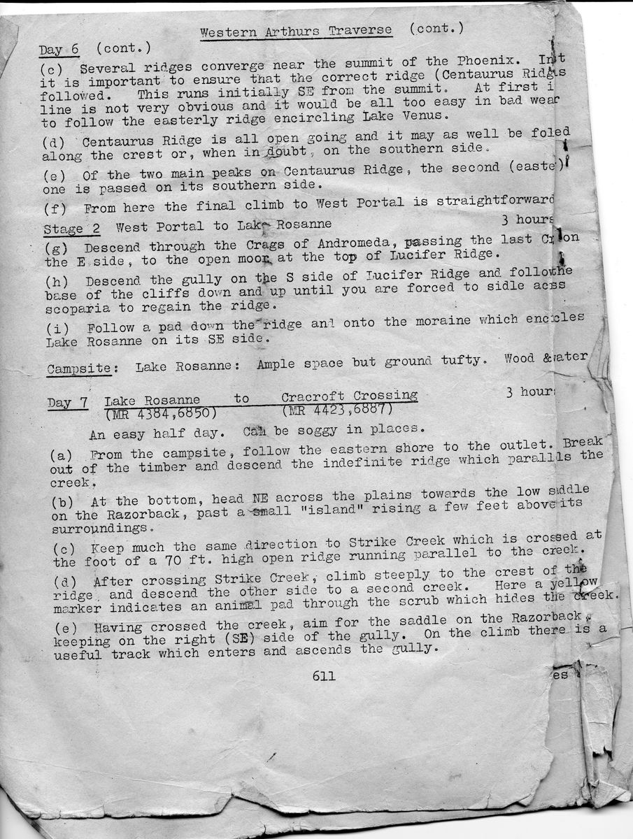
Some Old Tasmanian Route Guides and Maps
Below is a copy of the Hobart Walking Clubs Route Guides to the Western
Arthurs. This is what we used on our early trips through the range. As
well as the Western Arthurs (Route Guide Number 6) - the Hobart Walking
Club produced guides for the Eastern Arthurs and South Picton Range,
the Southern Ranges, the Mount Anne Circuit, the South Coast Track and
the Access Tracks


Above - Here is part of R N Smiths early sketch map of the Arthur
Range. Note - the favoured route used to be via Moraine B
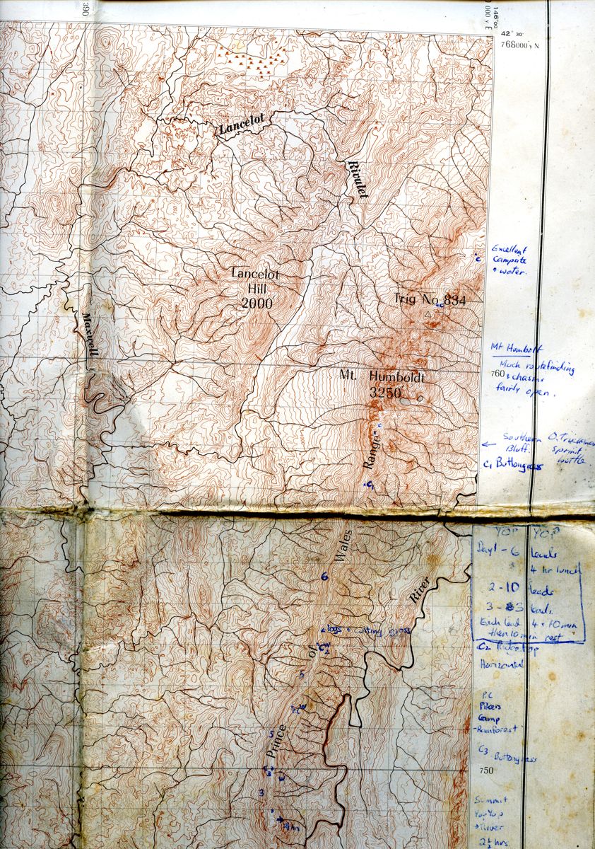
Above - This is a small part of the Olga 1 inch to the mile (1:63,360)
map that we used for the Prince of Wales Range. Even though it was not
colour - its good contour interval was much better for navigation than
the 1:100,000 Tasmaps.
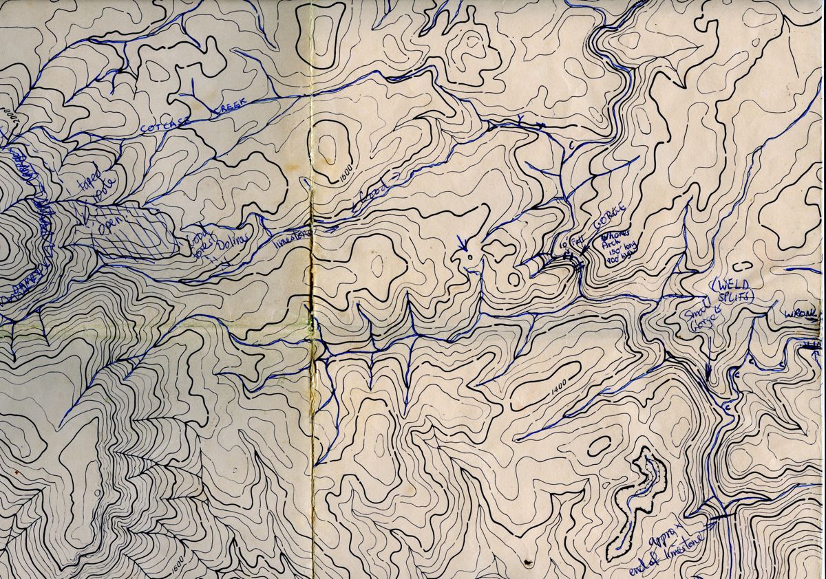
Above - A small part of a 1:15,840 dyeline of the upper Weld River that
we used in conjunction with an aerial photo to work out a good route to
the river from the old Post Davey Track near Mt Bowes.