Pinnacles near the Red Rocks
All images © David Noble. No image an be used for any purpose
without permission.
These pinnacles lie between Mt Dawson and Point Nicholson on the Red
Rocks - overlooking the Capertee Valley. Best access may be from Newnes
via Little Capertee Creek
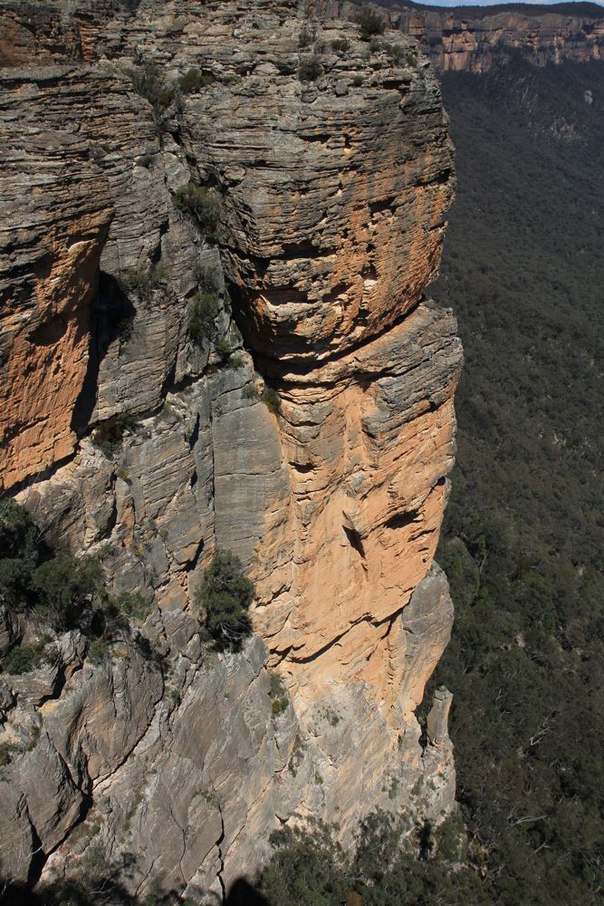
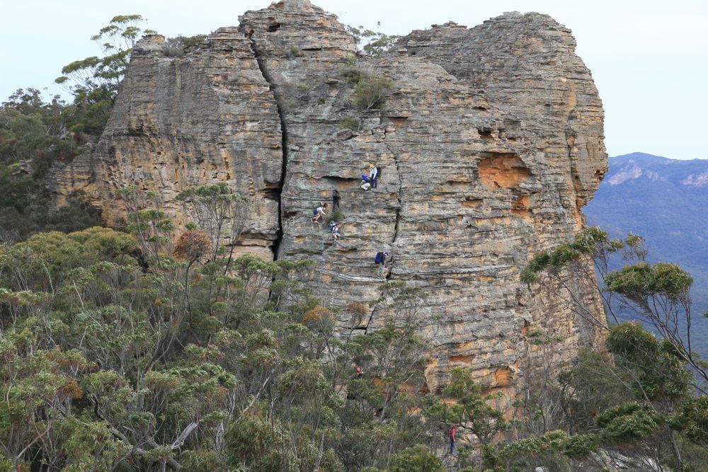
Pinnacle 1
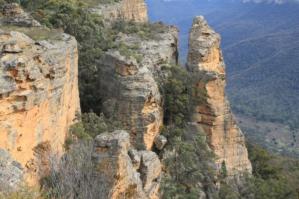
Above - in this photo - it looks like it has an impressive arete on the
right hand side. But this is a photographic trick
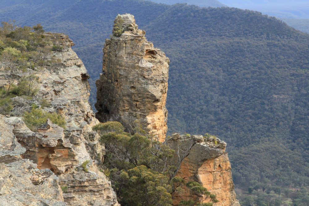
Above - another view of the pinnacle
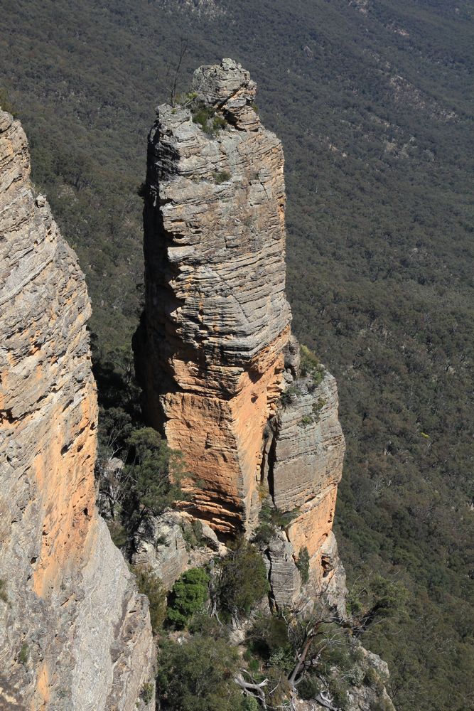
Pinnacle 2
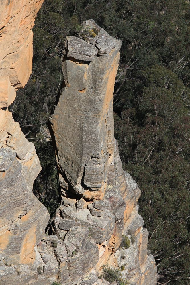
Above - this one looks impressive - but is actually quite small.
Perhaps 10m high? This is zoomed in a long way.
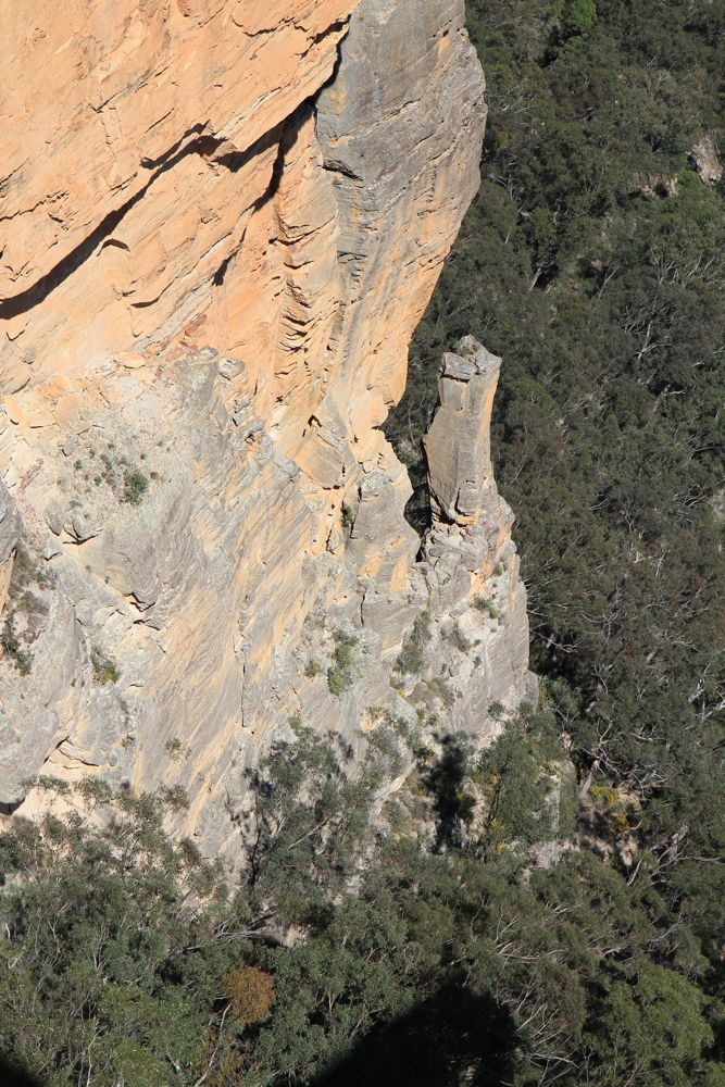
Above - it lies at the bottom of an impressive wall
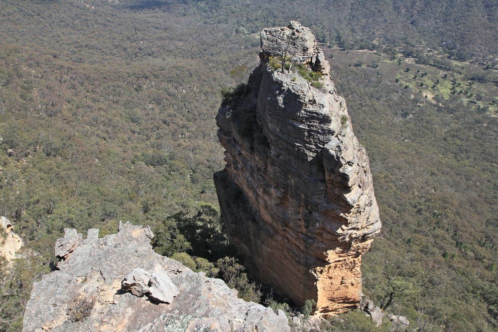
Pinnacle 3 - Ross's Knob
Above - Ross's Knob is an old bushwalkers name for this pinnacle. It
has been marked on the new 1:25,000 Ben Bullen map as "Gindantherie
Pinnacle" (the parish that Newnes is in or close to). I would think it
at least 50 m high on the left (shorter) side. It could possible be
climbed via the vegetated ledge on the right side. First up the obvious
weakness to the ledge, then another pitch up the face which may offer
some gear placements. All other sides seem chossy.
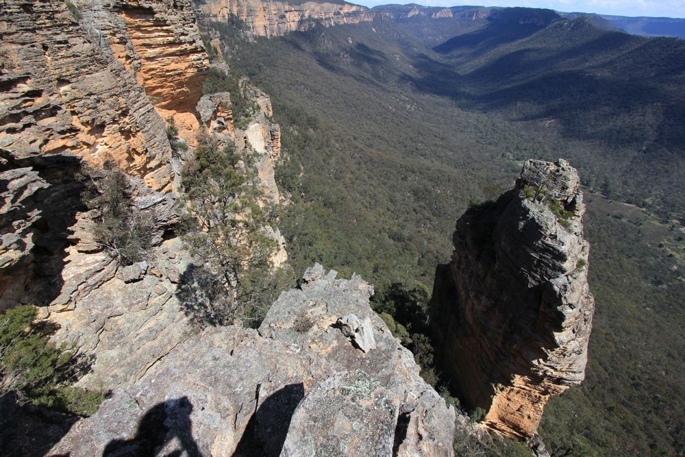
Pagoda of Death
Above - An easy but exposed scramble to get down off this big pagoda
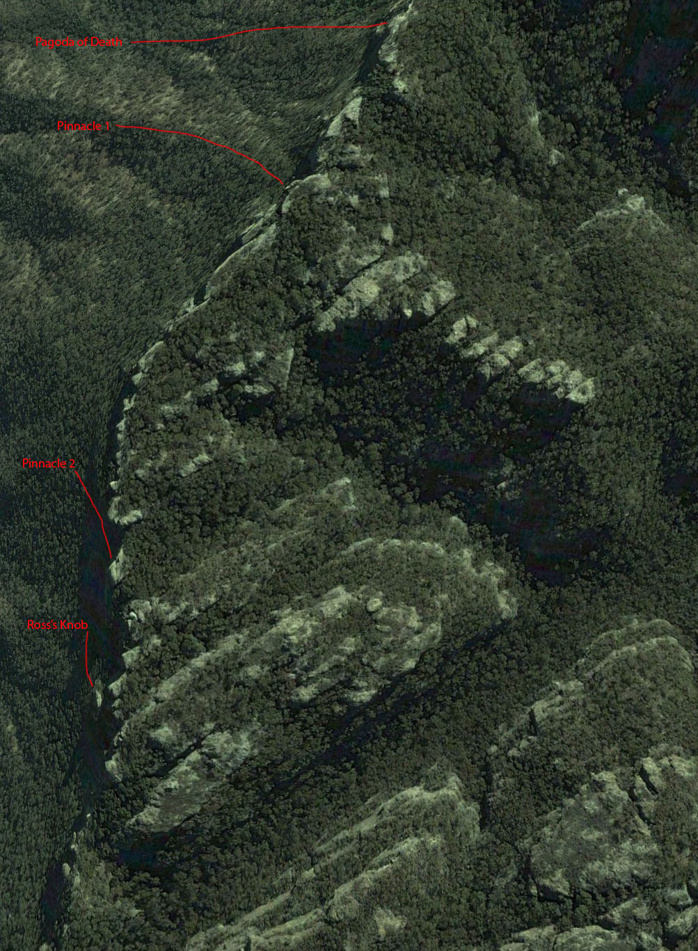
Above - A Google Earth image showing locations. The Capertee Valley is
on the left. Little Capertee Creek is the creek flowing to the right in
the lower part of the image. It joins the Wolgan River at the Newnes
campground. Mt Dawson is just off the image to the south.