Lucas Heights - Menai Rides 20 Feb and 24 Feb 2008
I did the first of these rides solo and the second with Chris Collier
What follows are Google Earth images with the GPS plot of the rides -
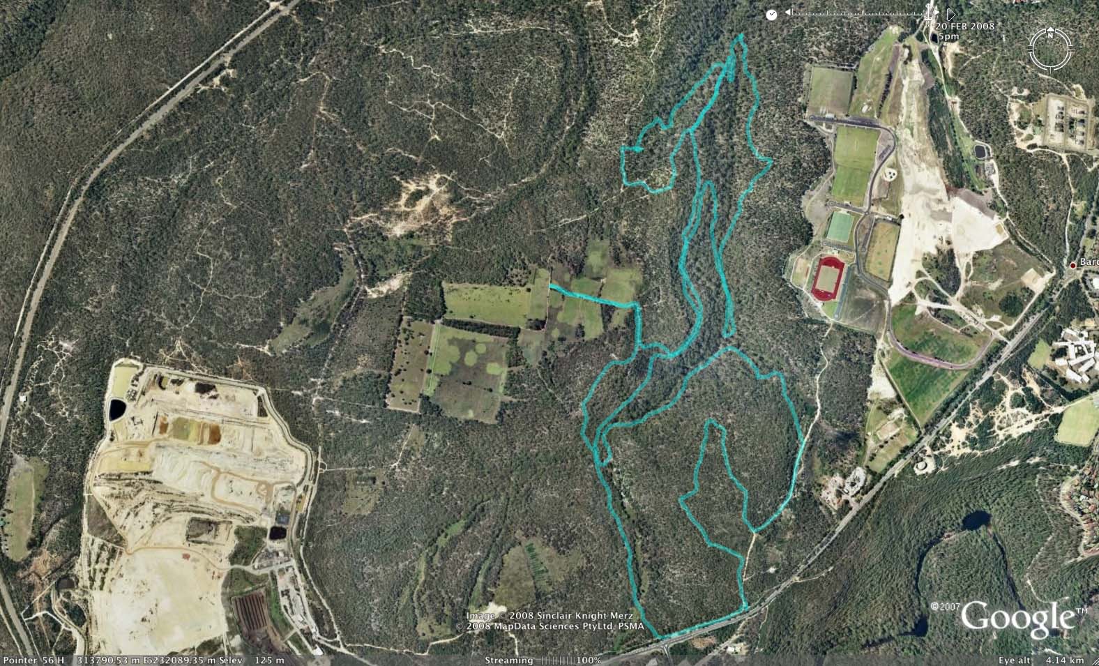
Above - I stayed on trails on the east side this time - and fairly close to the eastern drainage creek

This image shows the directions I took. I tried to use a route that
would allow me to plot a lot of trails - and yet minimise backtracking.
I started at the red dot and went towards the usual entrance opposite
the reactor. I turned right onto the single track and over the wooden
bridges - then followed the creek on its true left to where it turns to
the left and crosses a small creek and goes up a hill. I went up the
hill and then out and back throuh the paddocks. Then down off the rocks
to the lower track - following it past the sweeping bend - and then
back to the left - through the ferns to the creek - where a lot of
trails intersect. Then i crossed the creek and went downstream on the
true right - all the way to the right hand edge of this image. Then up
the hill (with a little out and back checking out a lower trail) - to
the rough ground - and eventually back on the tops - and now on
firetrail - then followed it to the right for a short distance - before
picking up the singletrack that goes downhill to the rickedy north
shore stuff. Then more downhill - crossing a small creek twice - to
rejoin the trail near the bottom right - and back up the rough hill
once more. This time - turning off part way up - and taking the trail
to the left. This is just above the trail I had been down earlier. It
eventually joins that trail - and I continued to the left back towards
my starting point - but now o na lower track. When i reached the trail
i had been on much earlier - I crossed the creek once again and
followed the trail on the true right - to where i said above where a
lot of trails intersect. Then i went uphill to the power line road -
and along that up the first hill - then did the first singletrack loop
out to the right and back - finishing at the red dot.
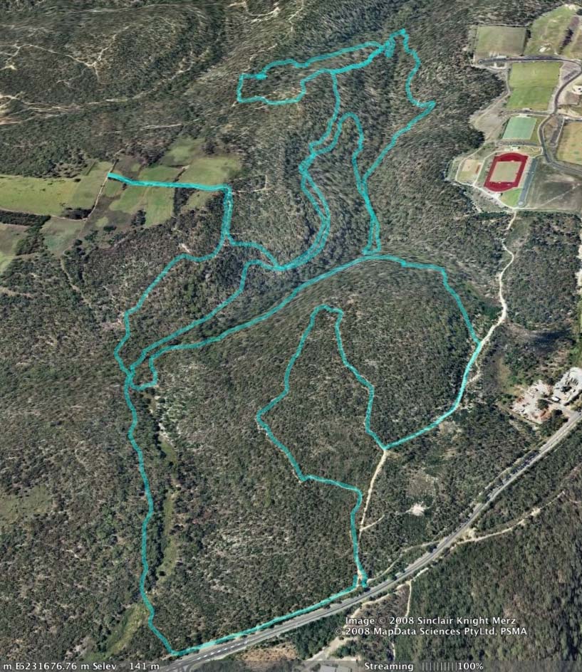
Above - another view of the ride
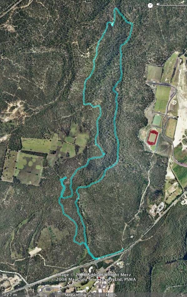
Above - This is the route that Chris Collier and myself went along on 23 February
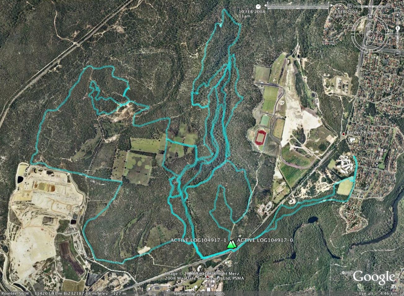
Above - This image shows the combined trails of three recent rides -
showing some of the best singletrack sections (that I know of) in the
area.
Return to rides menu