Menai Ride - 8 March 2008
Riders - Chris Collier, Dave Noble
Here is a Google Earth GPS plot of our ride -
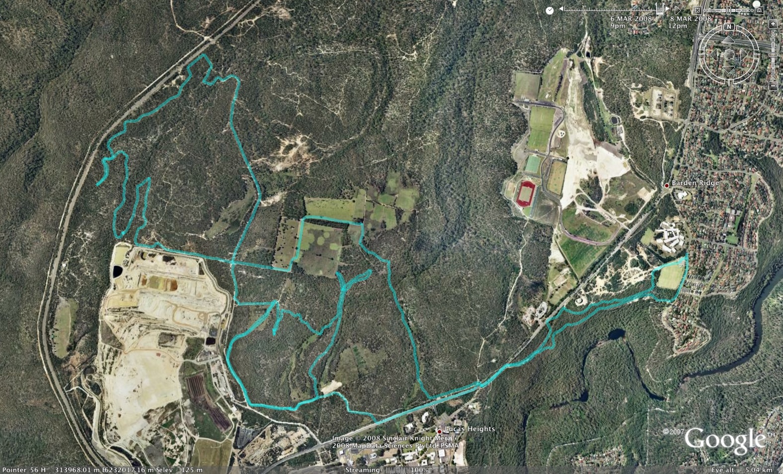
We started from the community school at Bardens Ridge - and followed
the high level track to the Nuclear Reactor. Close to the reactor we
crossed the main road and followed it on the other side for a while and
headed to the open area with the concrete slabs and old BMX jump park.
We continued out towards the tip on the main trail. We then headed off
exploring some trails to the south and east. One we followed out and
back - but the other went down a valley and crossed a swampy creek and
followe it down heading towards the new north shore stuff. On the way
we noticed another trail on the right - which we later followed back.
We continued north crossing the creek - the trail eventually took us to
the rocky area - very close to the new north shore stuff - and we got
onto one of the tracks we had explored last trip. We returned the way
we had come from and took the other tarck mentioned above - which went
very clsoe to the old BMX jump park (the nearby concrete slabs are the
white area above the word "image") - the back along the track towards
the tip.
We then followe the northern boundary of the tip - and along the
singletrack to the north - this time taking a left hand bend - back
down to the creek along a nice section of singletrack - we followed the
creek upstream - and then climbed up tracks that eventually took us to
the shooting gallery gate - so we headed back along a rough road -
eventually reaching the ford. Here we crossed the creek - and went up
the hill to Little Forest. We bypassed the "wastelands" - staying on
the roads to the fenced off paddocks. When we reached our outward path
- we turned east - again along raods through the paddocks - and took
the shortcut trail to the top of the hill and back along the main trail
to the entrance. Then along the main road - crossing it and back along
the lower track - back to the school. The ride was a little over
21 km.

Here is the profile of the ride
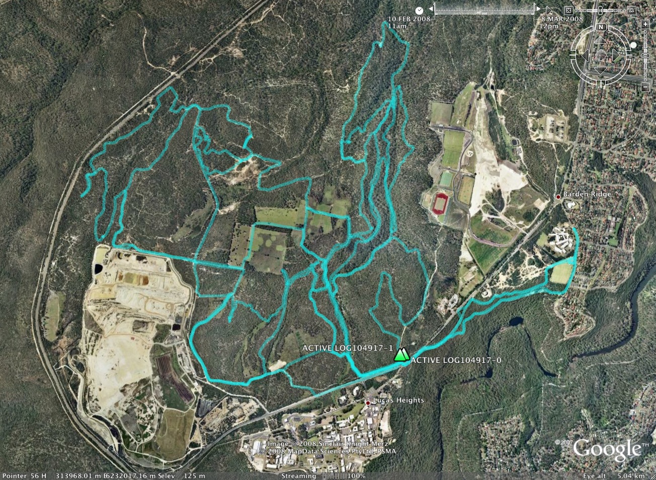
The google earth image shows all the tracks followed on recent trips - there is still a lot more to map!
Return to Rides Menu
Return to david-noble.net