
Bob and myself spent a very interesting day walking in the Blue Mountains near Katoomba.

The main purpose was to have a look at the waterfalls of Bonnie Doon. The waterfalls were a notable omission on my Waterfalls of the Blue Mountains Web Page. I thought it would be a good time to see them after recent good falls of rain.
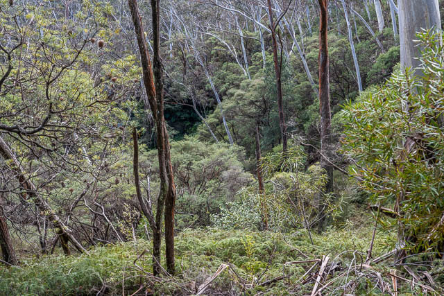
And because of the good falls of rain, on the way up, we first visited Golf Links Lookout at Leura to see if Microstrobos Falls was in good flow. It was not. Here is the lower part of the waterfall and you can barely make out a trickle. I think this is one waterfall that only flows during a big storm – and for not longer after.

And while we were at the lookout – a few photos of the valley –


Then we continued on the way up to Katoomba. We first visited Pulpit Hill where we checked out the old convict graves.
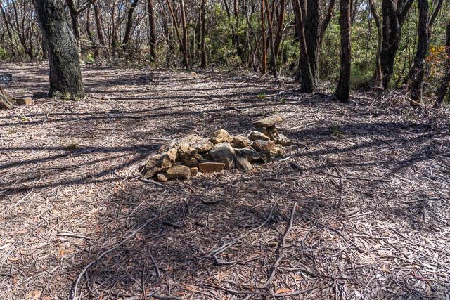

I am not sure how many graves there are, and if these piles of stones are the actual graves. Close to them was stone that looked like it may have once been a tombstone with perhaps an inscription. I have seen a report that says the graves once had wooden crosses (See “Katoomba to Jenolan Caves, the Six Foot Track” by Jim Smith). Another report can be found here saying it is the last resting place of Edgar Church who died in 1822.
Update – thanks to Bob who found this fairly definitive report online by Blue Mountains historian John Low about the old convict graves.

We then went to the SixFoot Track carpark where we saw notices that the Six Foot Track was closed due to flood and landslide damage. This meant we would not be able to see the waterfalls of Bonnie Don from below. But we could still visit the top tracks, so we headed down to North Lookout.
This lookout is named after John Britty North, an early mining entrepreneur of Katoomba. But this is a relatively recent name for the lookout. Thee whole area was one quite different. In the late 19th century, the area was owned by John Britty North, and he had given it the name “Bonnie Doon”. On this block, he was responsible for constructing a large network of private tracks. These were a bit like the private tracks constructed behind the Hydro Majestic Hotel at Medlow Bath.
An old map shows these tracks. It exists in two versions. The 1894 Blue Mountains Railway Guide has a version titled “Railway Guide Map Showing Pathways at Nelly’s Glen or Megalong Pass”. A copy of this map is reproduced in Jim Smith’s book mentioned above (page 102). The same map, with a slightly different title is available on Trove or can be viewed here. This map shows an intriguing network of tracks that seem to go past three waterfalls.
We wanted to see if we could find these old tracks.
Brian Fox’s Blue Mountains Geographical Encyclopaedia has 2 waterfalls named in Bonnie Doon – Brides Veil Falls and Ethel Falls. Brides Veil Falls is supposed to be about 60m upstream of Ethel Falls and has been described as a “pretty fall with a large remarkable cave behind”. This sounds distinctive and should be easy to recognise. The lower Ethel Falls is described as a “cascade formed by the union of two streams”. Again this should not be too hard to find.
But what about “Bonnie Doon Falls” – that name appears on the old map, and was perhaps the overview name given to the whole series of waterfalls. Or could it be a separate waterfall? The old map does have three waterfalls marked.
There are photos online of a waterfall seen near the Six Foot Track captioned “Ethel Falls”. Tom Brennan has an example on this page. However, I am not sure if this waterfall fits in with the description of being a “cascade” which I understand to be a waterfall that goes down a series of small steps. Also, it is not immediately below a stream junction.

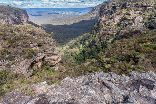
At North Lookout, we admired the views.
A note about the names. Bonnie Doon seems to be a John Britty North name for his block of land. Nellys Glen (or Nellies Glen) seems to have been named after either his wife or daughter. And it refers to the lower valley – which is a part of the larger Megalong. And another of his daughters was named “Ethel”, although Jin Smith names the waterfall “Ethal Falls”. The pass used by the Six Foot Track was referred to as “Megalong Cleft” or “Megalong Pass”, but now seems to be called “Nellys Glen”.
The Bonnie Doon property was later resumed and declared a reserve.

Looking down the valley, we could see the lower part of Silver Spray Falls.

This waterfall is near Peckmans Plateau.
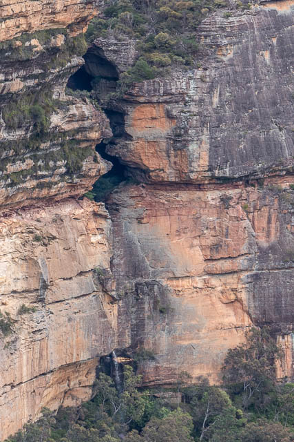
Bob speculated that this steep ramp/cleft could be a possible pass –

We then walked back a bit and headed off on the Bonnie Doon tracks. They follow a different route to the old tracks and are not marked correctly on the current topographic map. Open Street Maps has them much more accurately marked. According to Keith Painter in his small book “More Katoomba Walks” he says these tracks were constructed in the 1980’s by the Blue Mountains Council.
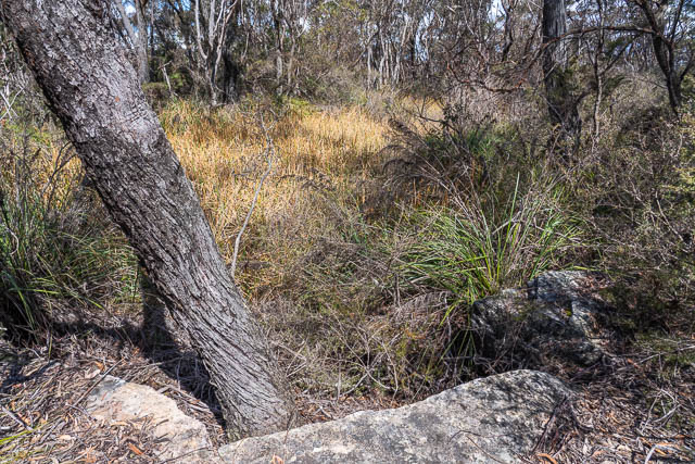
We crossed the first of three creeks. At the second creek, we noticed signs of an old track that went down just after the crossing. We followed this down to a nice lookout.
Then we went back to the main track and followed it past the third creek crossing. Here was a place that appears to have been named “Birdies Bower” on the old map. But another map has that same name applied just above Silver Spray Falls”.
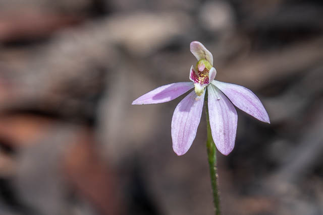
We saw quite a few Caladenia sp. Orchids.
We followed a side track to Therebulat Lookout.
We then headed back over the last two creek crossings looking for where the old tracks should have gone. We went out to point, then looked for way down. We tried one way, but that did not seem to go, then after consulting the old map again we tried another way. We got down to the creek level, then looked for old track formation. If it was there, then it was not obvious and very overgrown. But some parts could have been old track. We were not sure. We reached a drop in the creek and contining on the true right – the bank that the track was shown to be on, did not seem possible, so we crossed the creek, and with some tricky scrambling reached a view point above a waterfall.

This appeared to be a waterfall right at the junction of two creeks. And there was perhaps a large cave at the bottom.
We scrambled down to the top of the waterfall and then crossed to the true right. Climbing up, we found a cave that could have been used by the old track. We continued towards the side creek coming via a waterfall above us on the right.
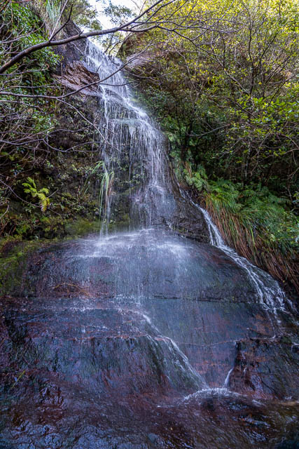
We carefully crossed this side creek – it was on slippery rock and poised above another large drop. This is a photo of the waterfall above us, just where we crossed.
We had expected that we could continue – but or ledge ran out. There was no way on.
Bob spotted an old bolt on the face of the waterfall we had just crossed. This was the first definite evidence we had seen of any of the old tracks in this creek. Then we noticed some old cut steps below the bolt.

We climbed over to the bolt, but it was far too dangerous in the wet slippery conditions to try and continue without rope. So we headed back. We then visited the cave I mentioned earlier on the true right, and we found it did continue up to near where we had earlier been, and climbing up we found a shorter easier route to the higher level. That was probably the route used by the old track.
We then climbed further to the new track, and took the side track that went up to the highway. This was also most interesting.
Near the highway, we came across a large pond or dam. One section had bit cut out of the rock. We wondered what it had been used for.
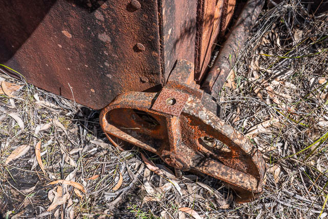
Further up, we found this old mine skip.
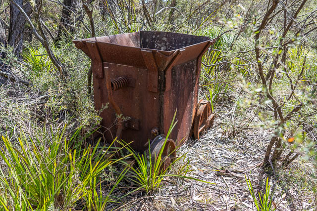

We speculated on whether it could have been used for the old shale mines lower down the valley. But later research at home showed it was used by a Brickworks that operated in the area in the 1930’s. The brickworks excavated local clay and shale, which were transported in skips on an old tramway. Water was obtained from the dam. There is a video online here about this brickworks. Page 7 of this edition of the Blue Mountains Conservation Society Hut News has information about how this site was later added to the reserve. The brickworks site can be seen on the 1943 air photos available on the SIX viewer.
We then walked back to the Six Foot Track carpark, and had a late lunch.
After our break, we walked back down to North Lookout to see if there was an old tracks that went down into Bonnie Doon. A look at the old maps showed a possible connection.
Here is another view looking down from North Lookout. I have marked in red – where we had been earlier –

On the lower left side you can just see the waterfall we had crossed – the one with the old bolt.
Here is anther view of Silver Spray Falls –
The cleft above it looks interesting.
We then looked around the Megalong Cleft side of the lookout. It soon became apparent that there could be no connecting track.
We found a lot of old sleepers that had been bolted to the rock. It seems that these were placed in the 1980’s to prevent erosion. In the 1960’s the council had constructed a road through the cleft – and this involved tons of rock being pushed into the cleft from the top. This road was supposed to be a bushfire escape route for Megalong resident but was far too steep to be practical and soon eroded away. It later was improved as the new version of the Six Foot Track in the 1980’s.
We did spot this Tiger Snake –

Back at home after the trip, looking more carefully at the old map, it became apparent that there was no connecting track to the lookout, but rather the Bonnie Doon track joined the Six Foot Track much lower down. This old photo supports this. When the Six Foot Track reopens, we will have to go back for a look.
And also – so far in our exploration, we did not see any Microstrobos pines. They are supposed to be in the area.
Hi Dave. Not sure if you’re still checking these.
I was wondering if I could use your photo of the “steep ramp/cleft”? The 11th photo from the North’s Lookout area.
I think it shows some old Sydney Rockclimbing Club Rhum Dhu routes from the late 1950’s or early 1960’s. The grey buttress just visible in the left edge of the photo is “Burgundy Buttress” and the pinnacle to the right of the “cleft” I think is “Dry Sherry Pinnacle”. The cleft itself also seems to have been used as an abseil descent by the SRC.
Yes – thats fine Sam.