
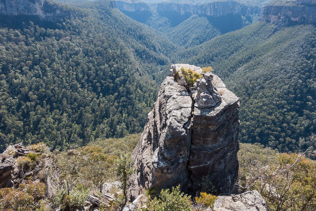
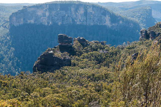
This was a very interesting walk. On many previous trips to the Asgard Plateau and on the cliffs on the north side of the Grose Valley I had plenty of chances to look at Burra Korain Head. I had never heard of bushwalkers climbing the head from the valley, but it looked possible. If so, it would be an interesting pass.
Recently, I had discussed this with Bob, and he thought he could recall an early solo trip up the Head, sometime back in the late 1970’s he thought. He had checked his maps and seen that he had indeed marked a dotted line going up onto the head from the Grose River. He could not remember any details of the pass up through the cliffs, but did remember that is was scrubby walking back along the ridge to Blackheath. So Bob and myself decided to have a go at getting up the Head. Rather than walk to Blackheath, we would only walk a short distance and then descend a pass back to near Victoria Falls.
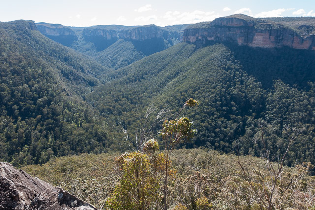
We started off from Victoria Falls Lookout and seen reached the bottom. We went up to the Silver Cascades to see from below which side would be the best to descend – the true right looked easier. We then made fast progress to reach Burra Korain Flat at the junction of Victoria Creek and the Grose River.
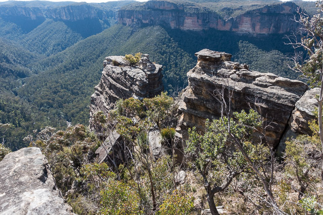
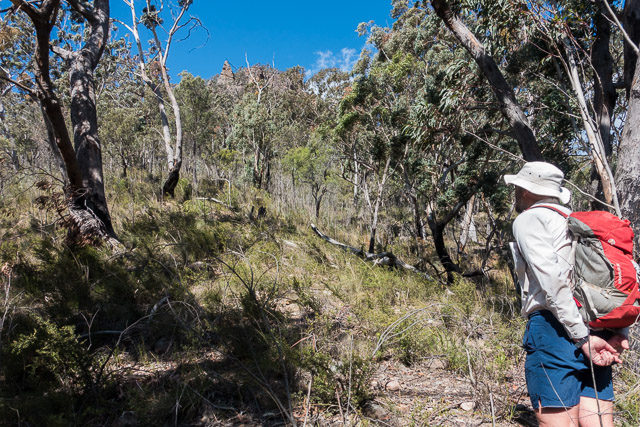
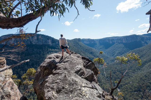
We then started climbing up the spur towards Burra Korain Head. With only daypacks, we made fast progress and soon reached steep ground just below impressive cliffs. We continued up and arrived at the rocky point. Going around on the left, we soon climbed on top. During the day, the wind had picked up – and it was quite breezy.
I had printed a photo of the Head taken from Asgard Head and it looked like the left would go. Bob checked around the point to the right – it looks very unlikely, so we continued around the left side – scrambling up loose talus around the base of the cliffs. We checked out a few possible leads – but they all seemed to end in cliffs. The further we traversed to the left, the higher the cliffs seemed to get. So we returned to the point. One last chance remained – back to the right for a thorough look.
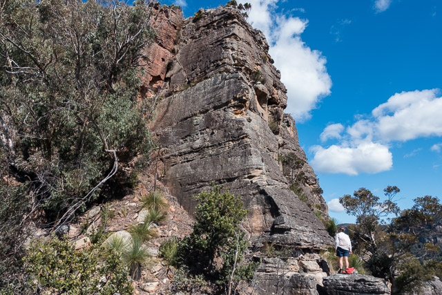
I had left my pack behind and traversed some steep rock on the right that brought me to the base of a chimney. I climbed up the lower bit – and it looks possible that the top might go. Bob came around and agreed. he started climbing, while I went back or my pack. I waited well out of the way – Bob and indicted that the chimney was very unstable – with many loose rocks. While I waited, I pulled out the printed photo and it revealed where the chimney was. it did not looked very likely to go, but if it did go, then there seemed to be no more difficulties.
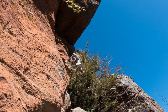
The wind did not help things – both with the scrambling and communications. But, then I heard Bob call out that it went OK and above the chimney was trivial. He had put a handline down the chimney, and this facilitated my ascent.
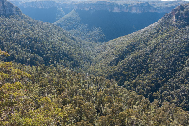
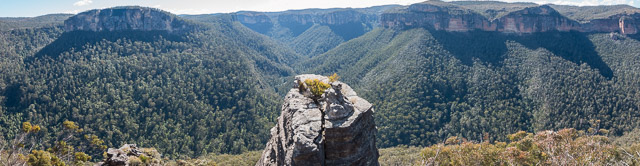
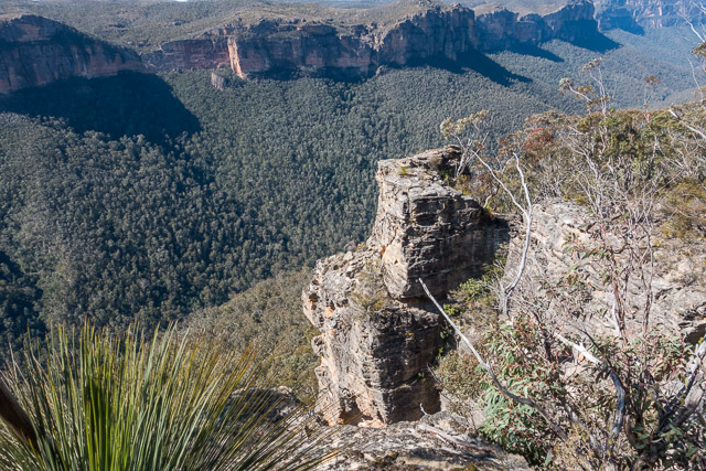
I was soon on the top. We enjoyed the great views and I am sure we were both relieved to be up. Bob was not sure if that was the same way he had been up earlier. Perhaps the cliff had changed a bit over the years – e.g. a landslide?
We found a sheltered sunny spot for lunch, and then found easy going along the ridge to the top of our planned descent route. There was not too much scrub due to the bushfire of a few years earlier. The descent was very easy except for the last 100 m or so – when we found ourselves on steep lawyer vine covered slope.
At the creek, I checked our location on the map on my phone. Only about 200 m to the top of the Silver Cascades. But we had to get our shoes and socks wet walking down the creek.
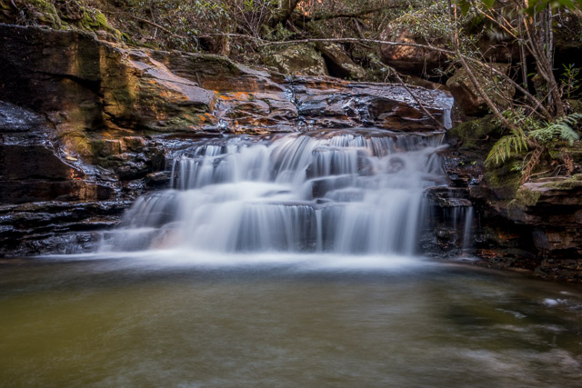
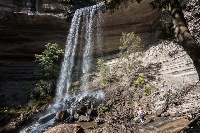
On the way, we passed a few attractive cascades. The Silver cascades was the last of these and the rock was too wet and slippery to try and climb down. From the top, the left looked the better route. We would try and traverse to the track back up to the lookout.
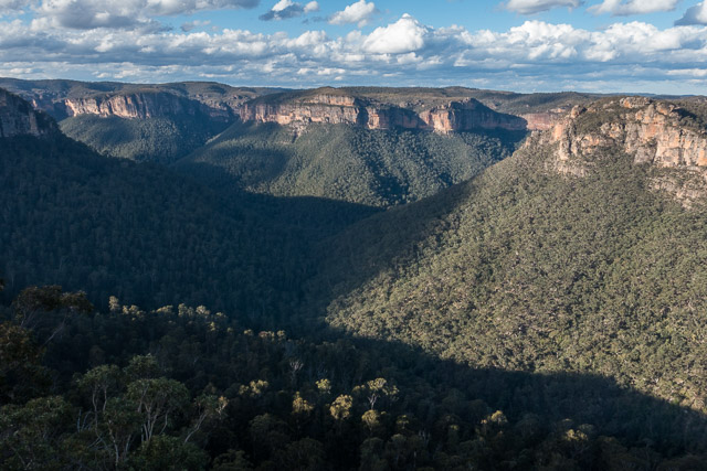
This was slow but interesting. Slow because of abundant and thick lawyer vine. Interesting because we came across the stone steps of an old track, now very overgrown. It must have gone up to at least the top of the Silver Cascades. Somewhat scratched, we eventually arrived at the track and then climbed quickly back to the lookout. At the top – we could see almost all of our walk.
More photos are online on my website here.