
My friend Enmoore was keen on some canyoning and suggested Thunder Canyon. It had been a while since my last is it to this magnificent canyon. This was back in 2008. So it was well due another visit. Wendy was also keen to join us.
We left Enmoore’s car at the Claustral carpark on the Bell Road, and then drove in Wendy’s car to Mt Charles. I think it was around 10:30 am when we set off from Mt Charles.
We used the same route to enter the canyon that I had used on my previous visit – a walk out along Lightning Ridge and then a descent to the creek at the big bend just upstream of the start of the canyon (Westerway Falls). This route is fairy straightforward navigation, but I think it is slowly getting a bit more scrubby. And you need to be careful finding a way down off the point above the bend. We scrambled down a fair way on ledges and then did two short abseils. We carried a single 45 m rope which was ample.
This took us to a very attractive part of the creek. I knew there were some wades not far downstream, so this was where we waterproofed our packs and changed into wetsuits.
Indeed, not far downstream was a nice section of almost canyon – some nice pools and scrambles – but no swims. Below this, the creekbed is a bit bouldery and some route finding is needed to find the best way. Care also needs to be taken on the slippery rocks.
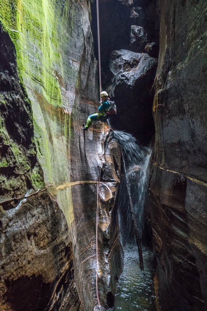
Enmoore on the first abseil
We soon arrived at Westerway Falls. This was named after SUBW walker, Don Westerway, who got “washed away” when abseiling down the waterfall on an early trip through the canyon. That trip was probably the first one where the waterfalls were abseiled. The first descent party, in 1960 (Col Oloman, Dick Donaghey and Gerry O’Byrne) appeared to abseil in lower down the canyon, just upstream of the Claustral junction. They named the canyon, because it was at the end of Lightning Ridge, and it rhymed with “Chunder” (a popular term for alcohol fuelled vomiting in those days) and from the noise made when rock were thrown down (which they may have done in order to judge the depth of the canyon and whether their ropes would make it down).
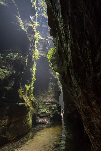
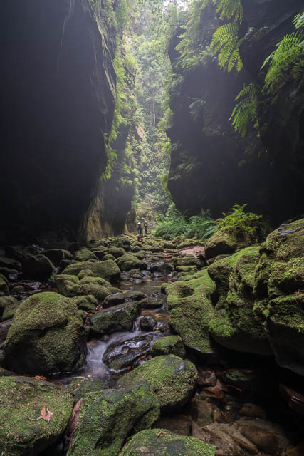
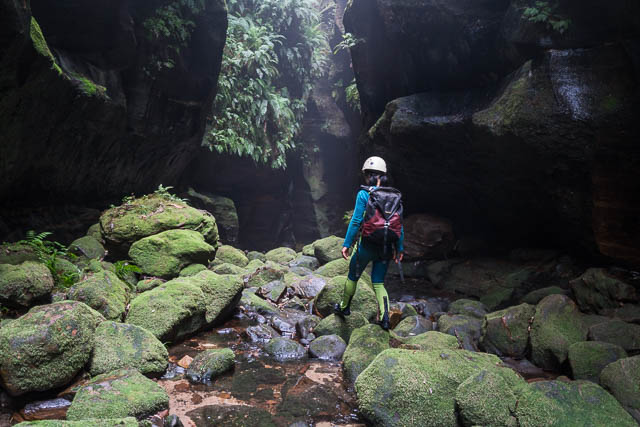
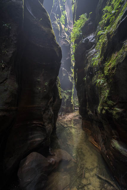
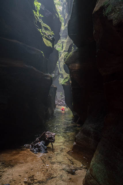
Wendy in the canyon
We completed two abseils down the falls. The first one around 21 metres and then a shorter second one in a dark slot.
Looking down the second abseil
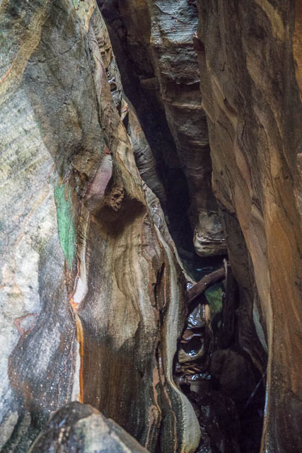
The the way through the canyon winds round an enormous fallen boulder. Part way around is the Glow Worm Cave – a short detour.
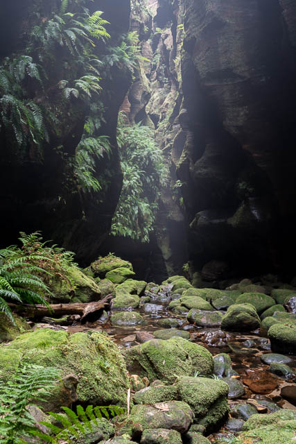
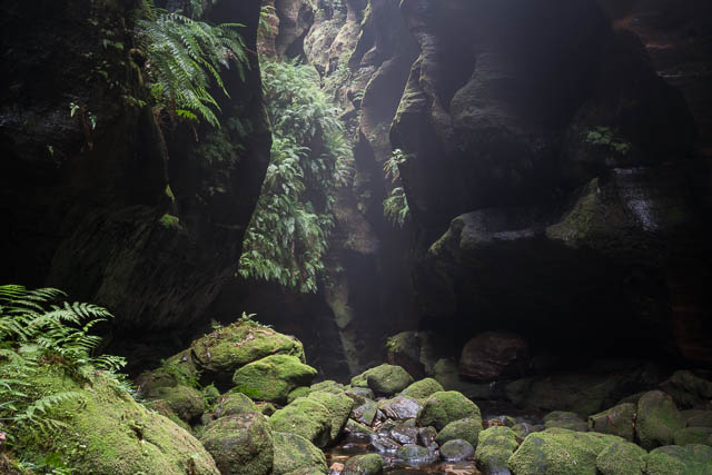
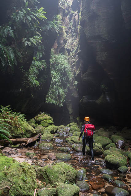
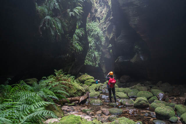
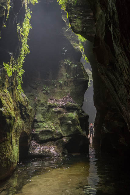
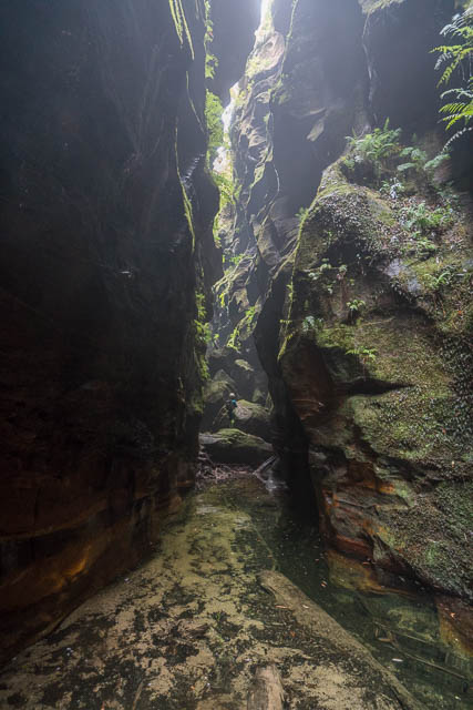
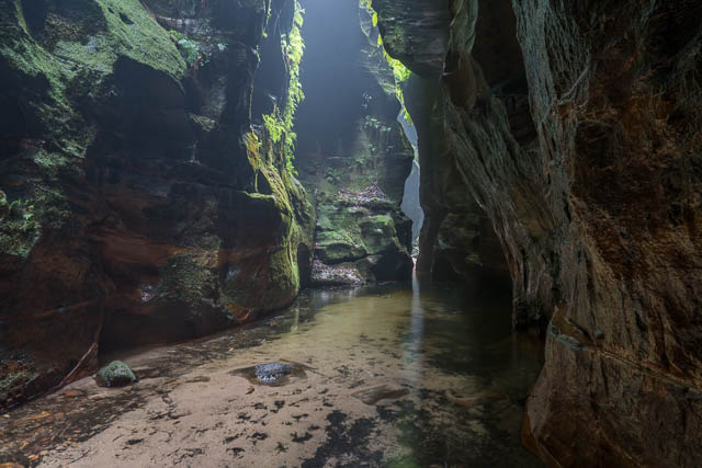
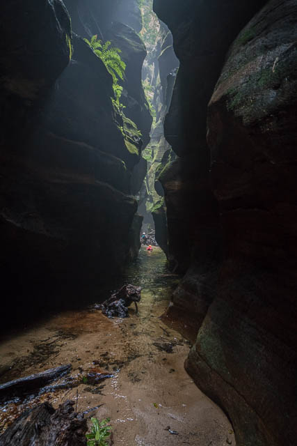
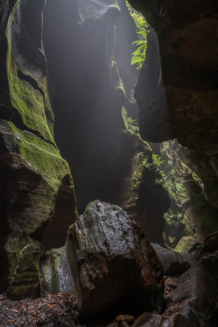
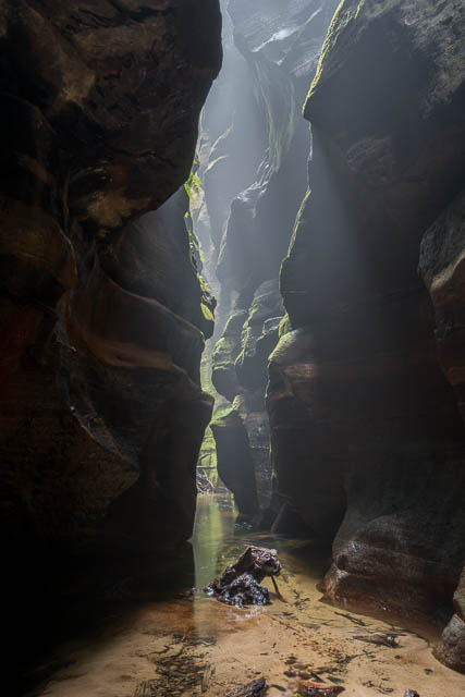
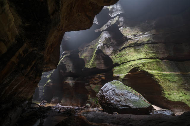
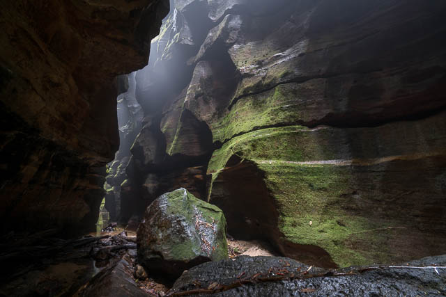
Below this, I set up my camera and tripod and took a few photos of the canyon formation. The canyon is very deep and dark here – and narrower and deeper than Claustral Canyon – truly impressive. On our visit, we enjoyed not only soft lighting in the canyon, which helps for photography, but also a mist seemed to be permeating in the slot. It was very beautiful.
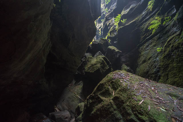
After a short swim and more impressive formation, there is a jumble of giant boulders – which can be a bit tricky to get through in the feeble light.

Then some more wades and swims and the junction with Claustral Canyon is reached.
This was where we stopped for a late (2 pm) lunch.
Below this point, it it still Thunder Canyon (Claustral flows into Thunder Canyon). It took us about 45 minutes to reach the exit point. Some points to remark on – it seems a few quite large trees have fallen over in the canyon nor far below the junction, and the tunnel swim is now in its shallow level. The water level here in recent years sometimes changes about 80 cm or so – probably depending on downstream blockages forming or breeching. When it is at the shallow level – the middle part is a wade, shortening the cold swims.
We then climbed up the exit gully ashore away and followed the ledges around to Rainbow Ravine, then more scrambles to get out onto the side of the Camels Hump.
On this trip, we decided, since we had a longer rope, to check out the alternative route to the Claustral entrance/exit gully. NPWS wants people to use the existing old tracks across the causeway and then down the original track into the upper part of the creek (I would think that section takes about 20 minutes to walk) and then it takes about 30 minutes to walk down to the entrance/exit gully. And there is one short swim on the way. It seems that at least some of the commercial guided parties in Claustral are using the alternative route, so perhaps the NPWS recommendation has changed?
The other way, turns off, at a spot now marked by a metallic arrow sign (placed by NPWS?) that points towards the causeway. Back in the 1970 or early 80’s I can remember using a very similar route that we sometimes used to overtake slow parties. It would take us down with a short abseil to a spot just upstream of the first water jump.
We found a well formed track on the new way. It wanders around a bit, on what is probably not the optimum route and then descends ledges to a point just above the entrance/exit gully junction. To descend needed two short abseils. When visiting Claustral Canyon, I only take a 25 m rope. I think it would just be long enough for the first and longer of these two abseils. But going this way, and taking the time to set up the abseils took us around 45 minutes, so not that much different to the NPWS recommended route. That time would increase with larger parties at the abseils. The other route would probably be a bit more strenuous, and perhaps a bit slower for parties that are not familiar with the optimum routes through tricky bits, but it takes you through some very beautiful section of creek and canyon. Its shame to miss it.
More and larger photos are online here.