
I thought it was about time to return to Mt Solitary. It was the start of my holidays – and I thought a three day trip would be good. This would allow some time to potter around on the mountain. My intention was to take photos – but also to seek out some good sites for photography.
I walked from Katoomba. My plans to descend to the Federal Pass Track via the Furber Stairs were put on hold when I found the top of the track shut with tape. It was closed for helicopter operations. No problem. This would give me the chance to walk east along the Prince Henry Walk to Echo Point and the descend via The Giants Stairway. This was a little further – but I had plenty of time.
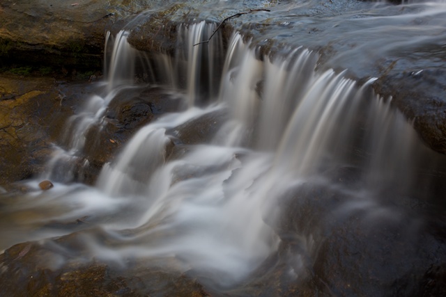
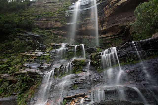
Katoomba Cascades
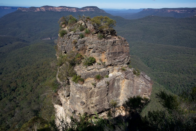
The first of the Three Sisters with Mt Solitary behind
So, soon I was on Federal Pass – heading for Solitary.
I soon passed the tacky theme park known as “Scenic World”. You have to be careful here! The default track is not the Federal Pass Track – but rather the boardwalk to the Scenic Descender. Oops! I had to do a little backtracking. Then, not far to the Landslide and through the delightful rainforest section past the Golden Stairs and out to the Ruined Castle turnoff. I continued over the saddle and then up the Korrowall Knife-edge onto Mt Solitary.
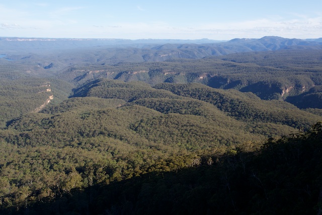
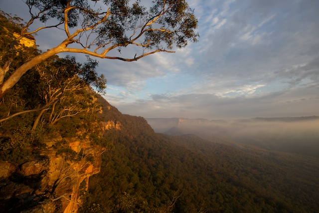
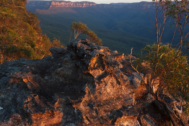
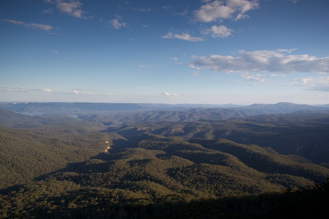
View south from Mt Solitary
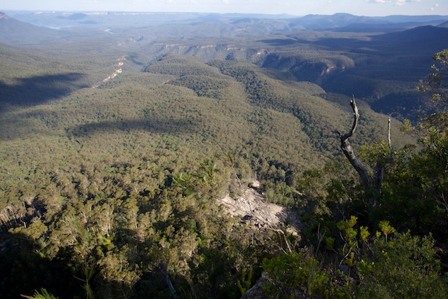
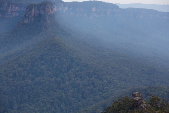
Lots of other walkers and runners were out and about. Most were day trippers. I stopped for a while at Chinamans Gully. The view from Melvilles Lookout to the south is always amazing. It spans a large part of the Southern Blue Mountains – the Blue Breaks, The Kowmung and Coxs Gorges, The Gangerang Range – including Mt Cloudmaker, The Wild Dog Mountains and behind everything – Mt Colong and Kanangra Walls.
I checked out the water situation at Chinamans Gully (there was plenty) – the best place to draw water is to go down the creek to near the cliffs and just past a small campsite. Here a side gully comes in. I think this gully has less chance of being polluted.
From the the junction of the side gully – two tracks head off – one a short distance to a lookout and the other, fainter track – climbs up through scrub to a higher vantage point. More photo opportunities.
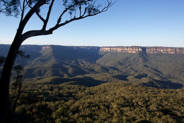
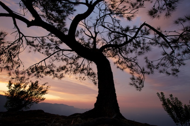
View north from Mt Solitary
I hadn’t decided where to camp, but as it was still quite early, I pushed on to the campsite at the head of Singa-Jingawell Creek. It is very sheltered, has good water nearby and is very close to the northern cliffline. I wanted a view the next morning to the east for some comet spotting.
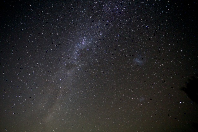
The sunset was nice but nothing special. What would the dawn bring? My alarm went off at 5am and I wandered out to the cliff to look for my comet. It was supposed to be close to the planet Mercury. Well Mercury was easy to spot – but not the comet. I had photographed it, Comet Lemon, earlier in the year – as an evening object. Now it is a faint morning object. Well, what I could not see – the camera might. So I set up the camera on the tripod and took some photos. The sky looked dark – but in the photos – all the eastern sky – where the comet was, was quite bright, due to sky fog from Sydney’s lights. But the comet was very easy to spot in the photos. Faint and green in colour with the hint of a tail.
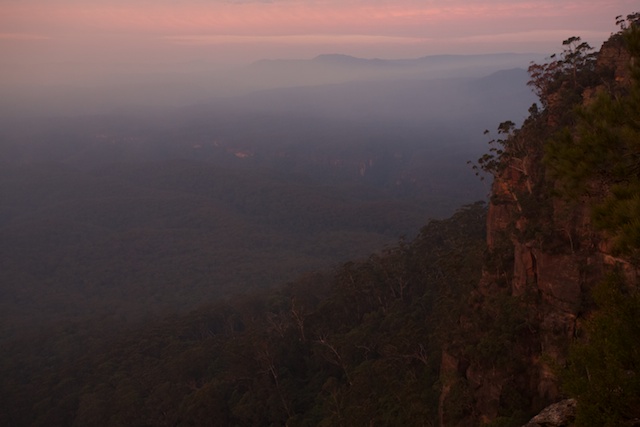
Then I had to wait around for an hour or so till sunrise. It was interesting. It had been a still night and I had been hoping for some valley mist. When I first got up – there was very little, but during the next hour – mist rolled in from further down the Jamison Valley, but then rolled back out again. By the time the sun rose – there was virtually no mist left!
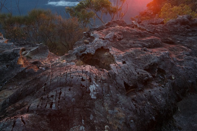
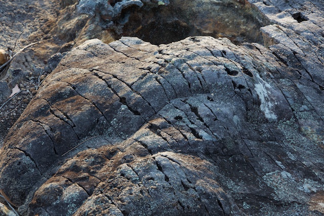
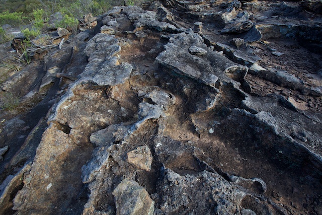
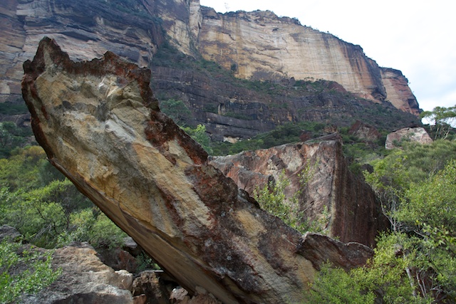
Not far from the campsite are some interesting rock formations – and these provided photographic interest for my dawn photos. As I was finishing my photographic session – the first of many runners came past. The first was a girl running by herself – at about 7am! Many more followed including bushwalking friend – Ashley Burke. He told me they were all out training for some future mountain running events.
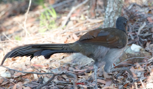
My breakfast was interrupted by male lyrebird foraging through the campsite. It seemed quite oblivious of my presence.
I next wandered out to the eastern end of the mountain – to The Col, where I signed the logbook. On the way back to camp I had a wander around Singa-Jingawell Creek. Another walker I met at The Col, had told me about his previous trip to the mountain – over twenty years earlier – and he seemed to recall descending of the mountain via Singa-Jingawell Creek. I didn’t think this was likely – and a view from a rock shelf just above the end of the creek seemed to confirm this. To me it looked like the creek goes over a high cliff (like the next creek to the south – Rayfrandell Gully – which I have been to the bottom of).
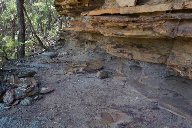
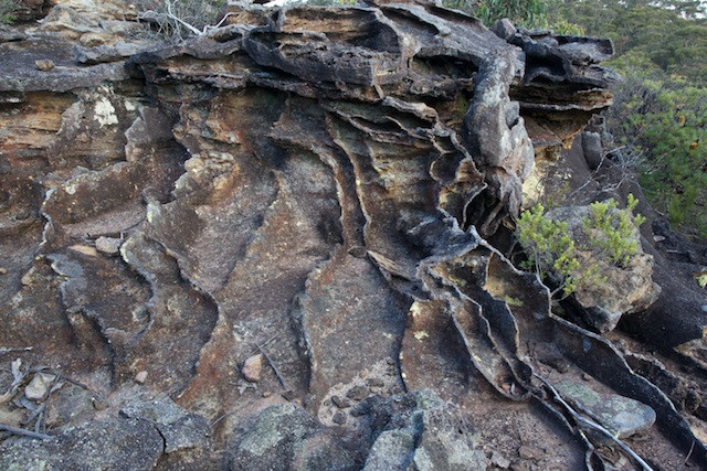
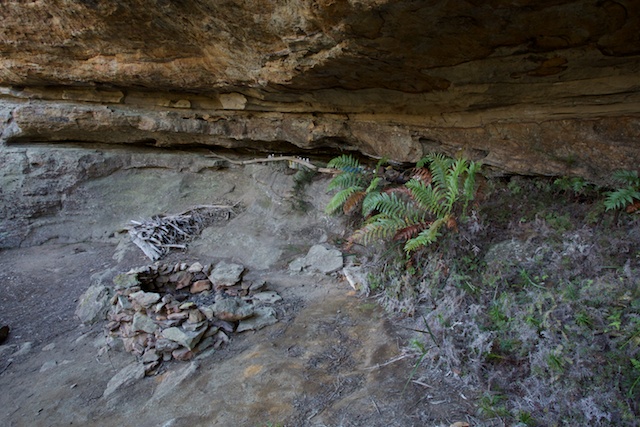
On some of my early traverses of Mt Solitary – back in the 1970’s – I can remember camping sometimes in a camp cave very close to Singa-Jingawell Creek. That cave now seems to have been forgotten. Perhaps because the campsite higher up the creek has both water and proximity to great views. Anyway – this time I could not find the cave. Perhaps it is quite far down the creek. I did find a nice cave with a fireplace – but it seemed too high above the creek level (about 20m, and it was about 200m downstream from the campsite).
Cave near Singa-Jingawell Ck
Back at camp, I had an early lunch and then packed up my gear and shifted camp to the head of Chinamans Gully. I had never camped at this site before – although I had stayed plenty of times in the nearby camp caves. The caves are good in wet weather – but tend to be dirty and dusty.
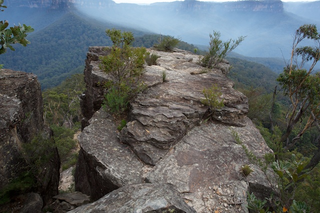
The campsite at the very head of the gully has the advantage of being very close to a lookout overlooking the southern cliffs – Melvilles Lookout. I guess this lookout is named after the late Ninian Melville – a prominent bushwalker, mapmaker and founder of the CMW club. Other names from Solitary – Singa-Jingawell – named by Dorothy Lawry (SBW) from “sing a jingle well” – after a night of singing around the campfire, Chinamans Gully – named by Paddy Pallin – during a very windy time – when they almost went “Arse Up” (Ahhs Sup – a Chinese name), Greenfields Lookout – I don’t know.
View from Greenfields Lookout
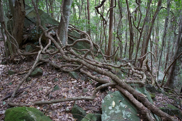
Anyway – after setting up my camp – I had most of the afternoon left, so I went exploring out to Greenfields Lookout. This is not far – but the way is quite scrubby, and I don’t think I would go out that way again. The views are no better than Melvilles Lookout, which has a far better viewing platform. But on the way to the lookout, I did find a hermits cave. Stashed in the cave were lots of water bottles, some sleeping mats and pots and pans and other junk. The cave looked like it hadn’t been used for many years.
The hermits cave
On my return, I wandered out to the top of the Knife-edge for some more photos and then back to camp. Melvilles Lookout was a great place to sit and finish off my wine and cheese.
Two more parties of bushwalkers had arrived – so I had company that night.
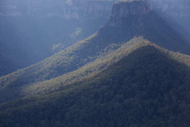
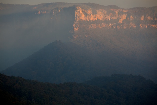
I woke up to an unusual sunrise. There was no valley mist but there was a high haze – perhaps smoke from controlled burns? It did make for some interesting lighting.
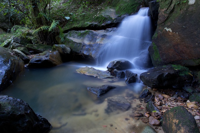
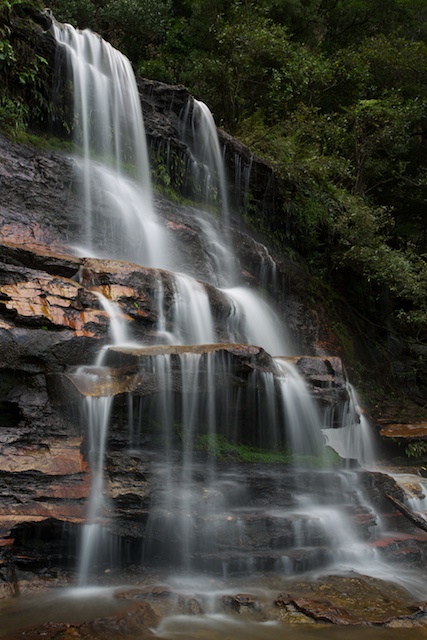
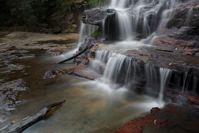
Then it was pack up and head off back to Katoomba. On the way I met a climbing and canyoning friend, Col, taking a party of guides on a camping trip. This time Furber Stairs were open – so I left the valley that way – and stopped for some photography on the mid level of Katoomba Falls.
There are more photos on my website here, including some large panoramas.
Not an expert but your lyrebird visitor looks like a female to me -I think a male in the first couple of years should have a rufous forehead and after that the tail starts to change towards that of the adult.
Thanks Andrew. I’m certainly no expert on birds.
Dave, next time you’re out cave collecting on Mt Solitary check out the south side at the head of Korrowall Buttress where I found a cave with an old fireplace and a 1940 stamped beer bottle. We also located the little cave close to and well down Singajingawell Creek, which I always presumed was where Dorothy and her friends sang their jingle well, but it seems you have found another possible candidate for this. That was with Mark Goodson, around the same time he found Goodson’s Pass (better known these days as the supposed “Miners’ Pass”.
Love the pics and commentary David! I’m preparing to do my 3rd walk up to the beckoning Mt Solitary and environ. The rock formations and caves are intriguing.
Love the pics – well composed with great detail and the careful capturing of the mountain colours.
Hi Dave,
Love your track notes.
Just a note on Greenfields Lookout. It was also named after a prominent bushwalker of the day- Wilfred Greenfield, my grandfather. He was a bushwalking companion of Paddy Pallin during those pioneering years. He told us about catching the coal trucks up/down the cliff face where the scenic railway currently is, to gain access to Jamieson Valley. also of one epic walk from Katoomba to Goublurn. He used to just carry a swag and alot of flour and treacle- turning it into damper and flour dumplings.
Hi David. Not referring to this post. I am always grateful for introducing Colin Gibson and my self over 30 years ago. We have cooperated to publish some important books.