While waiting for our bus at Scotts Peak Dam after the Western Arthurs walk I had a bit of time on my hands. So I perused the intentions logbook at the trailhead and made a few notes. Back home, I have looked at the figures and presented some of the results in some graphs.
Some people may be interested in these statistics. The logbook was placed at the end of July 2011 and figures are up to about 20 Jan 2012 and are only for parties that signed out at that logbook.
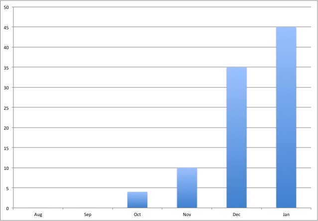
This first graph shows month of starting trip. The figures for January are extrapolated based on actual data for 20 days. It records the number of parties.
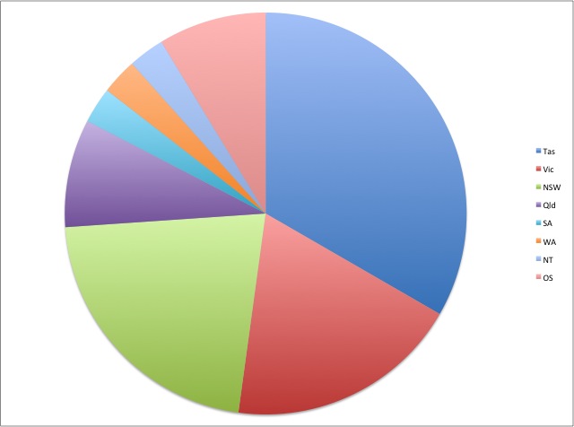
This pie chart shows where the parties came from – OS means from overseas. As expected most parties come from Tasmania. The average party size was about 2.4 people. A total of 184 people visited the Range during the period.
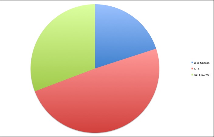
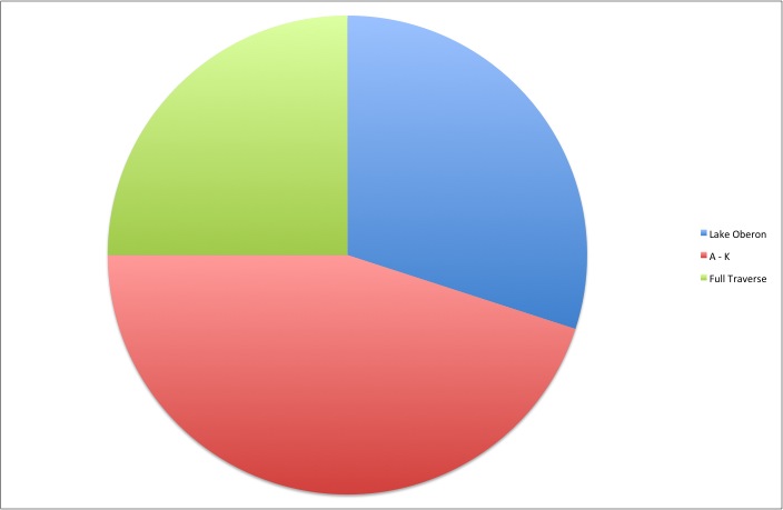
This pie chart shows party intentions. It includes parties that intended to traverse both the Western and Eastern Arthurs. Most of these parties do not sign out at Scotts Peak Dam – so those numbers have not been included in the later charts. The data for Lake Oberon includes parties that only wanted to go to Lake Cygnus.
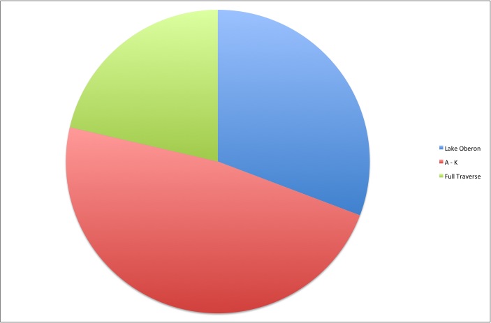
This chart, above, shows the same data as the one two above, but the data for the parties intending to traverse both the Western and Eastern Arthurs has been removed.
This chart, above, shows where those parties actually went. The charts below break up these figures based on original intentions to go on a full traverse or an A to K partial traverse.
This chart, above, shows where parties actually went that set out to do a full traverse of the range. You can see that only a small number of parties are successful. Most parties do make it as far as Moraine K, and about a third make it no further than Lake Oberon.
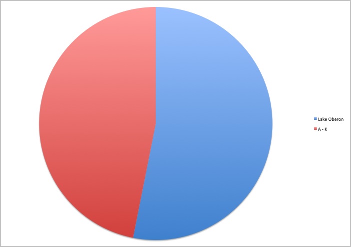
This chart above, shows the same data but for parties that set out to do an A to K traverse. Slightly less than half are successful.
I may revisit the raw data at some time in the future and include numbers of visitors rather than parties.

