
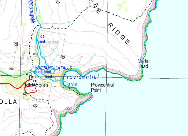
On the previous Wattamolla Walk, I recalled an earlier walk, Brian Everingham, the walks leader, saying that that the feature marked on the current map and signposts as “Providential Point” is actually “Boy Martin Head”, and the real “Providential Head” (not “Point”) is actually on the north side of the cove.
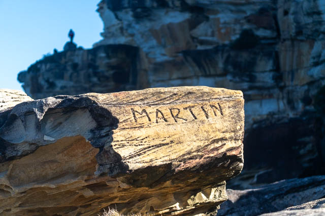
This is supported by an engraving “Martin” on the southern point. So, I thought I would look at some old maps. But first the current topographic map –
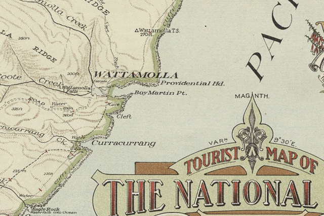
And here is part of the old “Tourist Map of The National Park and Port Hacking”. It shows the two names reversed.
The names come from Matthew Flinders expedition with George Bass and 17 year old William Martin in the Tom Thumb, when they explored this part of the coast. Apparently, they experienced rough seas and sought refuge in what they called “Providential Cove”. Flinders latter found it had the native name “Watta Mowle”.
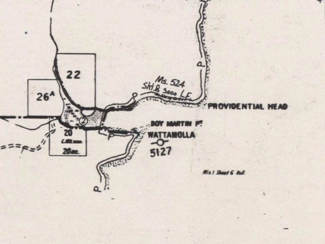
The names “Providential Head” and “Boy Martin Point” are probably due to Myles Dunphy, who with Ninian Melville, compiled the information on the Tourist Map of the National Park shown above. But the names are also found on old parish maps of the area –
It should be easy to change the current topography maps to be consistent with the original nomenclature, but it is harder to change signposts and bureaucratic inertia.