
This was the second walk we had planned in Tasmania. On the walk, as well as Wendy and myself, we were joined by Steph, and also, from Pine Valley Hut, by Freddy.
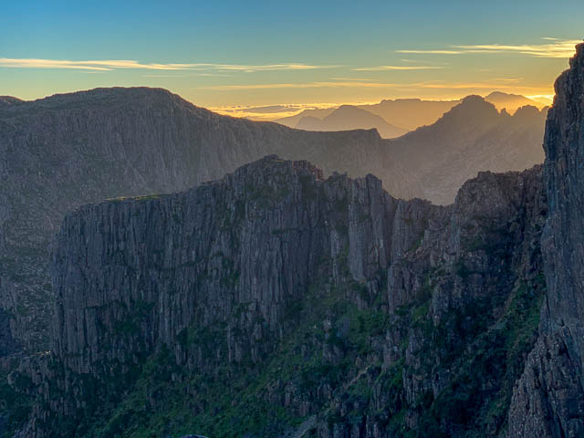
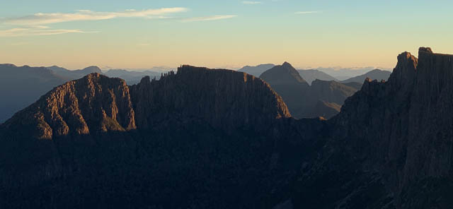
The Du Cane Range is one of my favourite areas in Tasmania. The attractions of the range are many – rugged high peaks like The Geryon and the Acropolis, beautiful alpine gardens, spots of particular wild beauty like The Labyrinth, and also the incredible ancient forest in Pine Valley. I have traversed the range many times. My last trip from The Labyrinth to Falling Mountain was on a trip in 2001. But I have been on more recent trips to Mt Massif – one in 2006, where we crossed Big Gun Pass to Mt Massif and then descended down to Kia Ora, and a trip in April 2004 where we crossed Big Gun pass to camp on Mt Massif and then returned the same way.
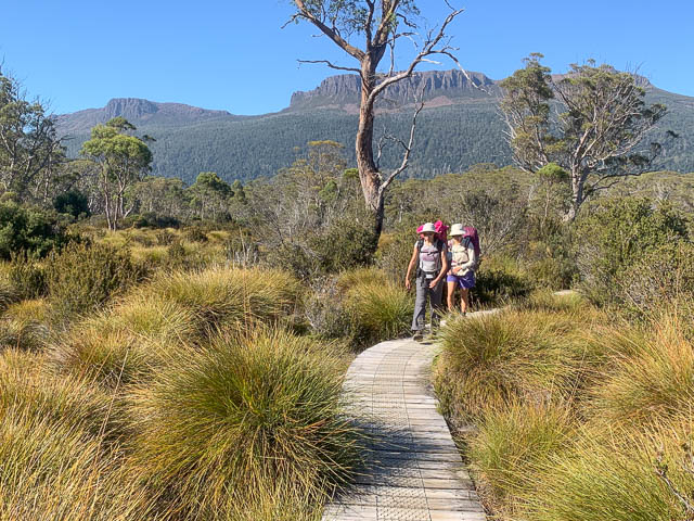
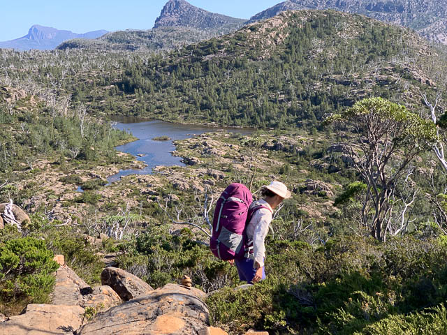
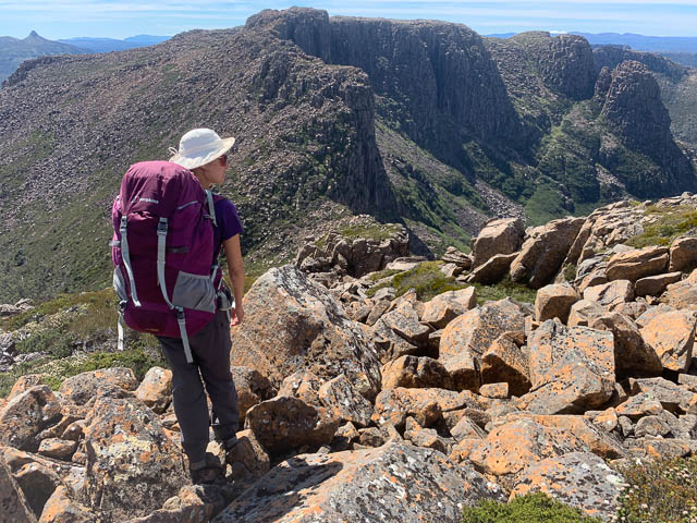
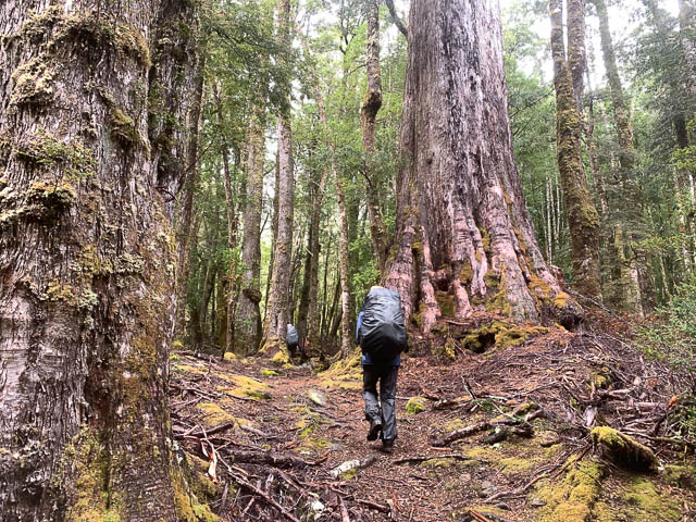
On this trip, we caught the ferry from Cynthia Bay to Narcissus and then walked up to Pine Valley Hut. After setting up our tents on one of the tent platforms, we set off to climb The Acropolis.
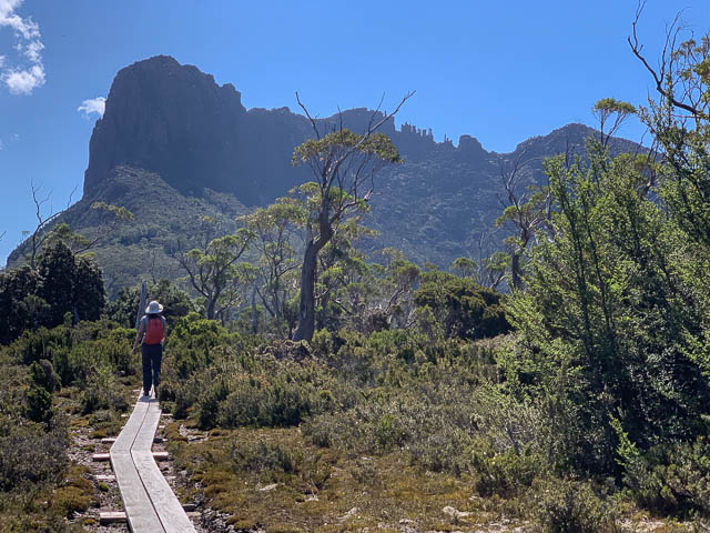
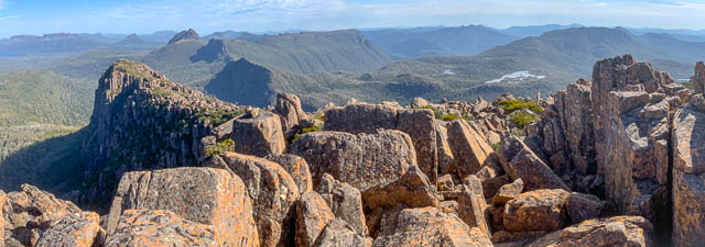
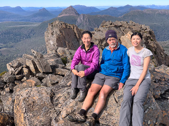
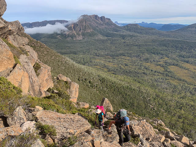
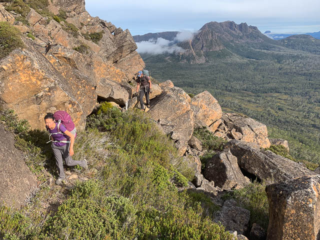
It is a pleasant walk, up through the forest, then across the plateau, a bit more of climb, then traversing boulders to reach the final scramble to the summit plateau.
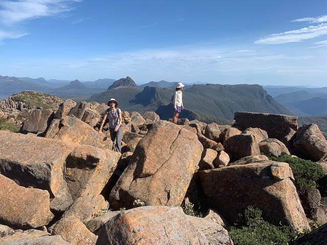
We then made our way to the high point, but the actual summit is the first of the pinnacles and requires an exposed scramble to get to the top of this. Steph was keen to reach this point and had no trouble reaching it.
The after a few more photos, we walked back down to Pine Valley Hut.
We cooked dinner in the hut that evening and while there talked to some of the other walkers, one was Freddy, a visiting hiker from France. He wanted to traverse the Du Cane Range, but wisely was reluctant to do this by himself with only limited information. So we invited him to join us, as long as he could keep up with the scrambling involved. He had no trouble with this, and also kept us entertained wiht his stories of his treks in some far flung parts of the World.
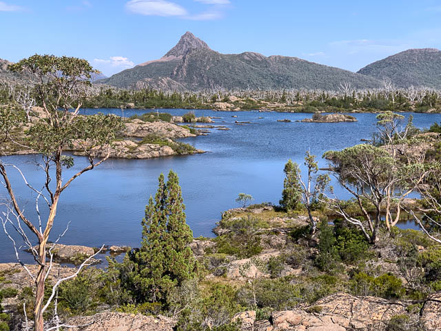
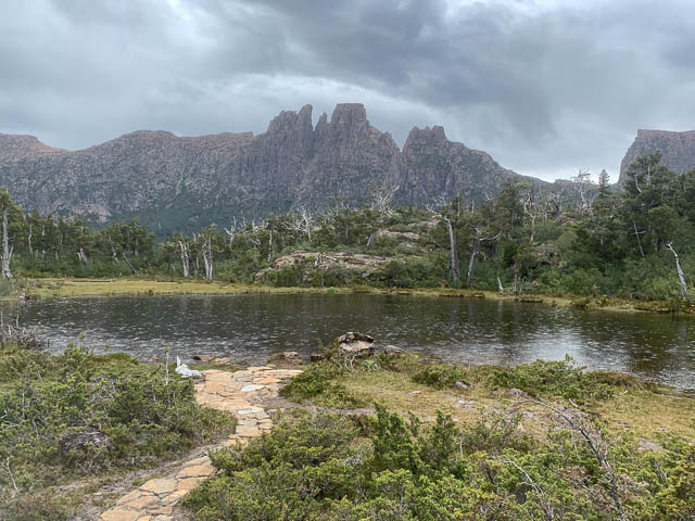
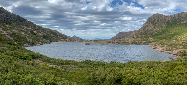
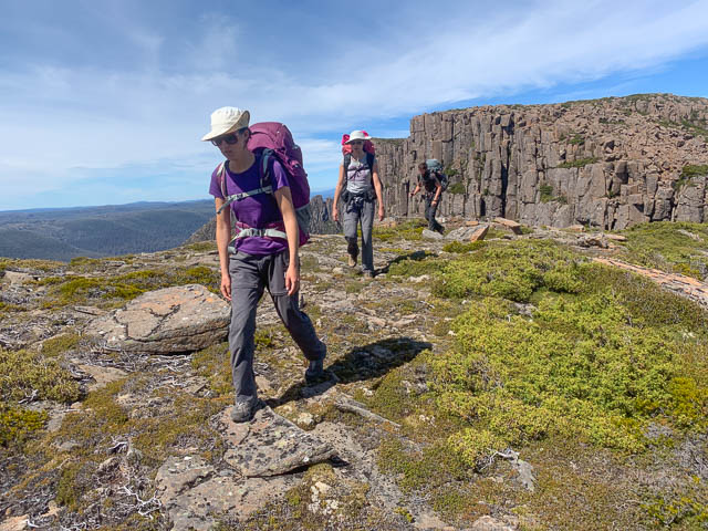
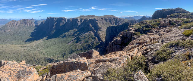
So, on our second morning, we climbed up to The Labyrinth. We set up tents at Lake Elysia and some of us cooled off by having a swim in the lake. One problem with camping in The Labyrinth is the impact the party make to a very delicate area. Its best to try and camp on a hardened area, walk on rocks rather than the vegetation if possible, and to do your toileting outside the catchment of the lake you are camping near. The Labyrinth is a very special place and visits to it are always rewarding, whether on day trips or overnight visits.

During the afternoon, the girls and Freddy headed off to climb Walled Mountain while I guarded the campsite. Then we had a pleasant evening eating outside and waiting for the sun to set.
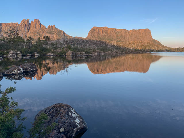
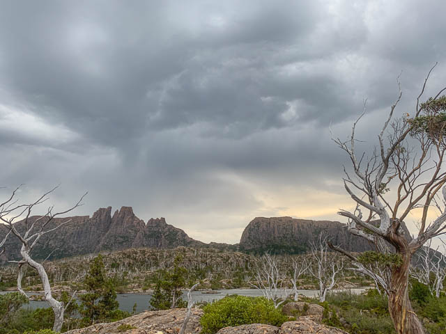
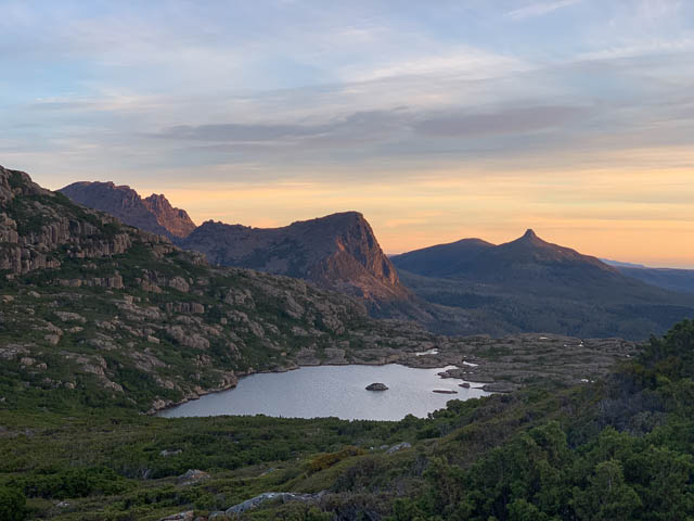
The next morning, the weather was a bit duller. The sky was grey and it was threatening to rain. The forecast for the day after was better, and we had enough time to either wait a day or move on and camp somewhere else. We didn’t want to move on to Mt Massif that day as it could get quite windy. There is a nice campsite part way there at the Pool of Memories, but we thought that was too close to be worthwhile. But Lake Helios may be a better option.
I was worried about the forecast wind, but not far past The Pool of Memories, I was able to get an up to date weather forecast on my smartphone and it indicted the wind would moderate that evening. So we continued on the way to Lake Helios. I had visited the lake a few times earlier, but was unsure how sheltered it was for camping. Its a high area and quite exposed being well above the treeline.
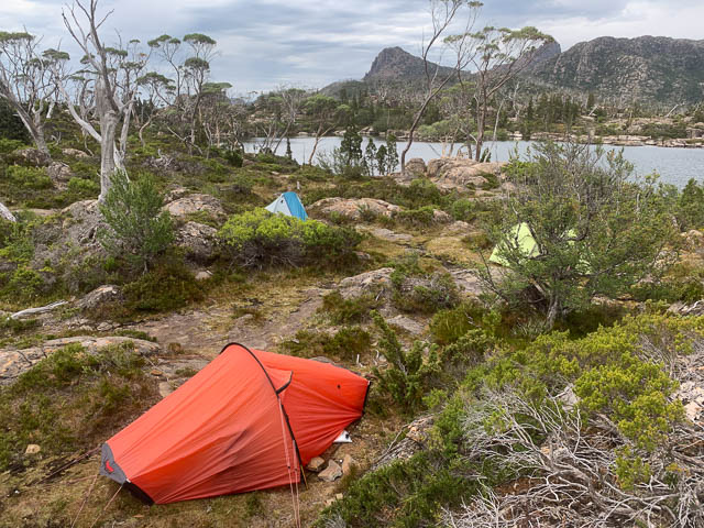
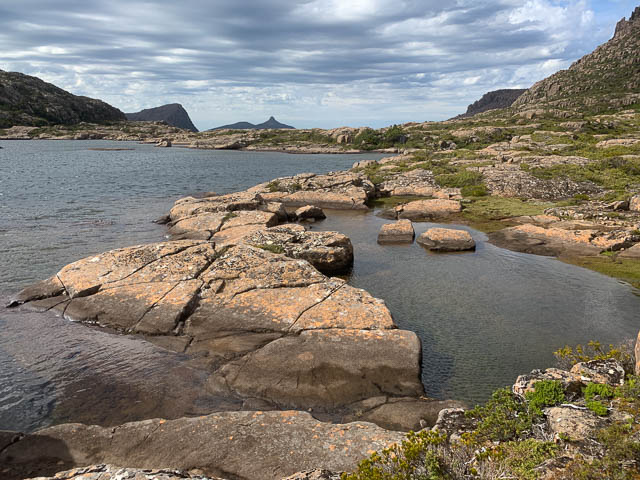
Once we were at the lake, we dumped our packs and explored the area for the most sheltered campsites we could find. The best place for shelter from the wind we had was away from the lake – closer to the saddle between Mt Hyperion and the high point. Here we put up our tents in gaps between the bushes. It turned out to be a good spot.
Later that afternoon, Steph and Freddy climbed the nearby Mt Hyperion. I wondered around Lake Helios checking out that area.
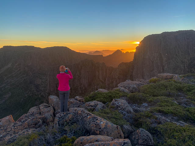
I later climbed up onto the ridge for some later afternoon photos, and then returned for dawn the next morning.
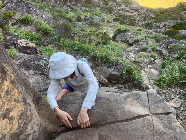
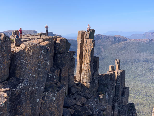
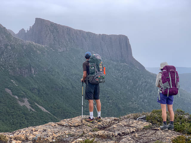
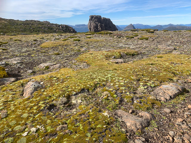
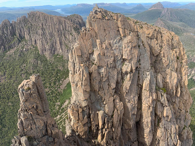
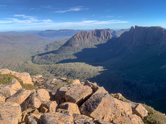
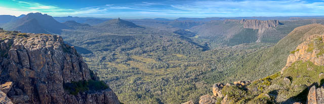
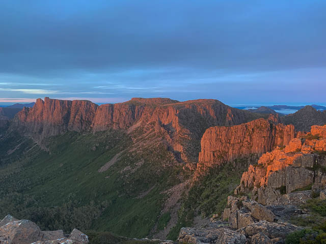
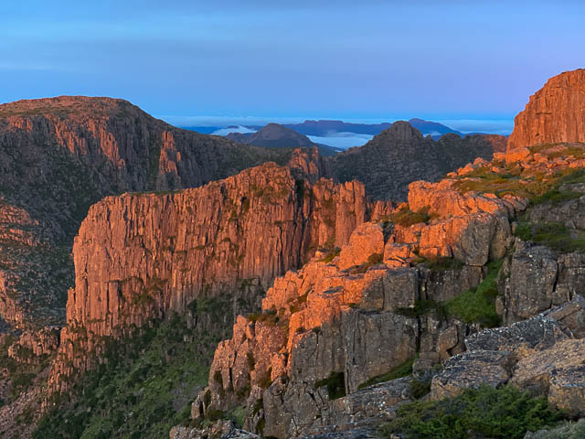
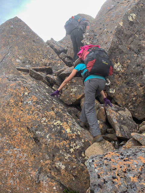
This is certainly a beautiful spot. The new day turned out to be much better – light winds and mainly sunny. Ideal for walking. We packed up our camp and climbed back onto the high point and then made our way towards The Geryon. we left our big packs in a small saddle, and then with daypacks set off for the last bit – climbing onto an open plateau, then crossing a boulder filled gap to the final scramble to the summit of the North Peak.
We soon reached the highest point and then celebrated with photos after we had admired the views.
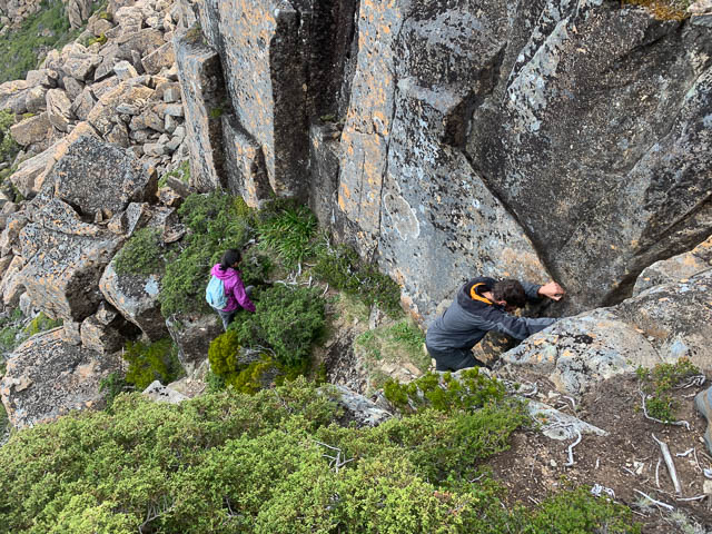
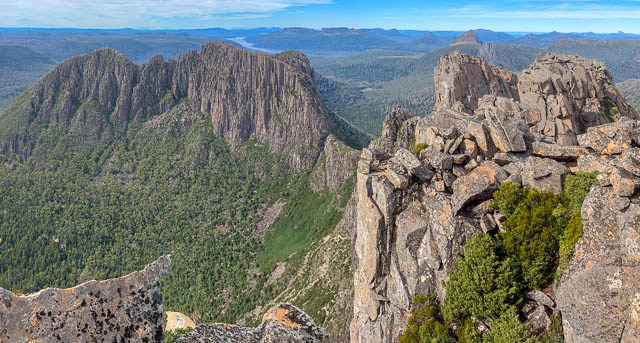
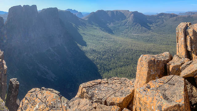
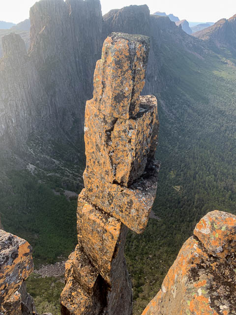
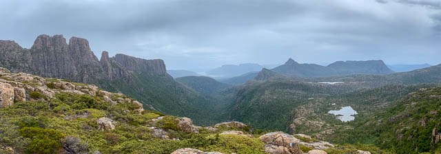
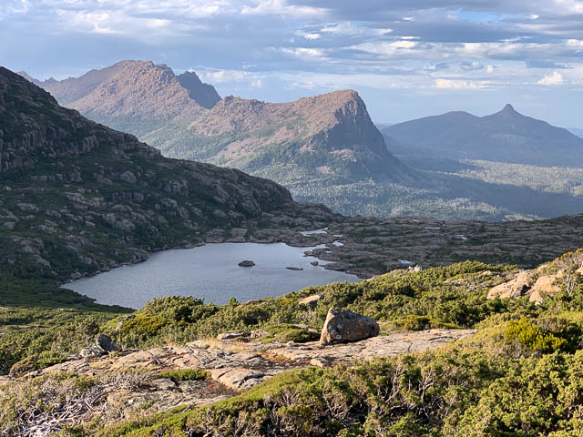
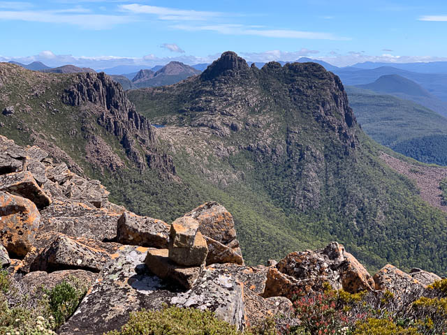
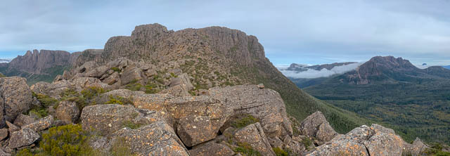
From my previous visits to this peak, I knew however, that the best views are not obtained from the highest point but rather from a slightly lower point a little to the south. To get to that point however involves more scrambling – down, then across a ledge then up a steep and exposed series of ledges. But it is worthwhile for the views of the Middle Peak – the Foresight.
Then we made our way back to where had left our packs. On the way we spotted another party of walkers. They seemed to be a large party heading towards our next objective Big Gun Pass.
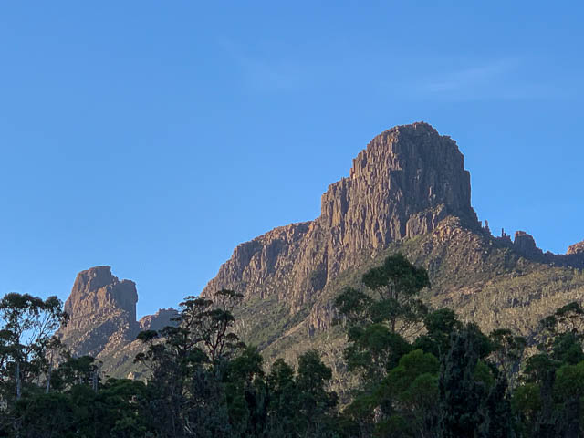
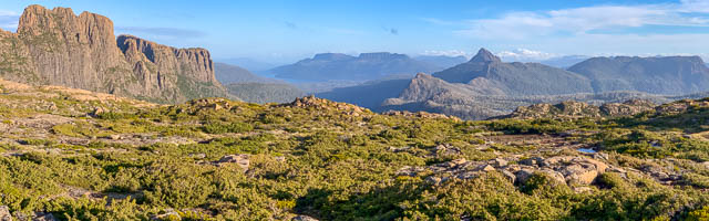
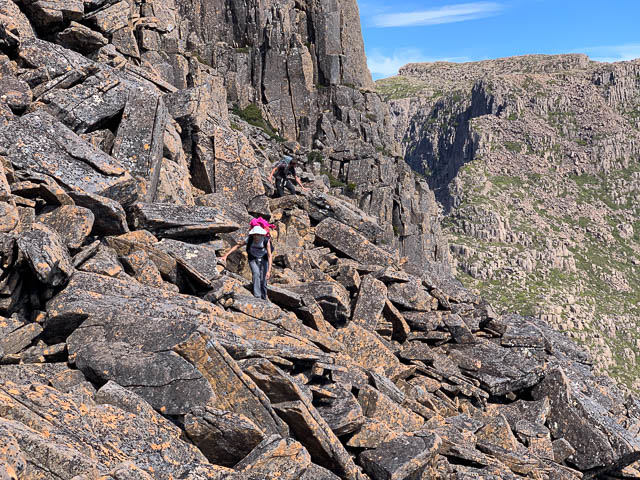
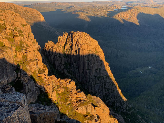
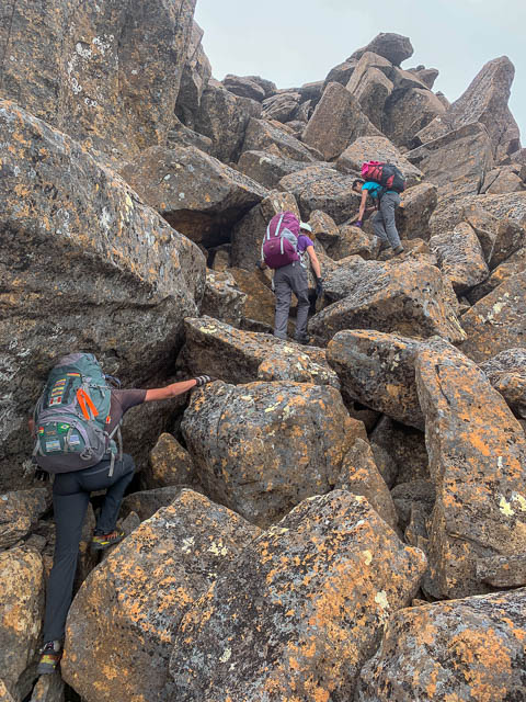
At Big Gun Pass, we quickly descended on a rough cairned route. We reached the other party at the bottom of the pass, and overtook them on the climb out. The last part of the day’s walk is a scramble over massive dolerite boulders to reach the summit plateau of the aptly named Mt Massif.
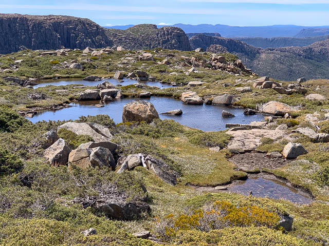
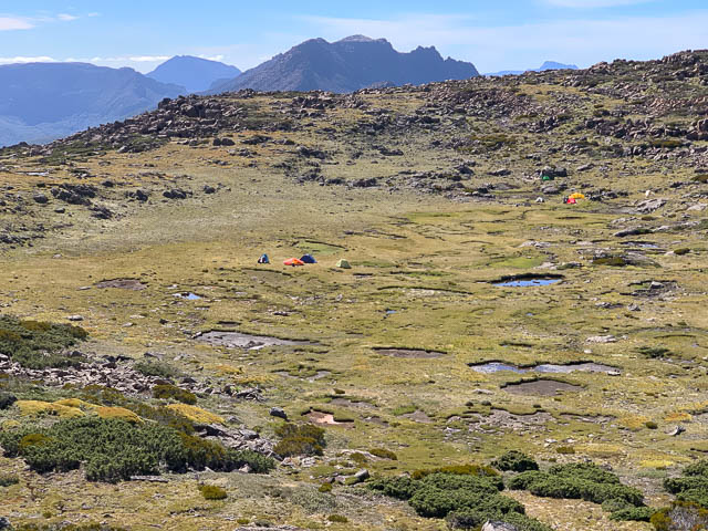
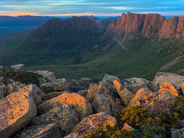
On Mt Massif, there is no trouble finding a good campsite. The summit plateau is not flat, but is bowl shaped – and the depression is both relatively sheltered and punctuated by many small tarns – so ample water. But the recent drought in Tasmania has been so severe that most of these tarns had dried up. Most, but not all – so there were still good places to draw good water.
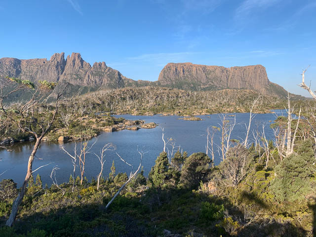
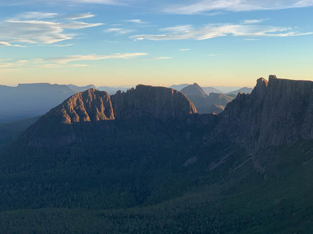
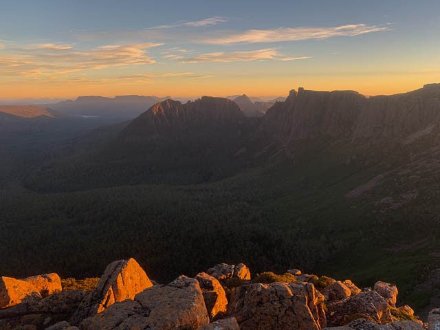
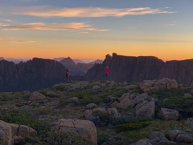
Mt Massif is also a great place for both sunset and sunrise – being a high place surrounded by rugged peaks. Nearby are the peaks of the Du Cane Range – in particular The Acropolis The Geryon, Mt Hyperion and Falling Mountain. To the north are the peaks of the Pelion Range – Pelion East and Mt Ossa being prominent. To the east are Mt Pellinger and Cathedral Mountain. Further away are the peaks of The Walls of Jerusalem, Mt Ragoona and the Mountains of Jupiter. Well to the south is Mount Olympus.
After we had set up camp, the other group of walkers made it to the plateau. They turned out to be from Hobart Walking Club, a party of five.
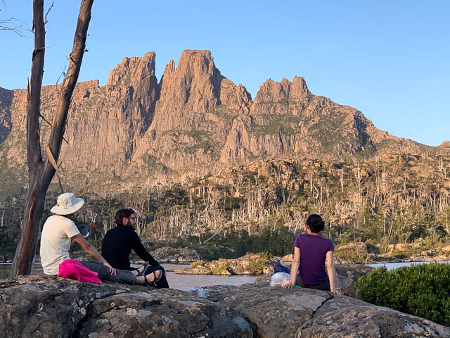
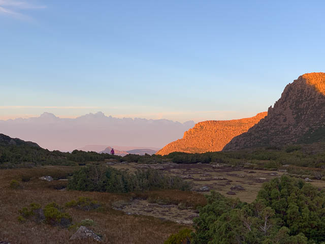
We had plenty of time to explore the area or just relax at the campsite. But we all headed up to the rim for the sunset. It was nice.
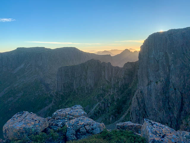
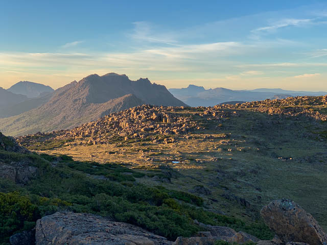
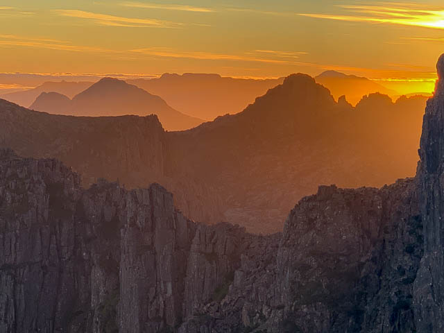
Next morning, I was the only one to make it back up there for the sunrise. It too, was quite nice.
Then after breakfast, we packed up for the next part of the walk. The weather was forecast to be bad that evening – with rain, wind and snow. Not good conditions to be up high. So were were keen to finished the traverse and get down low in the forest.
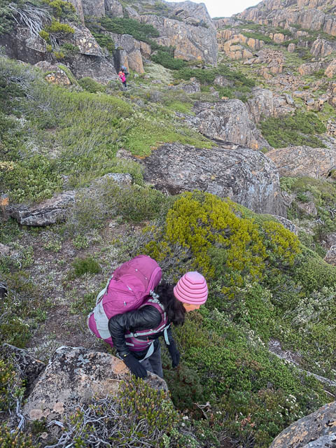
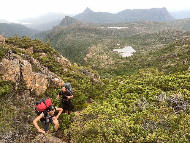
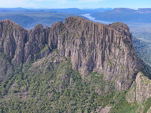
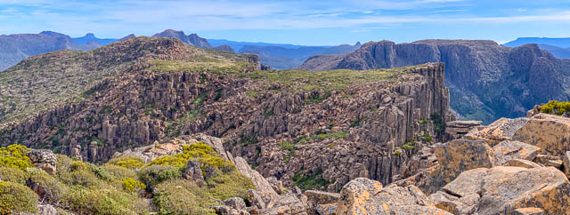
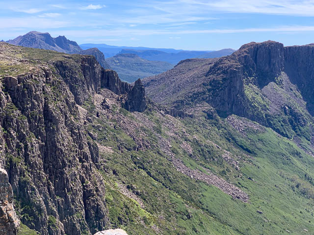
This part of the traverse, it is possible to follow the skyline, but it is easier to drop down a ramp, then traverse a bit and regain the ridge lower down. This avoids a steep bouldery section. Then more fun on boulders as you traverse to Falling Mountain.
Some parts of this we found a rough pad to follow. And we also passed a number of small pools – good sources of water. One of these offers a small campsite. We pressed on to the steep dolerite boulders leading up to Falling Mountain.
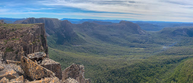
We soon reached the top. The weather now was starting to turn and we continued on the ridge towards Du Cane Gap, and had lunch just above the place were we dropped down off the ridge. To go off the end of the spur would mean hitting cliffs. It is better to drop off before the end on the left and with luck you can scramble easily all the way down the forest.
Our way down proved to be relatively easy – there were steep slopes, route finding was needed to find the best way, and then large boulders at the bottom. Then once down this, you don’t go straight down any more but rather start a sloping traverse – heading to a clearing in the gap that you could see from above. The last part is a bit scrubby.
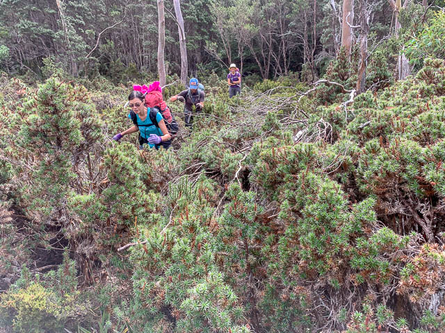
We were happy to reach the clearing, which turned out to be waist high scoparia rather than an open clearing, but we knew the Overland Track was close to the other side.
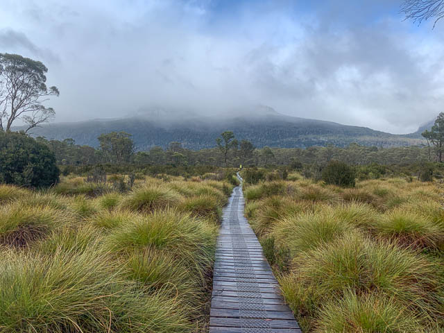
Once on the Overland Track, it was easy downhill walking to Windy Ridge. Once there, some of the party camped on tent platforms and some of us stayed in the Bert Nichols Hut. The next morning was cold, wet and windy. Snow was on the peaks. We didn’t mind the bad weather however and we were happy and relieved that we had not endured it higher up. We packed up for the last time and were soon on the track.
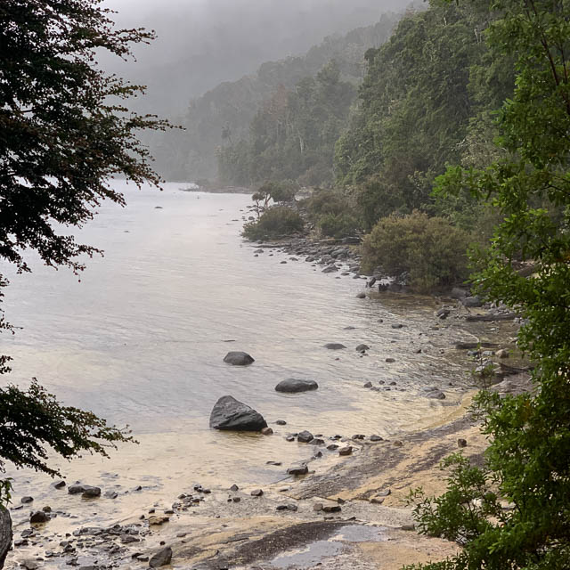
We made good time to Narcissus Hut, but a check on the radio, indicated that the ferries running that day were booked out, so we decided to walk down the lake. This starts out as a pleasant walk, but can become a bit tedious on the last bit.
We reached Echo Point Hut and sought sanctuary inside. It was a good refuge for lunch. But outside, two walkers were waiting for the ferry. Despite a confined booking, it cruised past ignoring their calls and arm waving. They came into the hut. We lent them a mobile phone and they were soon in contact with the ferry base at the other end of the lake. It looked like the next ferry would be able to pick them up.
We continued on our way, walking in light rain, then in wet snow. We didn’t stop till we reached Cynthia Bay. I made my way into the toilet and used the hand drier to warm up my hands. A fire in the visitor centre also helped. We then organised a bunk room and were soon enjoying hot showers. Later, beer, wine and food followed. A good end to the trip.
More photos are online here on my website.
Great photos David. Freddy ended up joining our group the week after for a traverse of the Pelion range! 🙂
Thats a good walk to do!
Hi Dave,
As always, I enjoyed your trip report and photos.
I have been following your Tassy jaunts for many years now and often take notes for my own advantage.
I’ve just started putting together an itinerary for our next hike in Feb next year.
At this stage, I plan to start on Mersey Valley road, walk up to meston hut, (or maybe up moses creek track to junction lake) then junction, then up to lake Artemis, across the traveller range, down to ducane gap, up fallen mountain and around ducane range finishing up back at pine valley and back to lake st Claire. I think you have done a similar route if I’m not mistaken. I would love any advice or suggestions. My biggest concerns are the drop off traveller range and navigating up fallen mountain. Would we be wiser to do it in the other direction? We’re a group of 5 or 6 elderly gentlemen ranging from 53 to 70! The 70 year old is probably the fittest of all of us. Obviously we’re quite experienced with off track and boulder scrambling.
Best wishes, Rob.
Rob – its a great area. Not always easy, but well worth the effort. Getting down from Du Cane Gap is quite easy – as long as you pick up the track. You generally walk along the ridge north of the Orion Lakes until you get to just above Du Cane Gap. This is north of the Gatepost – don’t go towards it. Anyway – keep going and at the closest point above the gap – look out for cairns and a track. It is steep at one spot, but otherwise OK and takes you to a Pineapple Grass flat right on the Overland Track. Its not far from there to where you would start up to Falling Mountain. Look for an open area in the gap, and l eave the Overland Track and descend to it and cross it towards Falling Mtn, then climb up through scrub (Scoparia and Pandanni) towards the cliffs, and then trend right if you hit any bluffs. It is easier going up than down in terms of finding a route. You may find bit of a track here and there. Most of the way along the Du Cane Range – you can expect a faint track. The other difficulty s the Traveller Range – cross the Mersey River at the hut, and then look around for the start of the track (cairns) – follow the track all the way to Lake Artemis, and then beyond to the north side of Lake Eros – the track gets very faint in places. The track seems to end close to the creek that comes from Lake Merope. I then cross that creek and climb up through scrub to the summit of the hill just to the south of Lake Merope. This is the slow section. Once on top – its much easier going – descend on the west side and then then make your way across the tops north of the Orion Lakes. It is mainly easy going – but dont expect to go in a straight line – its easier to wander around scrubby areas and small lakes. Great country. It is not fast going. I like to camp on the range – in a nice sheltered valley family close to Du Cane Gap.
Thanks David,
We’ve had to make a significant change to our itinerary as the Mersey Forest Road has been closed due to damaged bridges!
Very disappointed as I was really looking forward to that particular section.
We will now be starting at Lake St Clair.
We’ll spend a few days exploring and traversing the DuCane Range clockwise and then heading across the gap and straight up onto The Traveller Range. From there the plan is to follow the western edge, due south and then exit down to Narcissus River near the suspension bridge. I’m hoping there is not too much scrub along the way. If it gets too hard, we’ll drop down at Stony Creek.
Any of your priceless advice would be very appreciated.
Thanks again,
Rob
Rob – It is quite easy to get onto the Traveller Range – if you know the start of the track (look for a small pineapple grass clearing on that side of the Overland Track, cross it and then look for the cairns. One on top, you need to pick your way through to avoid scrubby patches. It may be easier to go on the north side of the first few Orion Lakes. Back in 2001, I was on a trip that did a similar walk. We waded across a narrow section of Lake Athena, and headed towards Mt Spurling, and then towards Mt Ida, and ended up at Travellers Rest Lagoon. The way we went was not too hard – but I had heard of other parties that had followed a route to the dam at the end of Lake St Clair – and had a lot of scrub and fallen trees – slow going. Stony Creek is supposed to be OK, and it is probably not too bad descending a km or so north of the suspension bridge. I would expect the first bit to be scrubby – and then it should get easier once you get into the forest.
Thanks Dave.
I’ll let you know how we go.
Hi Dave, Thank you for your detailled descriptions, its wonderful to share and benefit from your experiences, knowledge and photos. I am planning a route over the ducane range from the north. We are capable and experienced off route. Do you have intel for a route up falling down mountain off the overland track from the north side? My plan is to climb just after Ducane hut.
Cheers Alison
You probably could climb near Du Cane Hut – although I have never been up or down that way. Most parties seem to climb up at Du Cane Gap – from near the highest part of the gap – and cross a small clearing – then ascending up through scrub to get to the cliffs, then trending right, and up to avoid bluffs.
Thanks for the tip about the southern edge of the Geryon summit. I’ve wanted to climb Geryon for a very long time. Last week my daughter and I scrambled up there, and it was awesome to be able to look across the gap to the other summits! Abseil slings on the Foresight made me wish I was young again. 🙂