
Wendy invited me to join her on a walk through part of the Blue Breaks during Easter. Also in the party was Keith. The Blue Breaks is a remote part of the Southern Blue Mountains. It is also a very rugged area.

We started the trip, with a log drive to Yerranderie via roads that pass close to Oberon and Mt Werong.
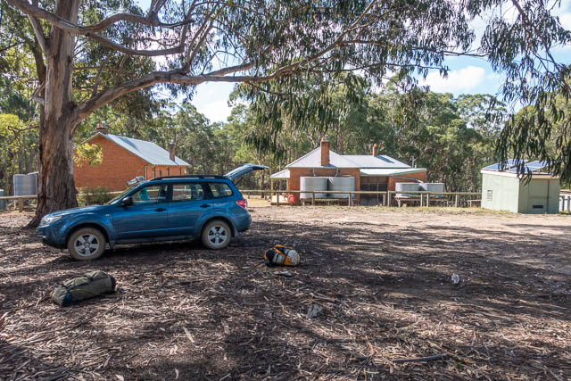
Even with an early start, we did not arrive at Yerranderie till after 11 am. Wendy parked her car at the campground near the old Police Station, and then we set off down an old farm road to the Tonalli River.
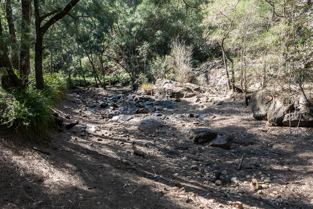
At the river, we hoped to get water which we would carry up onto Lacys Tableland for a high camp. But, when we arrived at the Tonalli River, it was completely dry. We looked upstream and downstream for water, and eventually found some small pools. We filled our containers and headed back to our packs to have lunch.
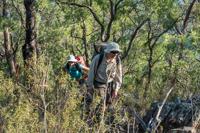
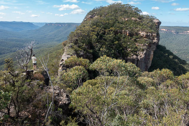
Then we set off up a long climb to Lacys Gap (which is now called Tonalli Pass on the latest edition topographic map). This is a pass in the cliffs of Lacys Tableland near a large block of detached sandstone known as “Pulpit Rock”. The climb was quite arduous, with it being a warm day, our packs were heavy with all the water we needed, and the route up was quite scrubby. We found an overgrown and very faint track for the lower part of the climb. It may have been once a farm road (there were some flat areas that may have been grazed higher up), or an old bridle trail to the pass, or even a more recent bulldozed bush fire control line.

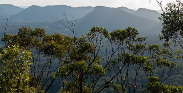
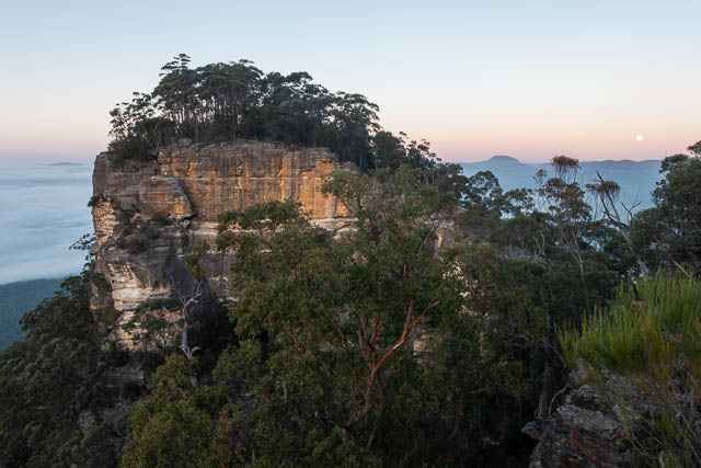
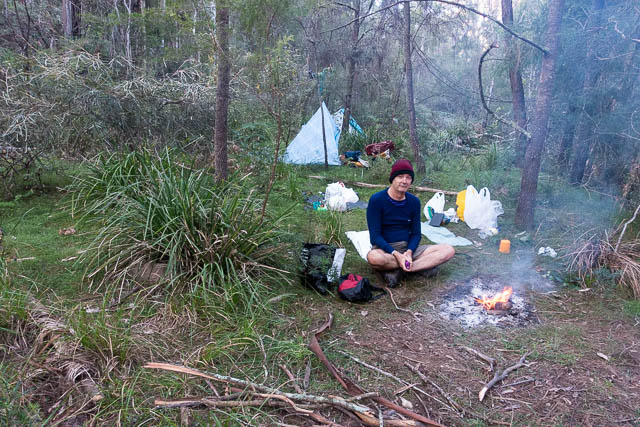
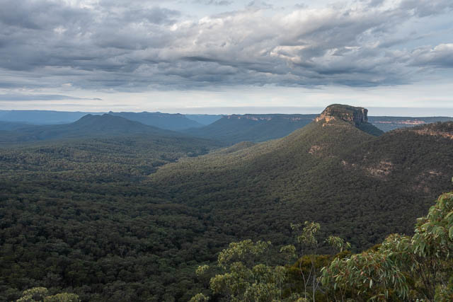
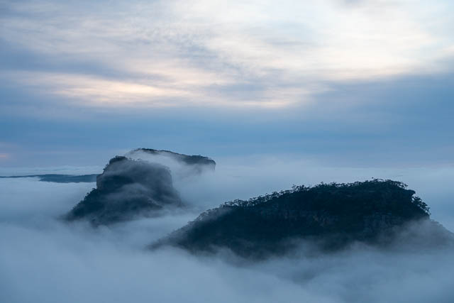
When we arrived at the pass, we climbed up easily via a break in the cliffs to the west of Pulpit Rock. We though our efforts getting up through the cliffs sufficient for us for the day, and we looked around and found a reasonable campsite. Nearby were some fine views of the Burragorang Valley in one direction and the Axehead Range in the other direction.


That evening, we were surprised to hear the howling of a dingo only about 50 m from our camp. The sound was repeated several times over a period of a few hours.
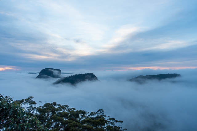
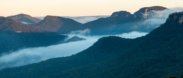
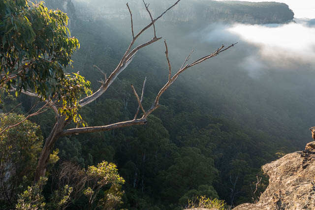
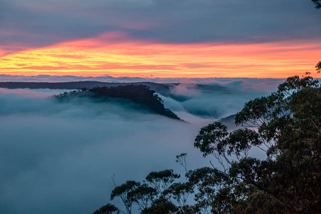
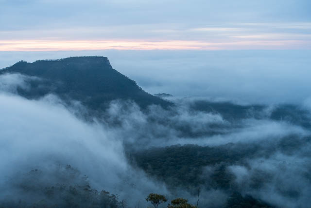
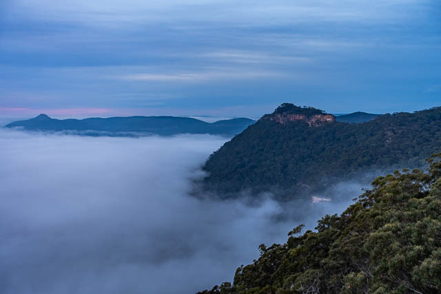
Next morning, we awake early, and found the Burragorang valley filled with mist.

There was less mist closer to the peaks of the Axehead Range.
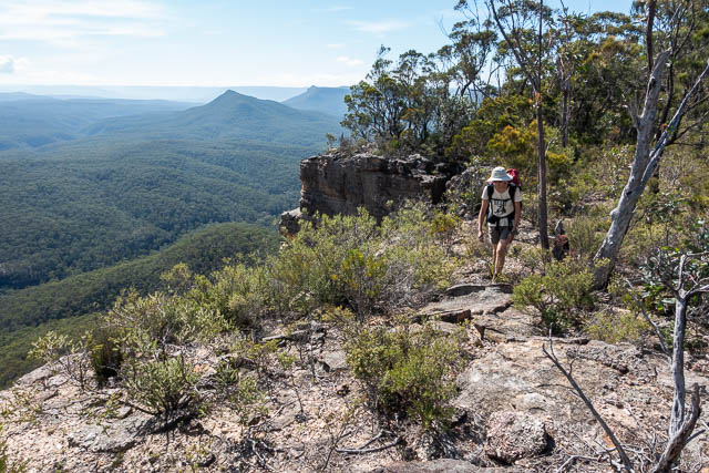
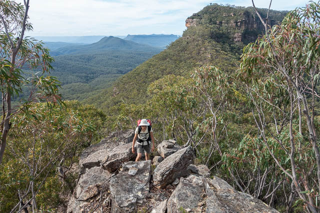
After breakfast, we packed and then started traversing a section of Lacys Tableland to the west. We followed the main ridge system to the top of a pass I had used a number of times on earlier trips – Cuff-link Pass. The pass is an obvious route from the tops to the start of Green Wattle Creek. We first used the pass on a Blue Breaks trip in 1978. It was either on that trip, or one slightly later, that one of the party members, Ross, stopped to do some bouldering on a rock on the talus slope. Feeling hot, he rolled up his shirt sleeves. Unusually for a bushwalker, he was wearing cuff-links. he left these on the rock and forgot to put them in his pack. Several years later, Ross, was descending the same pass, and by chance stopped at the same rock. On top, he was amazed to find his old cuff-links. Being gold plated they were is mint condition.
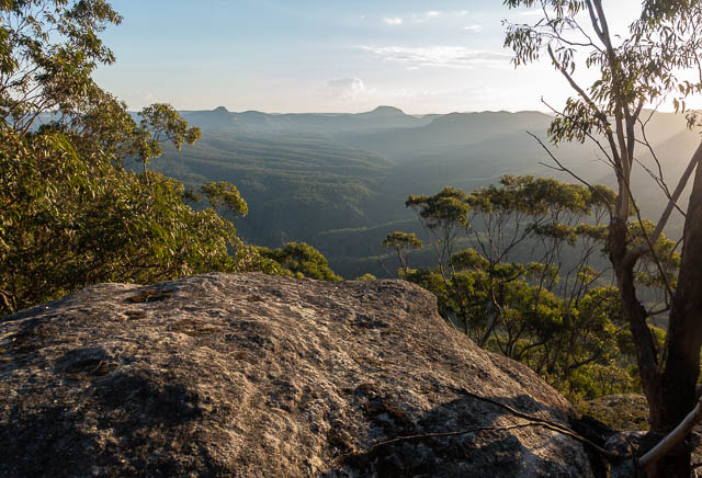
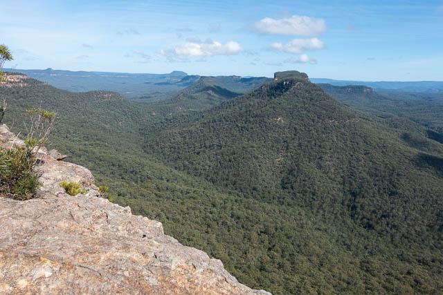
Anyway, getting to the top of Cuff-link pass was easy. The scrub on the tableland was not too bad. At one point, close to the pass, we left our packs and ventured out to a great lookout platform.
I mentioned that the name of Lacys Gap seems to have changed to Tonalli Pass on different edition maps. The same thing has happened to Green Wattle Creek. Older maps show two smaller creeks – Butchers Shop Creek and Bull Island Creek joining to form Green Wattle Creek. Now it seems Bull Island Creek flows into Green Wattle Creek and the name “Butchers Shop Creek” has vanished. A error or a deliberate name change?
Anyway, Green Wattle Creek has certainly changed significantly over the years. When I first visited the creek in 1975, it was fast walking on grassy flats with magnificent stands of Blue Gums. Now, the flats still have the Blue Gums, but they are choked up with secondary vegetation making walking very slow and tiresome. The creekbed is also choked up with fallen logs and bushes. The beautiful grassy campsites seem to have gone.
We had no trouble descending Cuff-link Pass, and we then took a route down an open spur which delivered us to to Green Wattle Creek about 500 m downstream of the Bull Island junction. That 500 m was slow going!
We reached the junction in time for a late lunch break. There was a reasonable amount of water in the creek – in a series of pools rather than flowing. We decided to camp at the junction at a small grassy area in the creekbed, not on the higher flats.
Next morning, we started early up the ridge to Vengeance Peninsula. Vengeance Peninsula is the last section of the Axehead Range. The name is one of many unofficial place names due to Sydney University Rover Crew who mapped the area in the 1960’s and described it in the Gundungura Guide. The Axehead Range goes from Byrnes Gap to Green Wattle Creek and consists of Axehead Mountain, Bull Island and Vengeance Peninsula. There is also another peak, on a side spur, given the official name “Bull Island Peak” and the SURC name “Alchemy Mountain”.

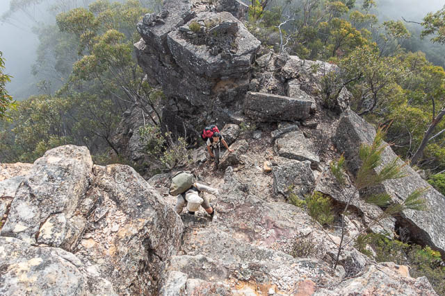
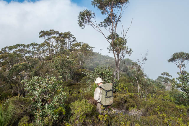
The ridge to Vengeance starts off a bit scrubby, but nothing too bad. Later the ridge becomes less scrubby, but noticeably steeper. In fact, at one place it is very steep indeed. This seems to be a general feature of the Blue Breaks – nice ridges becoming suddenly very steep for a short section. The steep bits require a bit of route finding to find the easiest and safest way up.
The SURC map shows Vengeance Peninsula is made up of three peaks – Mt Ruthless, Mt Remorseless and Mt Relentless. Our ridge took us up to Mt Relentless, then it is an easy saddle to Mt Remorseless. However, the next bit of the Peninsula is amazingly spectacular. The so called “Thin Bit”. The ridge passes crosses a saddle and is less than 1 m wide, and very exposed on each side. The fragile rock requires care and careful scrambling to negotiate a way across.

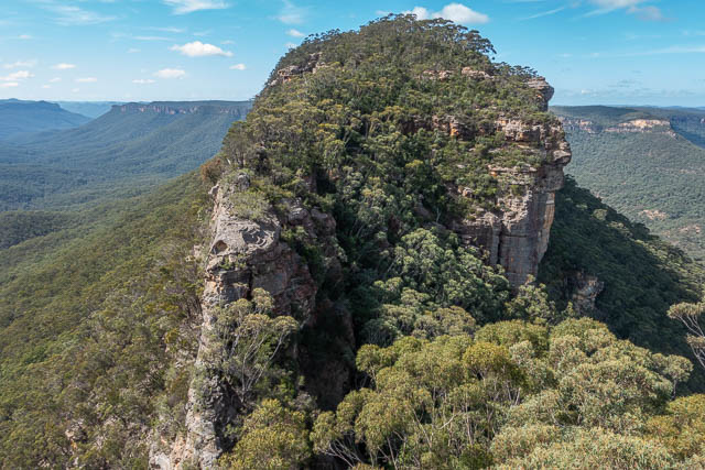

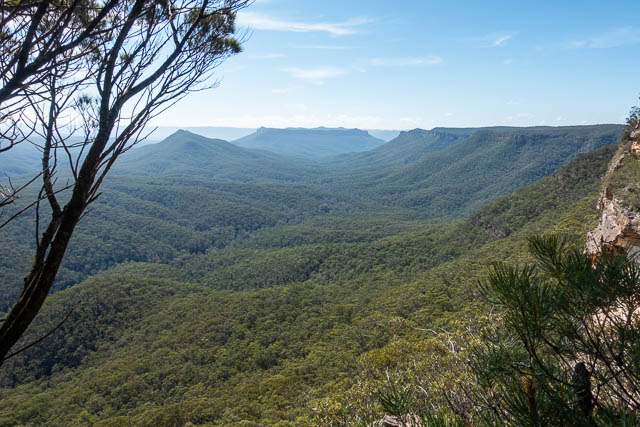
Once across this, we stopped to admire the views. to the east we could see the “Razorblade”, and extreme knife-edge ridge that extends from Bull Island Peak (Alchemy Mountain) to Bull Island Gap. Beyond that is Terni Head – which is a steep scrambling pass onto Lacys Tableland.

It is then an easy descent to a lower saddle. On the way down we disturbed a wombat sheltering in a cave. We wondered how animals like wombats are able to get water on a dry ridge like this.

Next, we had to climb Bull Island. Another climb, with another short very steep section took us to the top, then a sloping descending traverse on the north side allowed us to skirt the cliffs.
We then crossed Green Wattle Gap – a large saddle. It too has steep parts – but in this case both sides of the saddle are cliffs, so it is more like a causeway.
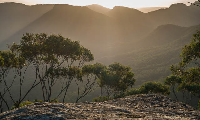
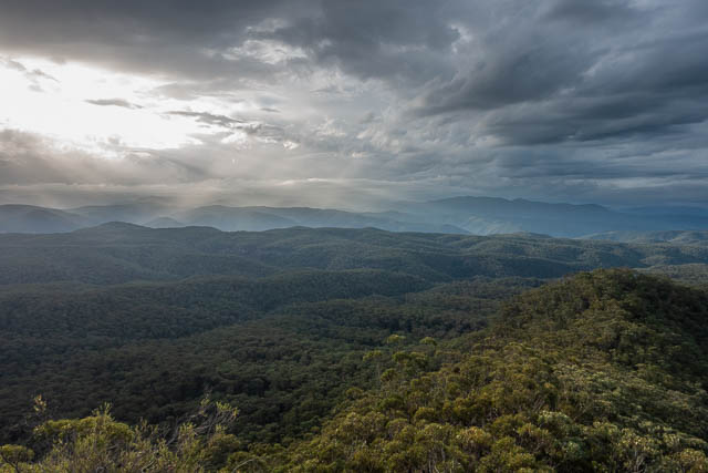
Then another steep climb up to the north east end of Axehead Mountain. Being another quite hot day, and carrying lots of water, we were glad to arrive at our campsite. The area where we camped was nothing special, but close by was a magnificent viewing platform. This spot is one of my favourite places for a high camp.
No good sunset – there were storms brewing to the west. We only had a few drops reach us.

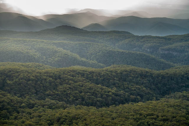
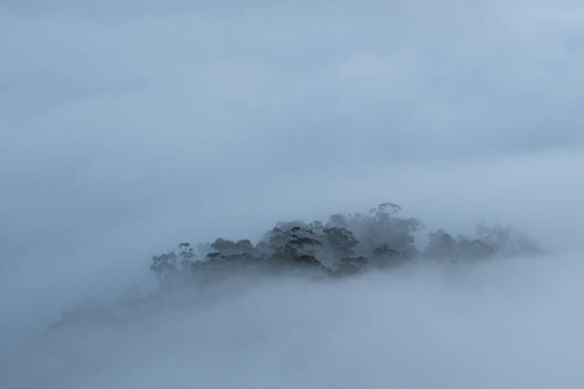
Next morning, Keith woke us early to view the dawn. There was a beautiful red glow to the east. The valleys were full of mist.

Unfortunately the red glow did not last long. The Sun rose, but was hidden behind a big bank of clouds. Instead the valley mist rose and soon our high camp was shrouded.
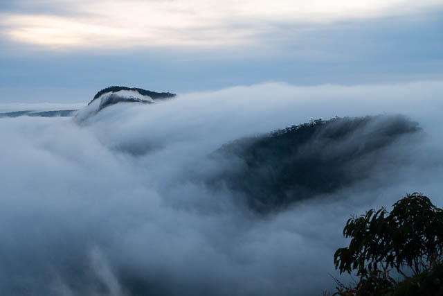
It was still very misty the new set off, and it required careful navigation not find the right way off our high point.


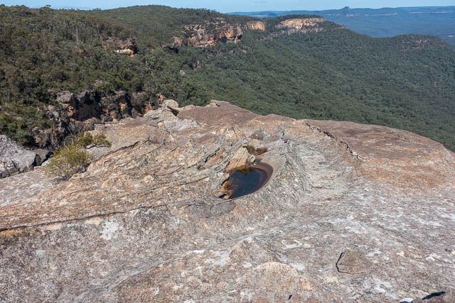
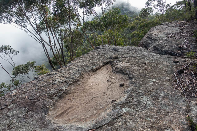
We climbed up to the next high point. Here you can find a (usually dry) rock pool and a set of Aboriginal sharpening grooves.
We kept on walking through mist for an hour or so. Gradually it was being evaporated by the Sun. When it was nearly gone we spotted a Brocken Spectre and Glory.

We made good time traversing the rest of Axehead Mountain and soon arrived at Gander Head which overlooks Byrnes Gap. An old track provides a passage down through the cliffs.


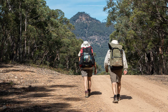
At the bottom, we soon reached the fire road to Yerranderie. About 90 minutes walking later we were back at Wendy’s car.
More photos from the walk are online here on my website. Many thanks to Wendy for organising the walk, and to both Wendy and Keith for their company on the walk.
Hi Dave,
Do you happen to know the easiest way to get to Lacys creek yerranderrie?
Is there a possible way (in theory) to get a quad bike or dirt bike there?
Could you get one up the Tonalli gap?
Thanks!
The easiest way would be to go by boat – but there are some difficulties there (Catchment area, big fines etc).
Otherwise walk there from Yerranderie via Lacy’s Gap. There is no way you could get a dirt bike or quad bike there – way too rugged, and illegal in the National Park.