
This was my last activity in Tasmania, and it was a bushwalk in North West Tasmania, along a track called the Dooley Track that goes along the Wilmot River. My sister Alicson and her husband Shane had both suggested the walk, being one that they had not done, and it was great that they organised it and were both able to come along.
The Wilmot River is a tributary of the Forth River which joins the coast not far to the east of Ulverstone. A track along the river was originally cut by James Dooley, a prospector, in 1859 after a gold rush in the upper Forth Valley. The Wilmot was seen as an easier, less rugged route and so Dooley cut a track along the river. Recently bushwalkers have looked for and found this old track and cleared it, added river crossings and alternative tracks making it an attractive bushwalking area. And particular credit must go to the late Bill Shepherd, who initiated the project and seems to have done most of the work. You can read about the walks and their story on wilmotwalkingtracks.com.
The walk we did starts from near the Alma Bridge – about 1 km along the Wilmot Road after the bridge. At a bend in the road, you can park, and then look around for the start of the track.
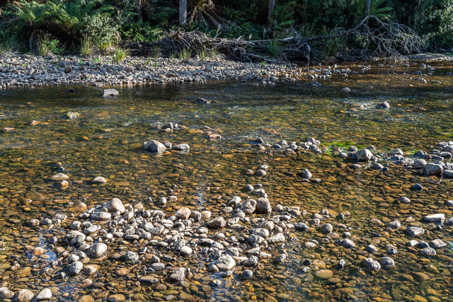
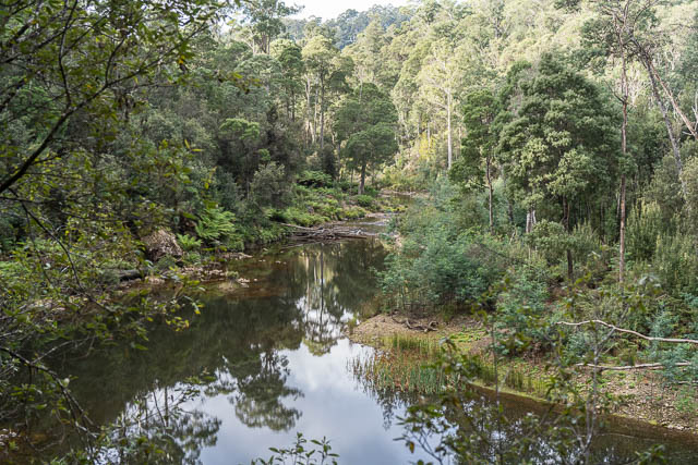
The track descend to the river level via 11 switchbacks, and then goes upstream. This section of the track is known as Lucys Track (named after Lucy the dog). We found the track well marked and well maintained. on the way we passed the Shoestring Crossing – which we would use on the way back. We kept on going upstream on he true right bank all the way to Ellis Flats, where there is a car accessible picnic area and another crossing point. We crossed here to the true left and then followed the Dooley Track downstream to the Shoestring Crossing and then made our way back to our start point.
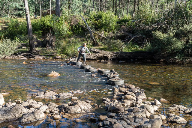
The two river crossings are interesting – utilising old car tyres filled with rocks to make them stable and to keep them in place. They seemed to work very well.
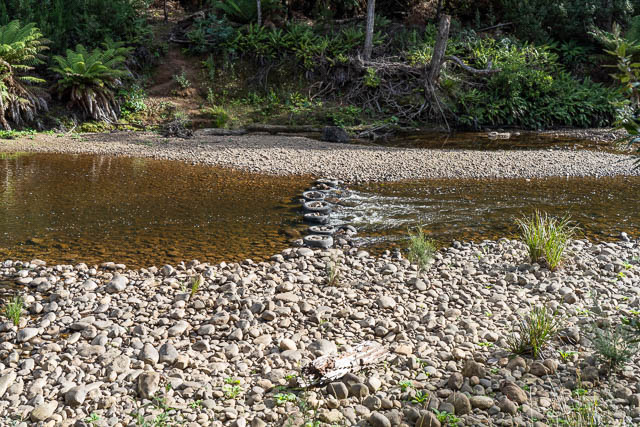
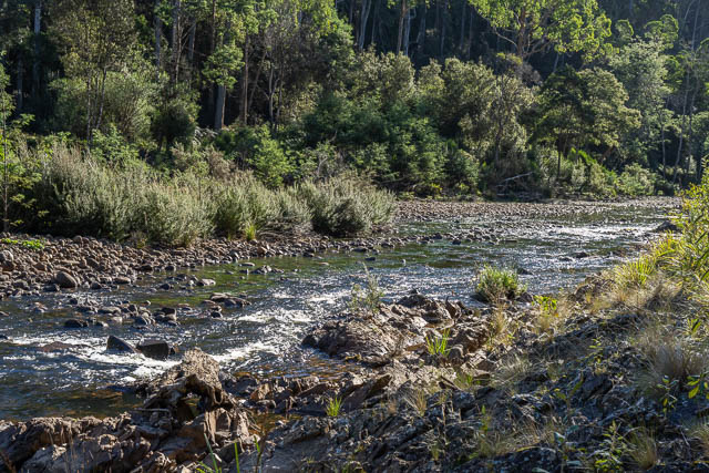
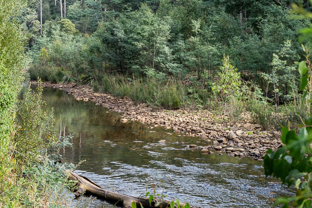
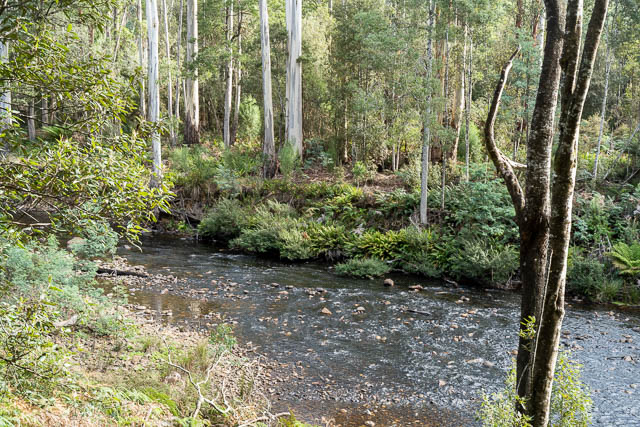
The walk along the river on both banks was very pleasant going though attractive country. The river itself looks great to raft down in higher water or to swim in in summer. There are many easy looking rapids and cascades.
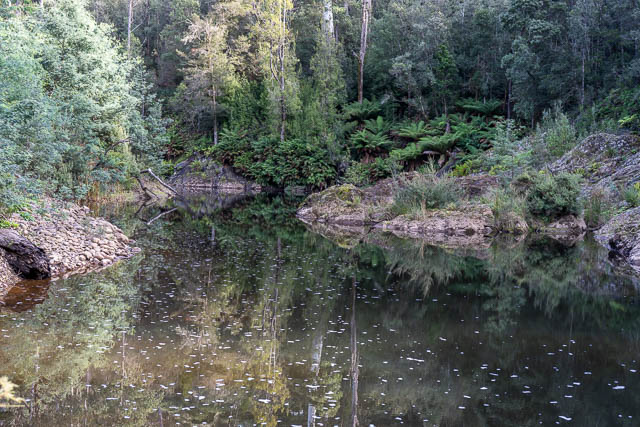
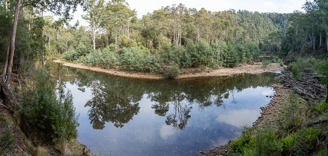
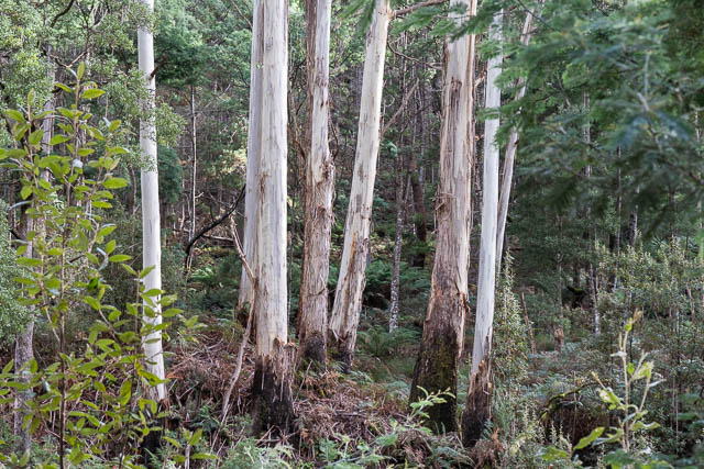
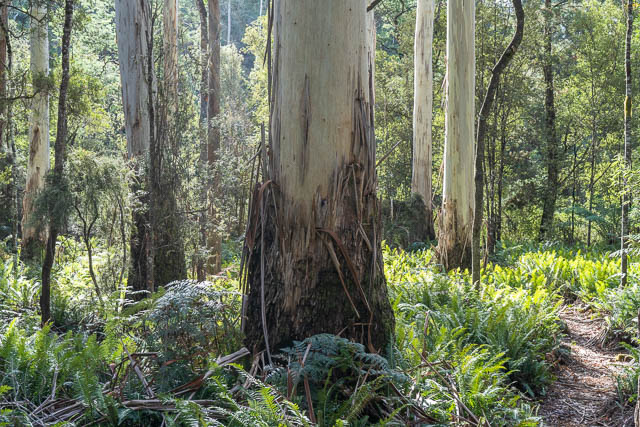
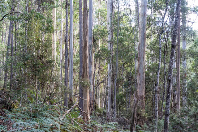
The forest on the banks is also very attractive. Lots of tall Eucalypts, and in places many tall tree ferns.
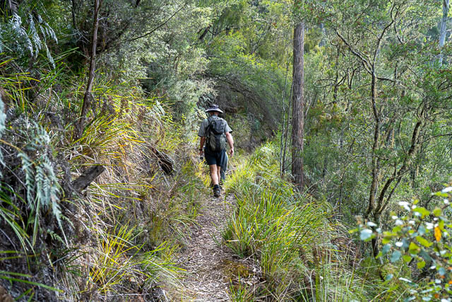
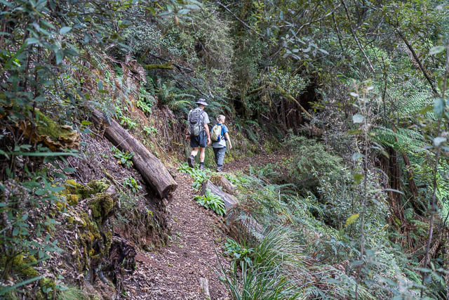
Along the way are track markers, signs and laminated maps attached to trees. Its very easy to find your way.
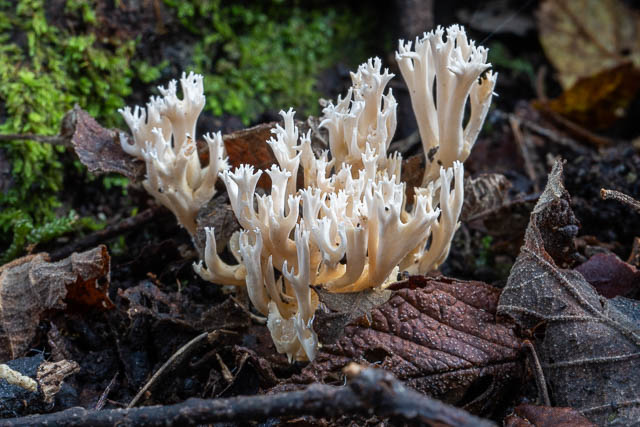
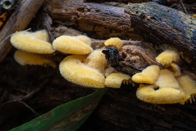
I also was on the lookout for fungi – and found a fair amount out. Here is some –
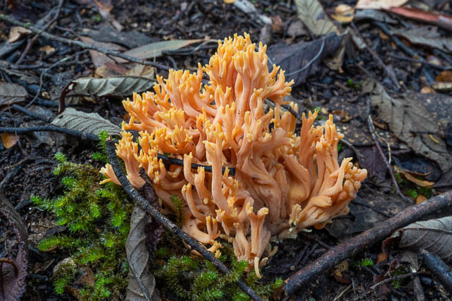
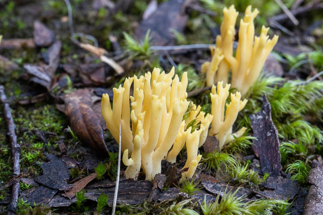
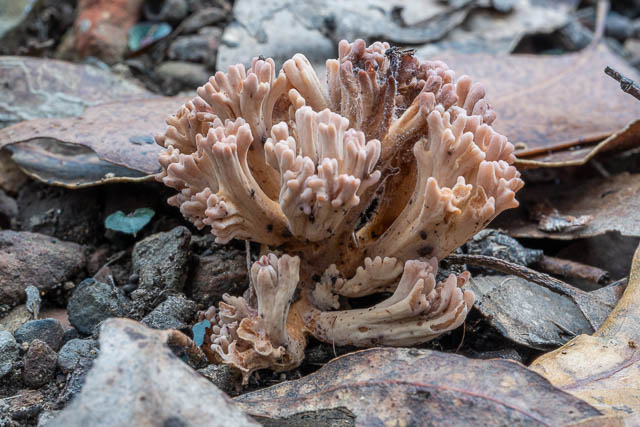
Ramaria sp.
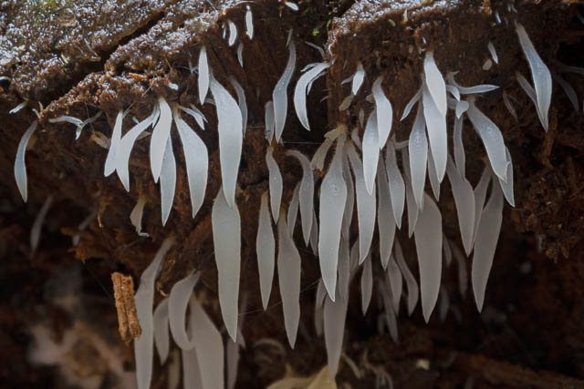
Pleurotus purpureo olivaceous
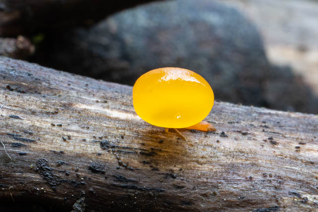
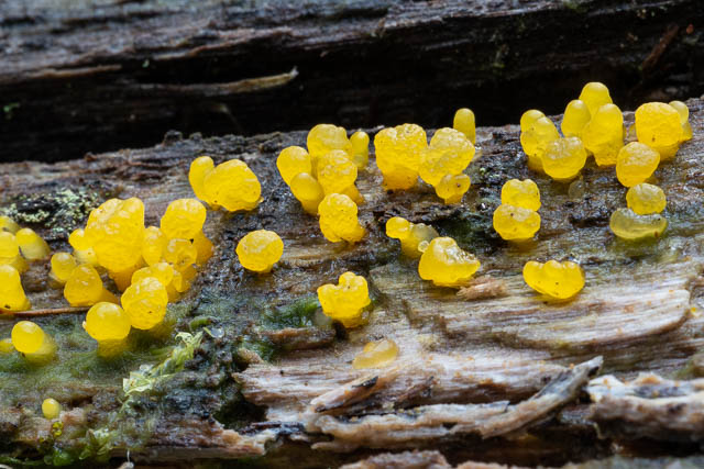
Dacrymyces cf. stillatus
Xylaria sp.
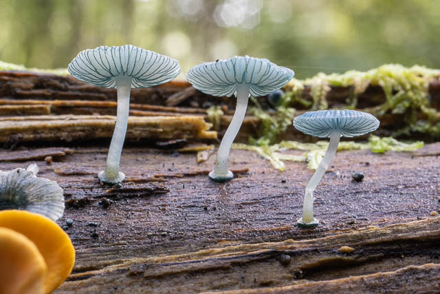
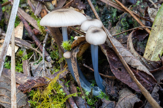
Mycena interrupta
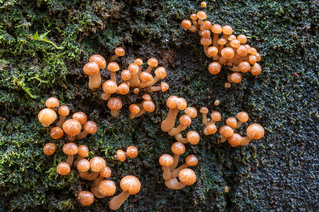
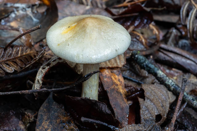
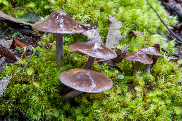
Hypholoma sp.
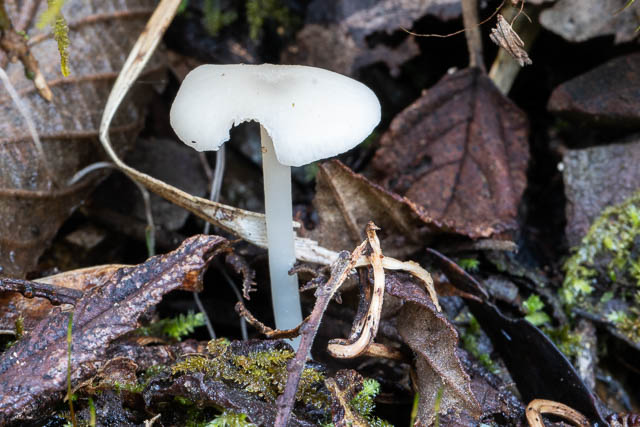
Entoloma albidocoeruleum
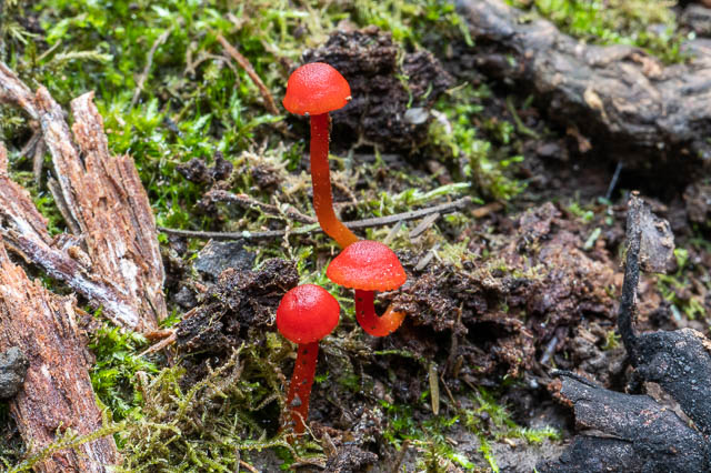
Hygrocybe rodwayi
Hygrophorus involutus
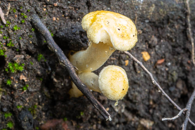
Hygrocybe firma
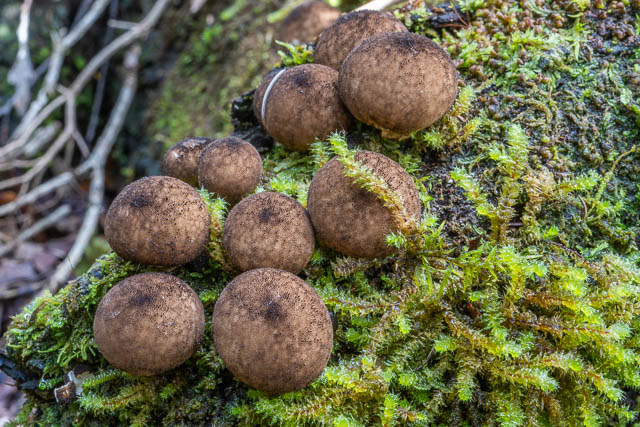
Puffballs – Lycoperdon sp.
Ramaria sp.
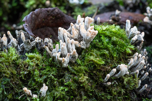
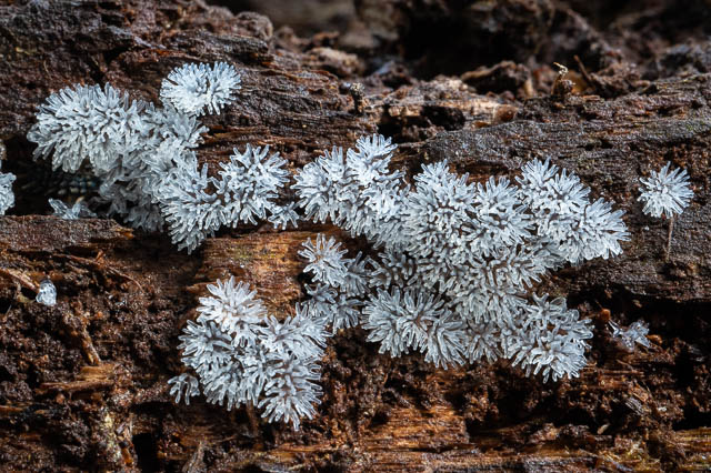
Leucogloea compressa
Cortinarius rotundisporus
Cortinarius submagellanicus
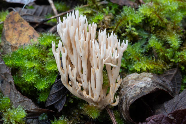
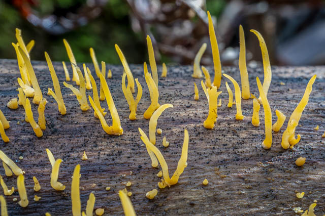
Ramaria lorithamnus
Dacrymyces sp.
Ramaria sp.
Mucronella pendula
Calocera guepinioides
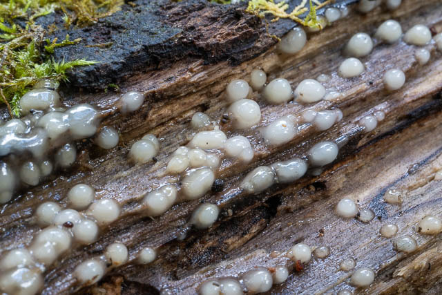
Slime Mould – Ceratiomyxa fruticulosa
The walk we did was a nice round trip. Mostly easy country. One major hill – back up the 11 switchbacks up to the carpark. After heavy rain the river crossings may be impassible.