
This was a most interesting walk with Bob. I had never visited the upper parts of Glenbrook Creek above The Lagoon – the large pool at the junction of Glenbrook Creek with Sassafras Gully. On a Sassafras Gully walk, I had walked a short distance upstream on a rough track and the country looks quite reasonable for walking. I had also heard of bushwalkers that had came downstream from well above – eg Linden.
Bob had recently spotted a newly marked track on Open Street Maps that started a short way along the Oaks Fire Road at Woodford, and led into an upper tributary of Glenbrook Creek near Linden. This seemed a good way of getting into the creek.
So we went up to Springwood in Bob’s car, parked there, and caught a train to Woodford. Then a short section of street walking to get to the start of the Oaks Fire Road.
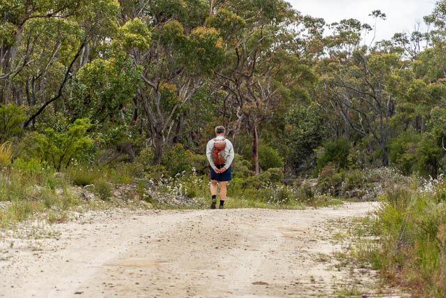
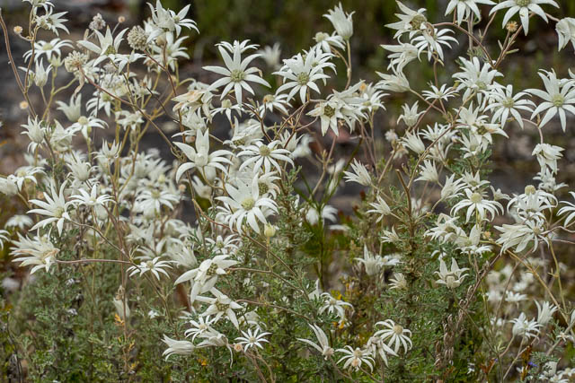
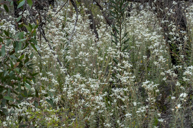
We set off down the fire road, passing large blooms of Flannel Flowers.
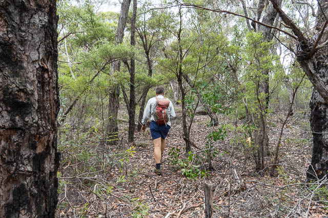
Then, we turned off where the map indicted, and soon found ourselves on a rough track.
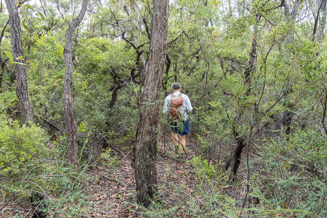
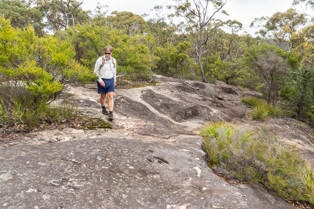
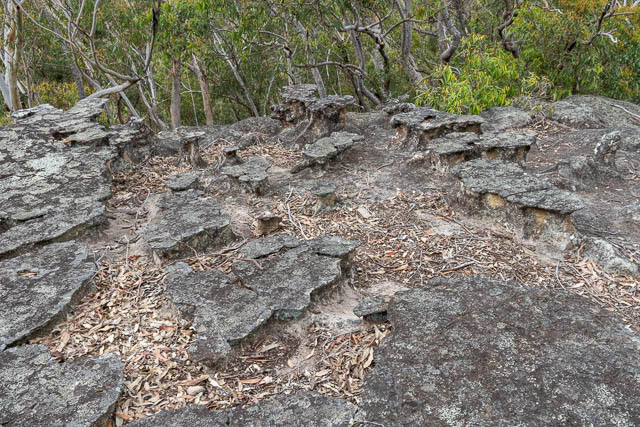
It was easy and pleasant walking along a ridge. At some parts there were open rocky areas. The track was marked in places by pink tape and the odd cairn (duck).
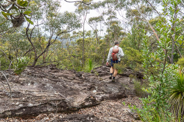
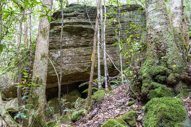
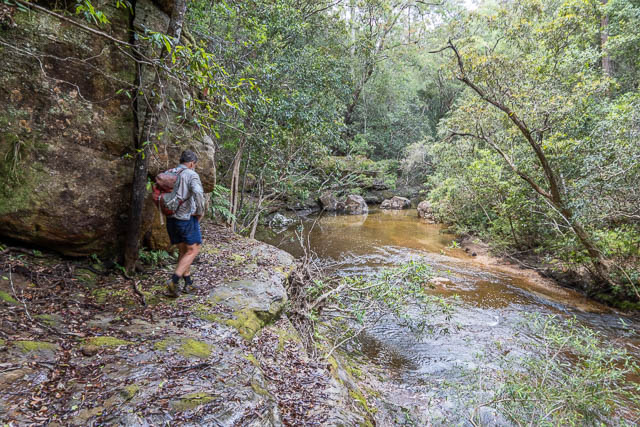
The track then descended steeply down through cliffs to the creek. On the descent it was harder to find the actual track and care was needed to avoid lawyer vines.
Before we reached the creek however, we noticed what appeared to be an old and very overgrown road. There was another similar overgrown road on the far side of the creek. We guessed they must have been old logging roads. Some old stumps and fallen cut trees supported this. This was interesting. I knew about an old sawmill and funicular railway nearby at Faulconbridge on the other side of the railway line and highway, but I was not aware of any logging on the south side.
Later, at home, I checked out a few old maps to see if any logging roads showed up. I could not find any on the Windsor 1:63,360 sheet, but the Miles Dunphy Grose Valley Map had some old roads marked that could fit. One went down the ridge from Lady Martins Bath and another made a loop down closer to where we had entered the creek from another ridge on the Linden side.
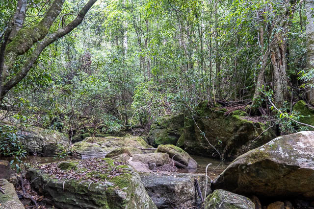
Anyway, we then proceeded down the creek. At first it was rough walking. The track seemed to disappear – perhaps it had been washed out, or was higher up on the true left bank?
We walked down the creekbed in places and soon got wet feet.
It did not taker too long to get to the junction of the creek downstream from Martin Place. The ridge here goes up to Martin’s Folly and Lady Martins Bath. On an earlier trip to the Bath, we had seen a taped track heading down the ridge, so I expect it goes all the way to this spot.
From here down we followed a rough track for the first bit. Here is one section where we found some yellow tape –
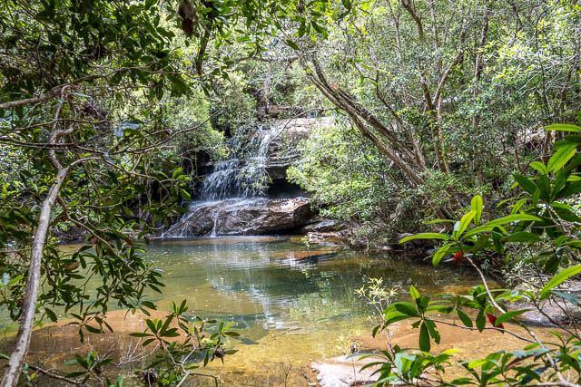
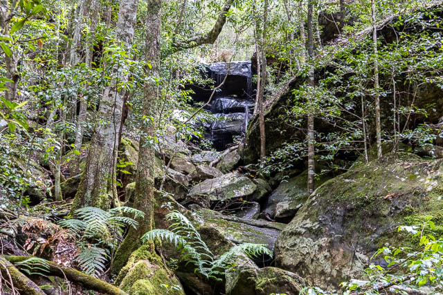
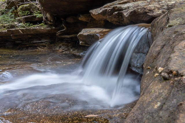
At the next side creek downstream, we found a nice waterfall.
The track seemed to peter out, but the bank was mostly quite open so was not needed.
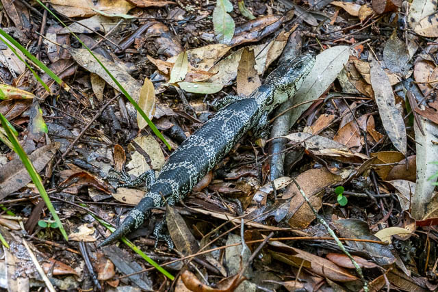
We spotted this lizard, which friend Ken Griffiths identified as a Pink-tongued Skink.
As we continued, we stopped for break at the junction of a creek entering from the true right. There was a nice swimming pool and waterfall here. There was also a nice spot to camp. This was about half way down the creek to The Lagoon.
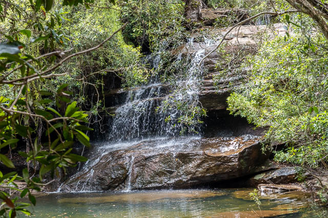
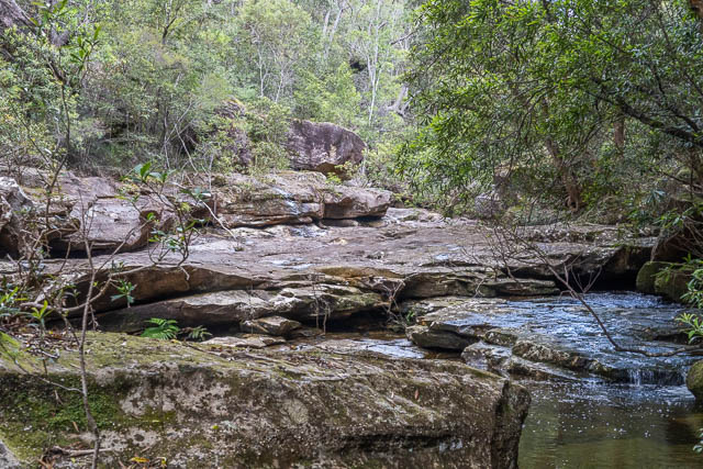
Further downstream was a nice section of rock slabs in the creekbed, and a small cascade.
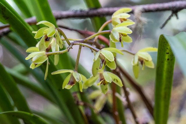
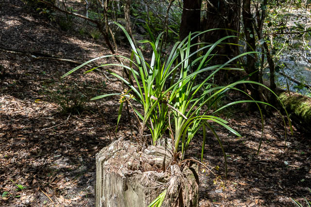
We also found a nice orchid, Cymbidium suave, growing on a log –
We then passed a very beautiful section. There was a long pool that looked great for swimming and downstream another area of rock slabs.
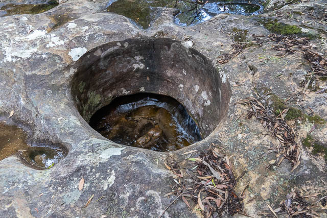
it was around here that we found some old stonework. Signs of an old track. I did not know that there had one been a track along this part of Glenbrook Creek. Back home and some internet research on Trove revealed this link from 1939. Here is a quote –
To the main creek above the swimming pool we now turn. So far we have only dealt with easy, well worn paths. Now we are in the realm of the “hiker.”
A track leaves Sassafras a few yards past the red shed. It passes through the finest timber of the district for two or three miles, then is completely lost. By taking to the ridge on the right it is comparatively easy to reach Linden, but by the gully it is five or six hours’ hard work. Keep rigidly to the gullies on the right, otherwise you will arrive at Woodford or much further afield.
So there was an old track here that went for a few miles. We certainly saw some great trees – Turpentines. The “red shed” would have been an old picnic shelter at The Lagoon. This shelter has not been there for many years. It was certainly not there in the 1960’s when I first visited this area. Perhaps burnt down in a bushfire?
We soon reached the junction with Sassafras Gully and stopped for lunch. From here it was an easy track back to Springwood. Before leaving, I spotted another Cymbidium suave orchid growing on stump.

While photographing the orchid, I noticed an interesting wasp.
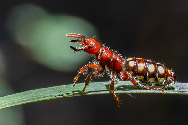
I went back around the other side of the large boulder to where Bob was finishing his lunch and told him he should see the wasp. When he had a look, he told me that there were two of them! The flightless female had been joined by a male.
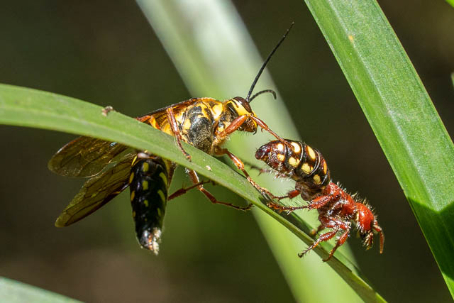
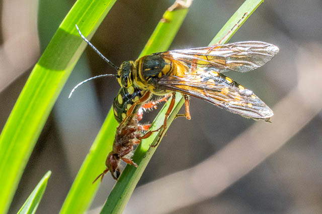
These wasps have been identified as Flower Wasps (Thynnus zonatus). Perhaps they are also pollinators of the orchid?
We walked back to Springwood via the Wiggins Track to Yondell Avenue and Bee Farm Road. The Wiggins Family, early residents of Springwood, were the apiarists of the Bee Farm and also involved in track building.
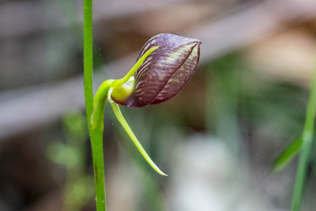
On the way, we found this Bonnet Orchid (Cryptostylis erecta)
This had been an excellent walk and turned out to be far more interesting than we expected.
Last week we tried the same walk. Got down to and crossed over Glenbrook Creek but we then found it slow going and it was a hot day. Returned to Woodford. Ha Ha. Did you stay on left true side? How far up from the Lagoon can you find the old track? How far from the creek is the old track most of the time? Any hints appreciated. Glad to find someone who has done it.
We stayed on the true left for almost all the way (the only place ewe may not have been on the left was early on where we followed the stream bed a bit.
The lower down track is so indistinct that it cannon be followed. We found one area of obviously stonework that showed that there had been a track. But that section is relatively easy going anyway.
I just noticed this track on Gaia topo (meters) – based on Open Street Map. All other results from the search were basically The Oaks firetrail. Except this!
Just wondering is the place with the nice waterfall and camp about 717654 on the Springwood sheet? Or 711651 – which doesn’t seem quite halfway (from the start of the “track” or from Woodford?) to The Lagoon.
I did not take a GPS log on the walk, but I think it was the more downstream of the two southern tributaries (Your first grid reference).
Thanks for that Dave. The lower creek has a spur coming down onto it so seems more likely. Less than an kilometer between the two anyway. So looking forward to checking this out. The rain is a bit annoying – I have crossed the threshold of needing to camp out and drying out all the gear after wet weekend.