
Bushwalking in the alpine areas of Tasmania is always very special. The weather can be challenging, so can the scrub and terrain, but the wild beauty is amazing. It is a privilege to return to some of the wild places in Tasmania and spend some time there.

On this walk, largely planned by Roger, we started from the Walls of Jerusalem and then walked off track along the Chinamans Plains. Then we planned to drop down to Lake Meston and walk out via Lake Adelaide. That is more or less how the walk turned out, except we left the Chinamans Plains a little early due to an ongoing bad weather forecast.

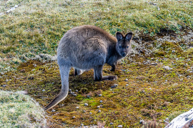
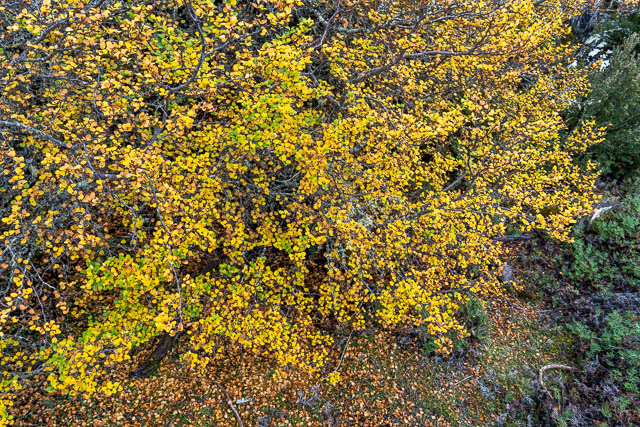
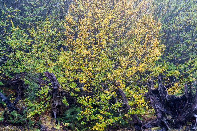
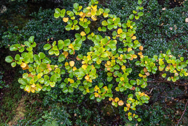
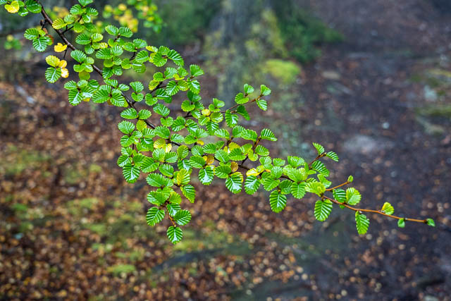
Along the Chinamans Plains and at Lake Meston we were fortunate to observe the “Fagus”, the native deciduous beech (Nothofagus gunnii) changing from green to orange. This is something exceptional to experience.
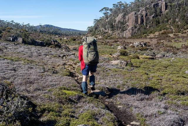
We drove to the Walls of Jerusalem carpark and were soon on the track to Trappers Hut. It was the last day of a long weekend, so there were a lot of walkers heading back in the opposite direction to us.

The day had started out misty, but as we climbed we were soon to of the mist into a beautiful clear sunny day. At Trappers Hut, we turned off the main track and walked up a rough pad to the Golden Gate. This is a nice alternative to the usual track via a series of lakes known as Solomons Jewels.
The Golden gate route offer some nice lakes and also some really nice alpine meadows that feature pencil pines and cushion plants.


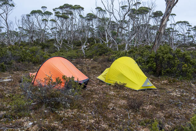
We walked past Lake Sidon and reached a smaller lake known as the Shepherds Pool where we looked around for a campsite.

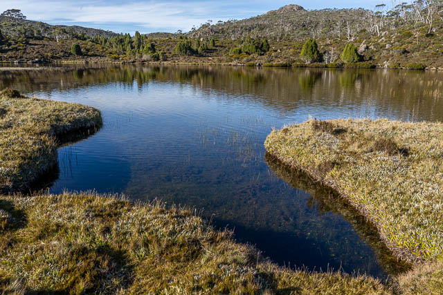
With a forecast for fine calm weather, we did not need sheltered campsite, so we set up our tents at a nice spot with great views of Mt Jerusalem.


Not far away was the pool.

I spent the late afternoon wandering around with my camera.


And I continued with my camera into the evening. The sky was nice and dark.


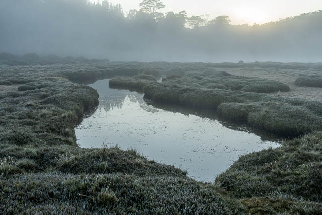
Dawn was calm and frosty. A light mist had formed over the pool. Again – more wandering around with my camera recording the beauty.


After breakfast, we reluctantly packed up and set off for our next objective.

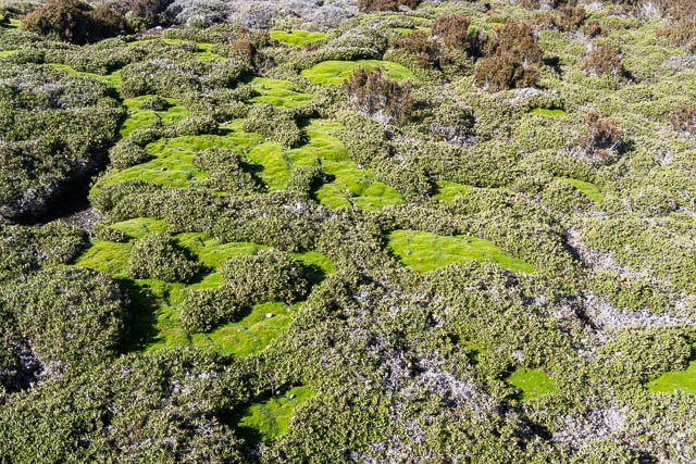
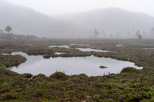
We were soon in the Valley of Hinom. I like the patterned peat bog at the bottom of this valley. We dumped our packs and explored maze of ponds – known as flarks and the land between them, which is known as strangs.


Further up the valley are some nice cushion plants.

At the top of the valley, we were on the track again. A few minutes later we were at the rustic Dixons Kingdom hut.

We kept on walking, along get track towards the central valley of the Walls of Jerusalem.

We camped in the shelter of some pencil pines and had lunch. We spent the afternoon climbing up onto the Temple and then wandering around the central valley.


Here is the Pool of Bethesda –


I was hoping for an atmospheric sunset from the Temple, so climbed back up in the later afternoon. I was a bit disappointed, as clouds obscured the sun. So I waited and was rewarded a little when some sunlight did appear.


That was the end of the good weather. The next morning, we set off and left the central valley.


We walked through the pencil pine forest back to Dixons Kingdom.

We then headed towards Lake Ball. Not far past the hut, we encountered some new duckboard.

The duckboard did not extend very far. It took us to some track workers who were building it. Not far past that we could see some newly built tent platforms. It looks like a major campsite is being constructed.


We continued down through the forest to Lake Ball. It was easy going following the marked out route for the new track.


At Lake Ball, we once again left the track and headed off track towards the outlet of the lake.

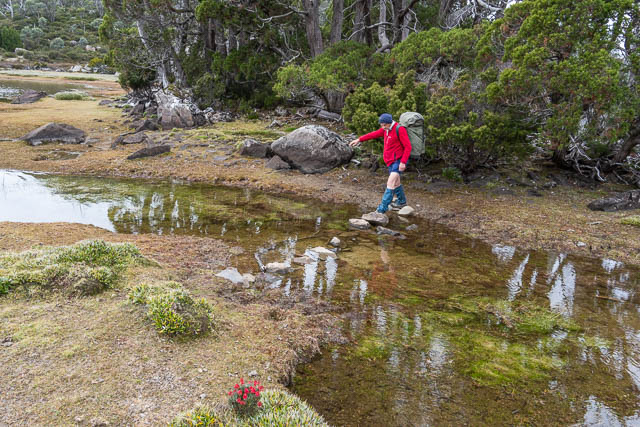
This time, we had no trouble crossing the outlet stream.
The route to the Chinamans Plains that I have used on previous trips, took us through an amazingly spongy forest. The forest floor was covered with a very tick layer of sphagnum.


Once through the spongy forest, we arrived at more more open moorlands.
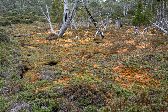
And we were soon at another place I wanted to revisit – a second patterned peat bog. More flarks and strangs.


More open going took us to the first large lake of the Chinamans Plains – Lake Nugara.


It was around the foreshore of this lake that we encountered the first fagus of the walk.


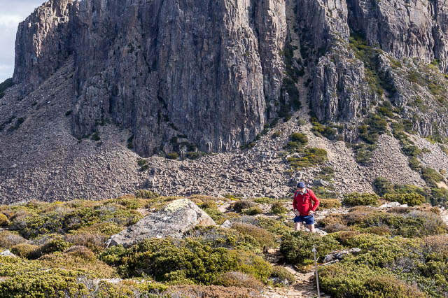
Leaning Lake Nugara, we encountered a short scrubby section as we climbed up onto a low hill. Once up, the country became more open. For bushwalking in this sort of country, it is valuable to have the 1:25,000 maps as they show the vegetation very well. By choosing a route that links up the white areas the going is relatively easy.

Rain was coming, so we decided to press on and have a late lunch in the shelter of our tents. This worked out quite well. We camped at a nice sheltered spot.

The next morning we set off again and soon arrived at Lake Toorah and some more fringing fagus. The rain was holding off.


It was nice to spend some time here.


One past Lake Toorah, we climbed up onto another hill. This hill not only provide excellent views of the whole area, it was also high enough to have a telephone signal.

We used our phones to get updated weather forecasts. I had bookmarks for forecasts for Triangle Lake and Lake Meston from the Norwegian Weather Service as well and a BOM forecast. They were uniformly bad. It looked like a spell of really bad weather was approaching. Rain and snow this time. After some discussion, we decided to shorten our trip and head down to Lake Meston earlier.

So we dropped off our high point and then headed to a small lake with a lot of peninsulas, where we hoped to camp. This lake was a short way from where we intended to descend to Lake Meston.
One at the small lake, we found a relatively sheltered campsite and also some nice fagus nearby.


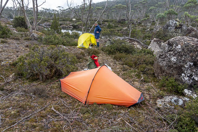
There was plenty of time to explore the area with my camera.


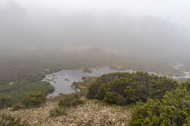
With bad weather forecast, we got up early and we were soon away. We expected the descent to Lake Meston to be the hardest part of the trip as it was likely to be scrubby. This time there was no “white sections on the map” we could link up. But the distance was short. It was quite easy to walk to the western end of out lake, and the next bit was also quite open. We intended to drop down to a triangle shaped lake about 1 km north of Lake Meston. We first tried going down the path of a small creek. These can be open, but this one wasn’t, so we left it and took to the ridge to the left. Slow going through scrub, but we seemed to be making progress. It was quite misty, so we navigated by compass, checking our progress every now and again with the phone’s GPS maps. But I think we were both a bit surprised when we broke out into open country. It had only been an hour and a quarter since we had left the campsite.

The mist was just as thick in the valley, and we could not actually see the triangle shaped lake until we got very close to it. Then we followed another compass bearing to where the track should be.
We did not see the track until we were about a metre from it.
Now wet and cold, we walked towards Lake Meston.

At the lake, we stopped for some photos.


And then about another 30 minutes walking to the hut.

The hut was cold and it was very dark inside. But at least it was out of the rain and quite dry.

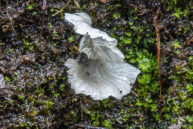
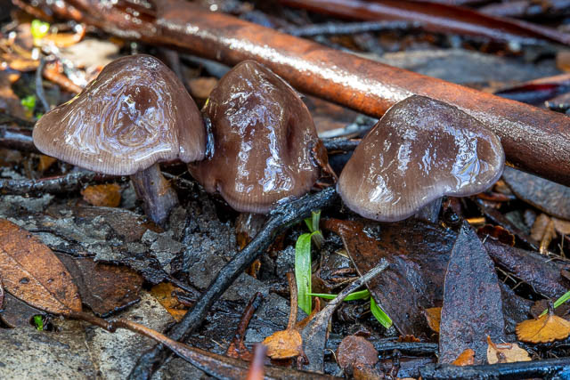
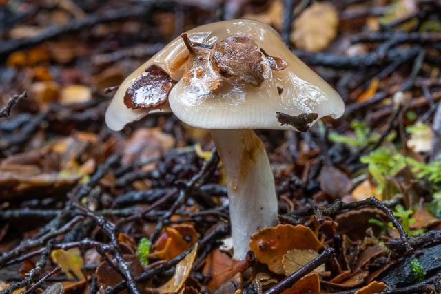
We decided to spend all the next day at the hut. That would allow is to sit out some bad weather and I was looking forward to wandering around looking for fungi. There was also some nice fagus near the hut.


And here is some of the fungi near the hut –


And with the rain, even the small streams were flowing well.


The next day, with more bad weather, we left the hut and headed to Lake Adelaide. Between Lake Meston and Lake Adelaide, there were some swollen creeks to cross.

The weather was too poor to be able to take photos for the rest of the walk. We walked around Lake Adelaide and then kept on going. Just north of Lake Adelaide, we found some more trackwork – several long sections of new duckboard. Nice to walk on in the wet conditions. They took us to the location of another new campsite. A new toilet was there. We had thought of camping on the way back, but instead decided to keep going. It was too wet and cold to stop for lunch or a rest. But it was not hard going along the fairly level country back towards the carpark where we had started our walk. At Trappers Hut, we did stop for a snack – that was our only break.
Down at the carpark, we were out of the wind and to was a lot warmer. We got changed and headed to Ulverstone.
So a quick end to our walk perhaps, but it was great to spend some time in this magnificent wilderness. Experiencing it in a range of weather conditions adds to our memories.