
Recent heavy rain in the greater Sydney area meant that a lot of the river were running high. Dan was keen to come up from Canberra for either a canyoning trip or for some packrafting. One of his suggestions was to packraft the Coxs River. It had been a while since I had been down this river so I thought it could be a good trip.
One problem was that the river gauge for the lower part of he river (Kelpie Point) was offline, so we didn’t really know the river level. The gauge on an upper part of the river at Glenroy Bridge (on the road to Jenolan Caves) indicated the river was up, but not that much. Some friends had packrafted the Grose River on the Friday, and reported quite high water levels.
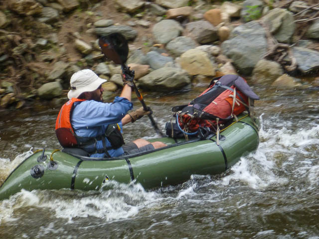
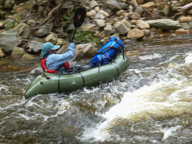
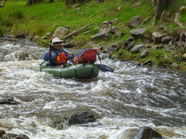
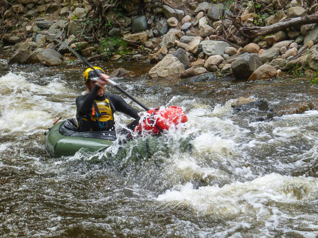
On a previous trip the level at Kelpie Point had been 0.35 m. On Saturday morning the level at Glenroy Bridge was 0.57 m (the steady level is around 0.5 m), and had been 0.59 m the night before. So the water level could be marginal. As it turned out, the river was not that high. It was up, but not that much, and even though the whole river was navigable in our craft, we often scrapped the bottom on the rocks. Dan inspected the Kelpie Point gauge when we arrived on Sunday and reported it indicated a hight of 0.28 m. But we still had a fun and very worthwhile trip. As well as Dan and myself, we were joined by Rob and John.
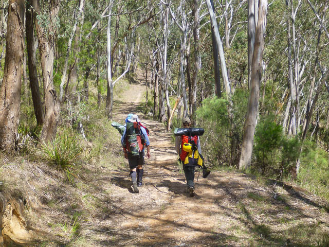
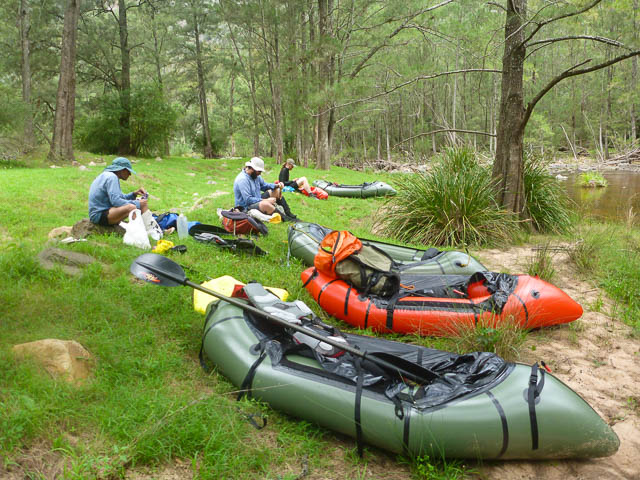
We started from the Dunphy Camping Area at Carlons Farm and followed the old Tinpot Horsetrail to the Coxs River near Flaggi Clear. This took about 2 hours. Then we inflated rafts and waterproofed our packs and set off downstream.
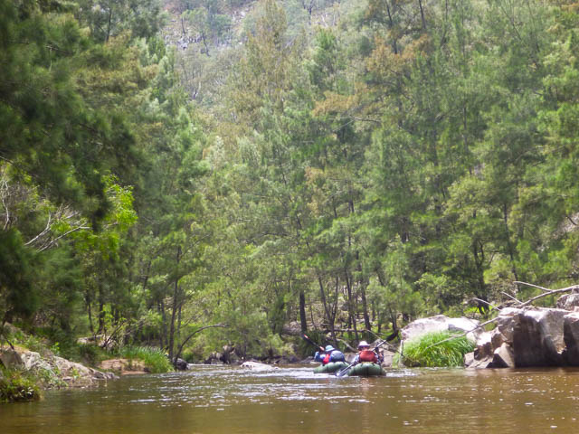
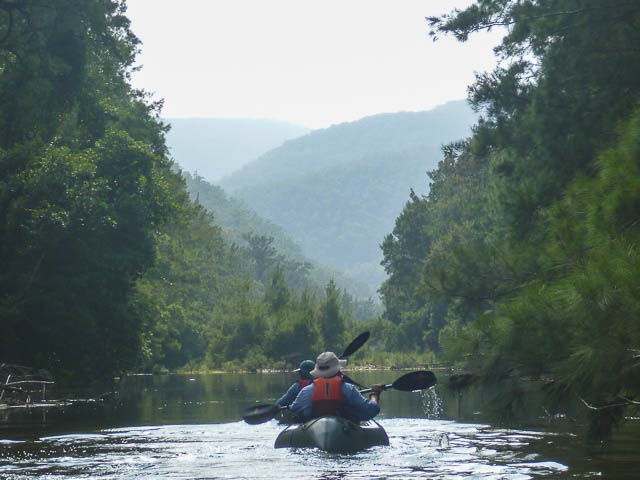
It was pleasant travelling downstream. We had set off on the water around noon, and had lunch a short way upstream of the Harrys River junction. We reached Breakfast Creek junction around 2:30 pm and arrived at Kanongaroo to camp around 5 pm. Not bad going given the relatively lower level.
On Sunday, we departed the campsite around 8:30 am and took a little less that two hours to arrive at Kelpie Point.
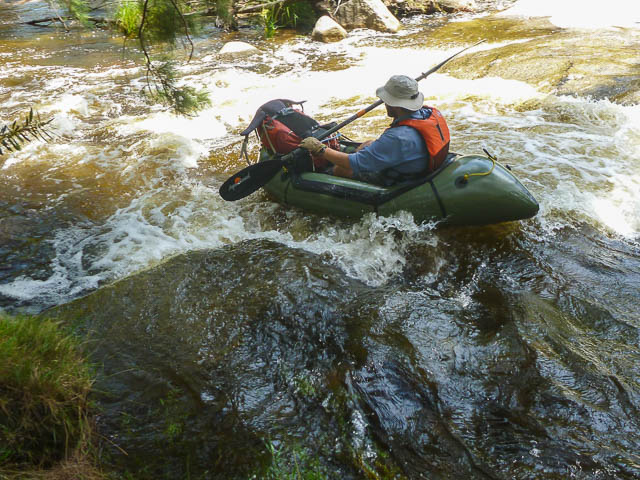
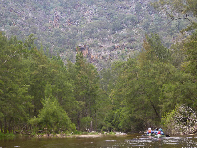
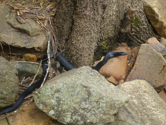
One of the highlights on a trip like this was the wildlife we spotted. Being on the river means you travel fairly quietly and you can sneak up on animals on the banks. We saw few kingfishers, lots of ducks, a heron and a sea eagle. I spotted what I thought was a platypus on the second day. We all saw a lot of carp in the river. On the banks we saw goannas and other lizards, one black snake (at a rare portage, to get past a fallen tree) – you would have seen a lot more snakes if you had been walking on the banks. We saw feral cattle and one feral pig.
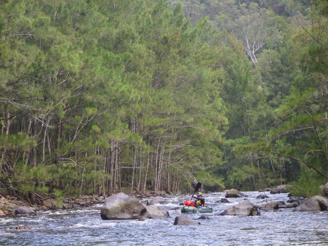
Probably the best thing on a trip like this is the journey through the wilderness. The river flows through some very nice gorges, and you can travel on packrafts a fair bit faster than walking and so enjoy a long section of river in relatively few hours.
At Kelpie Point, we packed away our rafts and then set off along the 15 km road bash back to the Dunphy Camping Area. It was a hot day and it was certainly a bit of a trudge back, particularly up the big climb up White Dog at the start. We stopped for lunch in the cool shade at Glenallan Creek.
More photos are online on my website here.
Fantastic!
Were there any rapids / drop-offs to be mindful of?
We encountered no major obstacles of danger. But rivers do change and caution is best. A log jammed in a rapid could be very dangerous for example.