
Doug had a a few days off work and wanted to do a walk and invited Bob and myself to join him. However, heavy rain on the weekend led us to change plans. Our original intention involved crossing some rather large creeks and that did not seem a good idea. So I had suggested the Blue Rocks area – in particular – a walk along part of the Wolgan-Capertee divide.
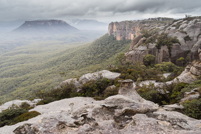
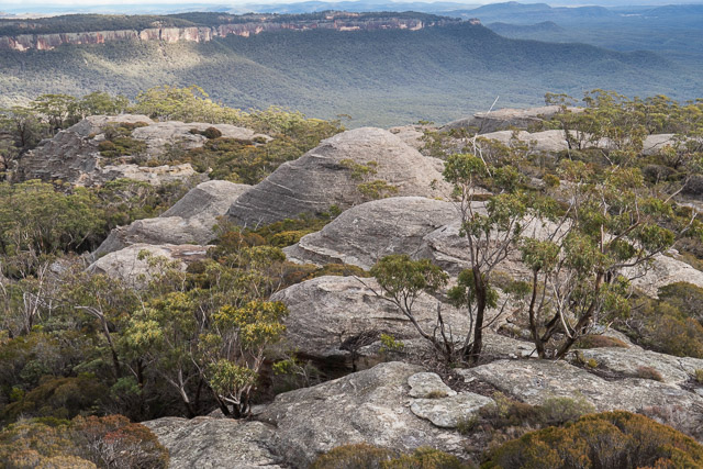
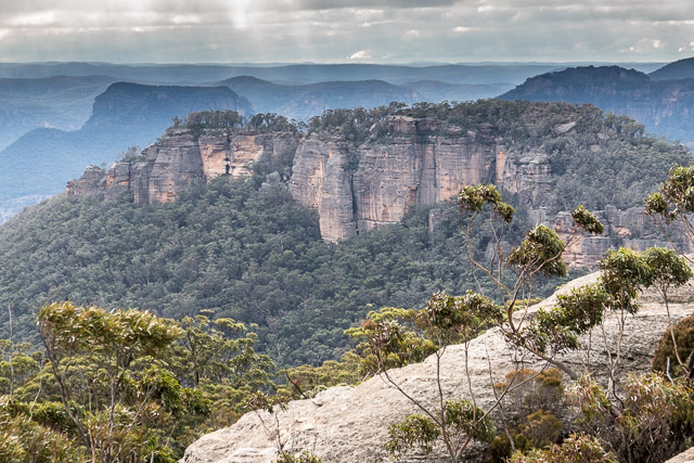
Looking towards Mt McLean. Gardens of Stone National Park is beyond the far ridgeline. The area we are looking at should be added!
This turned out to be a good choice. The weather over the two days was quite cold and windy and it was raining most of the first day. Along our route – there was a bit of shelter, a rough track most of the way and no scrub for the last off track part. Also, it was quite a short walk to a reasonable camp cave and from there we could do short walks to explore the country nearby.
The wet dull rather made the scenery a bit more dramatic and I think a bit better for photography than if it had been fine. However, keeping the camera and lens dry was a challenge.
Not long after starting out we reached McLeans Pass. This is a one of a series of chasms along the divide that must be crossed. McLeans Pass is quite a deep gap but is easy to cross. Also, within the chasm is a good cave, although it does tend to be a bit of a wind tunnel.
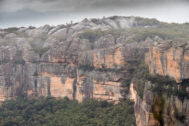
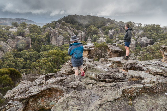
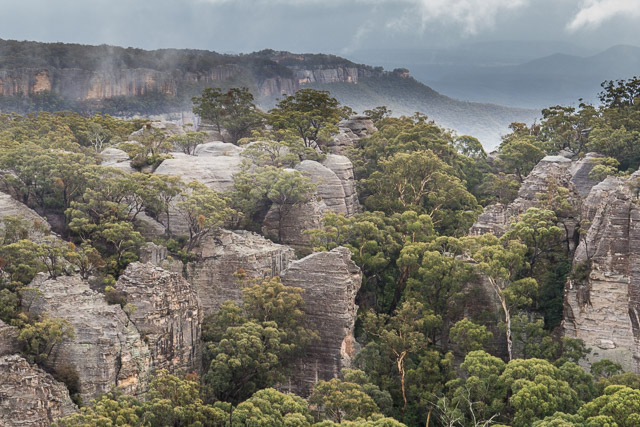
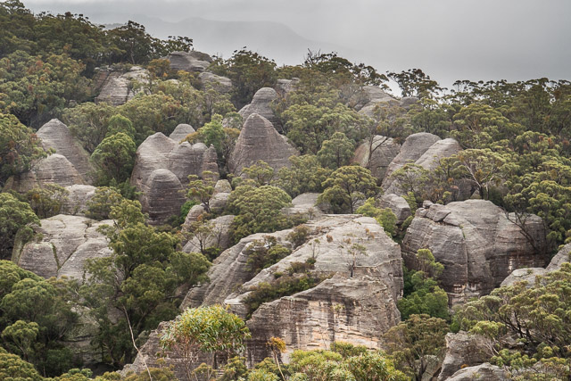
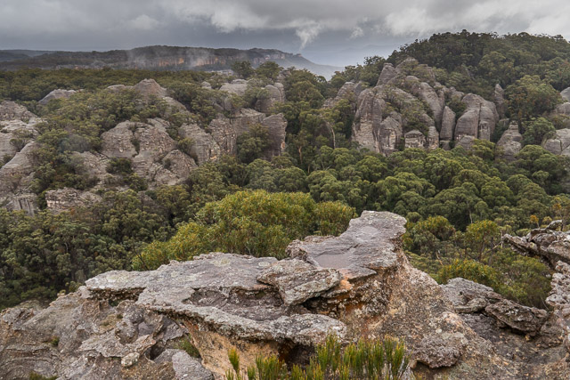
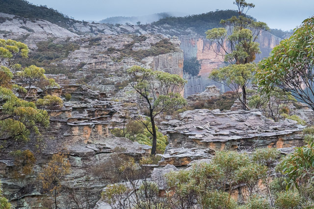
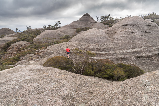
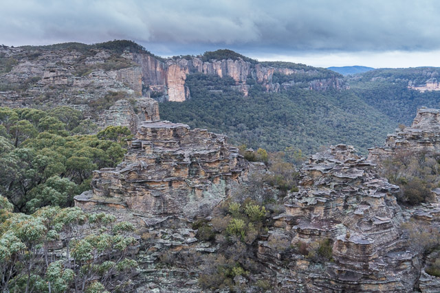
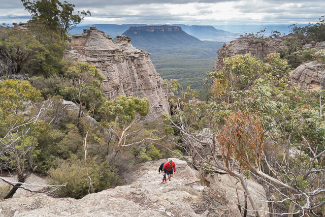
Then we continued on our eastward trek along the tops. As you proceed, the views seem to get better and better. The cliffs on the Capertee side are really spectacular. We soon reached the next chasm – an un-nammed gap, also easy to cross. Then climbing our we reached the remarkable “Exploded Pagoda” – an open rock slab littered with fragments of rock. To the north is the Capertee Valley with the sentinel of Pantoneys Crown standing out. Closer, and ion our plateau is a maze of pagodas – a virtual lost city. To the north east are a set of dome shaped pagodas near Point Cameron. Our destination was just before those domes.
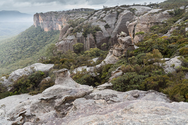
The faint pad we had been following soon ended and we the walked through open forest towards the Domes. Just before reaching them you cross an interesting open sandy area that looks like it was once underwater. This catchment drains to the north, but has been dammed up by a lot of debris – you need to climb over a small saddle and then you descend down to a small canyon. In the canyon is good water and at the head of it a small camp cave. That was where we camped.
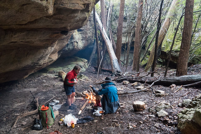
Despite lighting a good fire, the cave was a bit cold due to a swirling wind. Lower down, in the canyon was very windy. But the cave was at least out of the rain. After a late lunch, we explored some of the enable pagodas before returning to the cave to get out of the rain.
We explored a bit more the next morning. It was still very cold and windy, but not wet.
We returned back to the car the same way we had gone the day before. Nice walking despite the cold wind.
More photos are online on my website here.
Great post! This place looks amazing! Are there marked trails or some what of a well worn trail to follow? Where can we park our car?
Thanks
This is not a good place to visit unless you are fairly experienced as a bushwalker – and can navigate with map, compass, gps etc. There are a few fire roads and a few rough tracks – none of them marked on the map or signposted.