
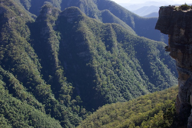
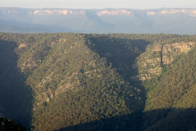
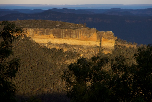
The Kowmung River is a declared wild river. It is one of only 7 declared wild rivers in NSW. It is also in a national park that has world heritage status. The Kowmung River and its valley is also a place of remarkable natural beauty. It would seem incredible then that the Kowmung River is under threat.
Twenty years ago, the Kowmung was under the same threat. The river then was in a national park, but the area then did not have world heritage status, nor was the river a declared wild river. A conservation battle took place – and the outcome then was the river was saved.
The threat twenty years ago the issue was the raising of the wall of Warragamba Dam by 23m. This is the threat that has raised its head again. The details this time are slightly different. The failure of the Warragamba Dam wall is no longer an issue, but flood mitigation remains. Infrastructure NSW has recommended that the dam wall be raised to provide a buffer to prevent major flooding on the floodplains downstream of the dam. For more information see the websites of the Colong Foundation and the Fat Canyoner.
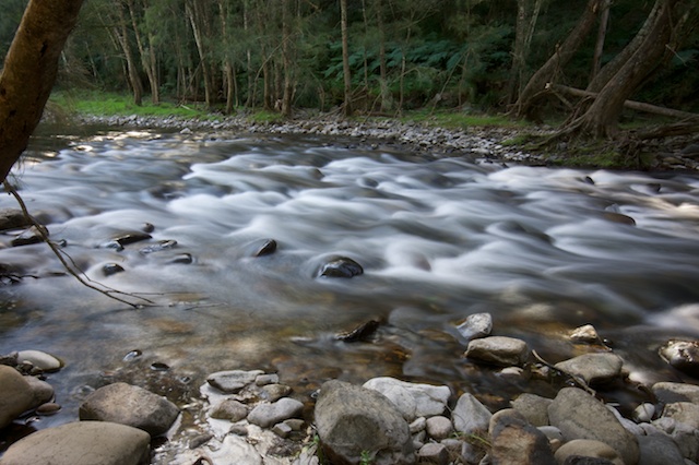
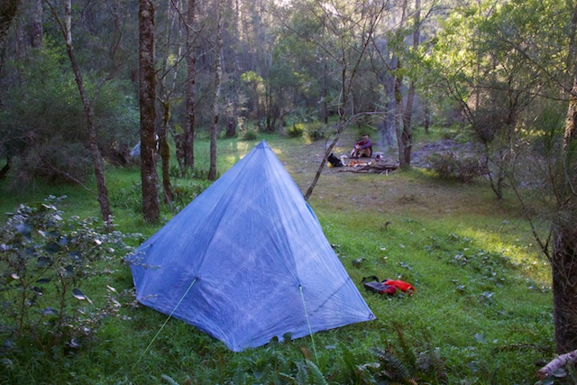
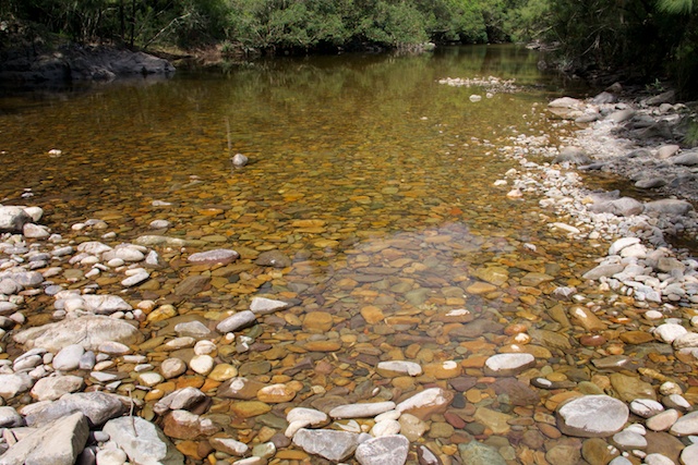
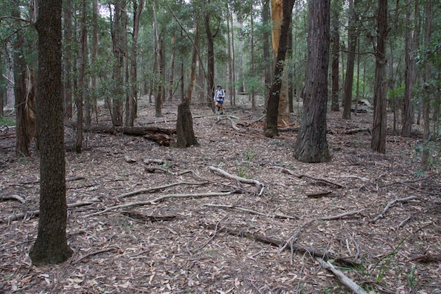
During Easter this year, I went on a walk with friend Rob to visit the lower Kowmung River. Its a place I have regularly visited on bushwalks during the past forty years. This time one of my goals was to obtain photographs of the river that could be used to help the campaign. It takes awhile to set up photographic equipment and to wait for the light to become suitable – and I thank Rob for his patience.
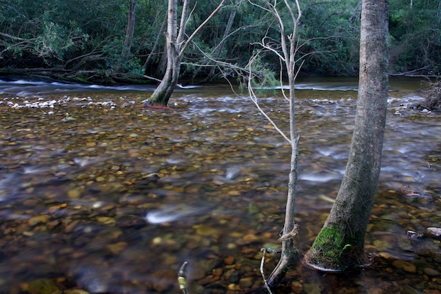
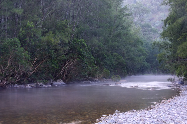
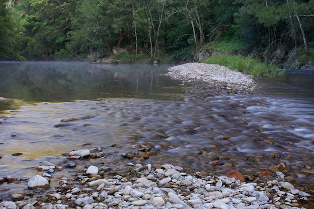
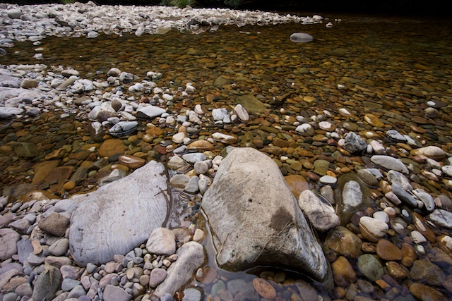
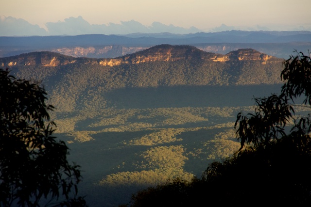
Our walk started from Kanangra Walls and then went via Gingra Range to the Kowmung River. Gingra is a long ridge, but is easy and fast walking along a good track, and we arrived on the river by mid afternoon. Walking down the river requires many crossings for the first section down to New Yards Range. Each bend of the river is best negotiated by following the inside bank.
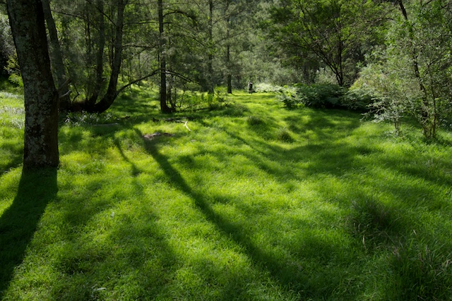
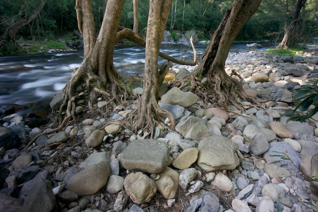
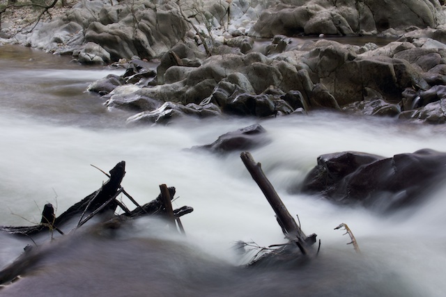
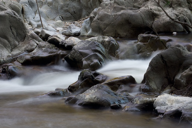
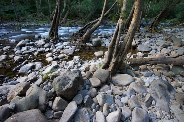
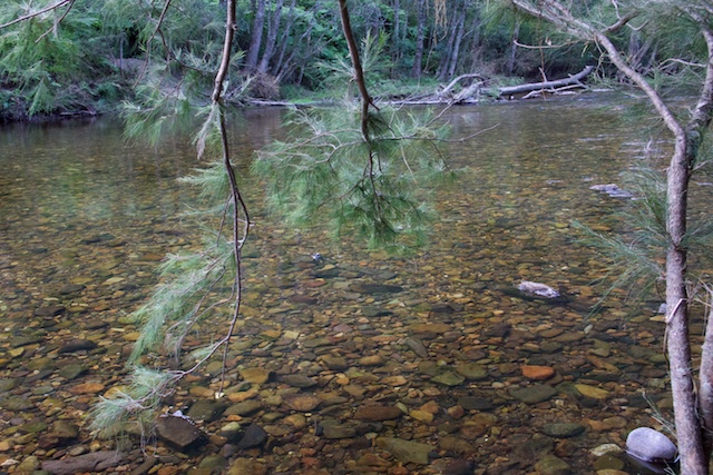
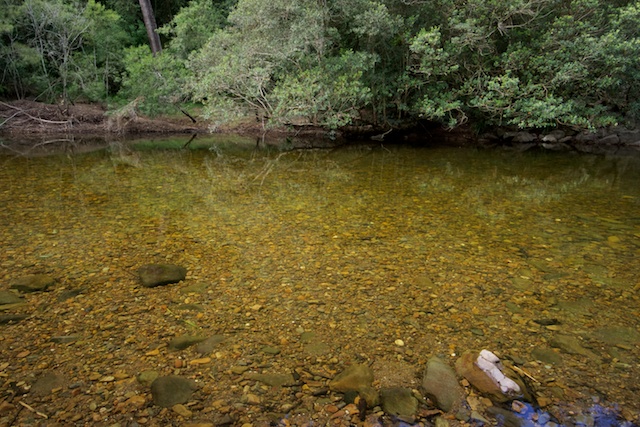
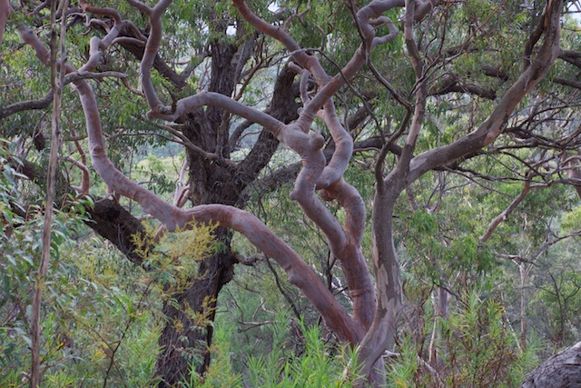
There are many great campsites on grassy flats nestled next to crystal clear pools in the river. Around Easter is not the best time for walking down the river – especially after a wet summer. There was a lot of regrowth on the banks. This seems to die away during winter leaving the banks clearer and easier to walk along. Crossing the river was easy and is best down at the shoals at the head of rapids.
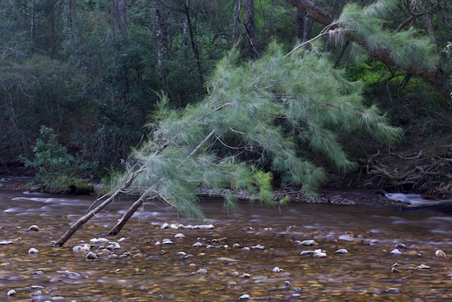
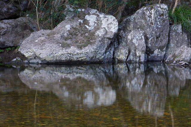
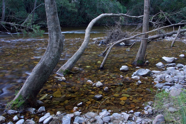
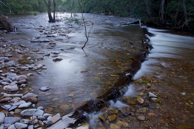
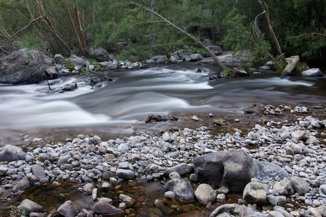
If the planned raising of the wall goes ahead – then all of this section of the Kowmung River is in danger of destruction. During major floods – the water will bank up to close to the Gingra Creek junction – and then the water will be slowly, over weeks, be allowed out of the dam. The riverbanks will be damaged. The river will be damaged. The wilderness will be damaged.
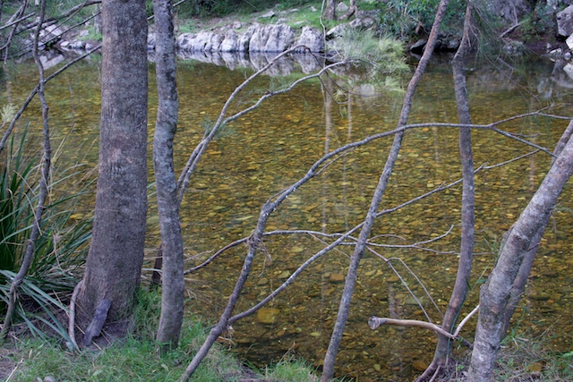
There was a little bit of feral pig damage on the banks which contrasted to many healthy huge wombat holes all the way along the bank. I have seen platypus in the Kowmung – but not on this trip. We did see a few snakes.
On the second day of Easter, we met some other bushwalkers at the base of New Yards Range. They had come down for a swim from “The Shack” huts used by Catholic Bushwalking Club members that are on the ridge above – a popular place to visit by that club at Easter. We had an interesting talk about the river and bushwalking routes.
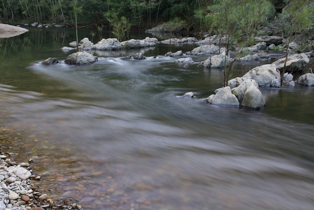
Our walk along the river finished at Ritson Elbow – a prominent bend on the river, not too far from where it joins the Coxs River and then the Coxs just downstream flows into the stored waters of lake Burragorang – the lake formed by Warragamba Dam.
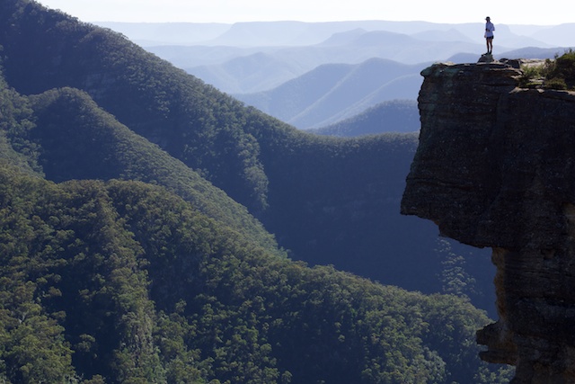
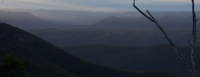
We then headed up onto Karil Mountain to the very open tops of the Low Gangerang Range. Once on the range itself – we headed a couple of kilometres out of our way to camp our second night at a spectacular lookout – Rigby Rocks.
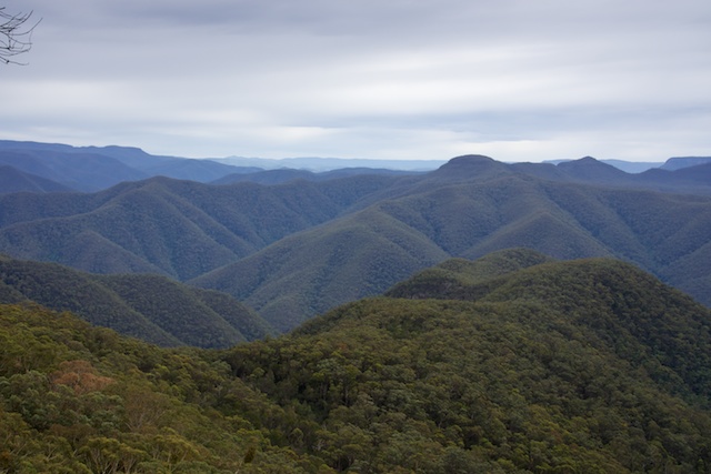
Day three found us traversing the Low Gangerang Range to Gentles Pass which provides an easy scramble up onto the plateau of the High Gangerangs. Then more open walking on the Carra Tops to join the track at Dex Creek. On our way we were surprised to see a fair bit of pig damage on these high and remote tops. We arrived for lunch at Dex Creek and jsut as we got there it started raining – so our lunch was quite quick! The off to Mt Cloudmaker and down to set up camp on Mt Stormbreaker. The campsite here is rather small and only offers limited views. But the rain had stopped and the sun came out at dusk.
Our walk finished with an easy half day back along the rest of the High Gangerang Range to Kanangra Walls.
For more photographs of the river see my gallery of Photos of the lower Kowmung River.
More photographs taken on the walk are online here (page 1) and here (page 2)
Please take action – you can write to the Premier via this page on the Colong Foundations website.
They will be a great promotion. Especially worth looking at is the panorama http://www.david-noble.net/bushwalking/Easter2013/Kanangra.jpg
Great photos Dave, I have sent a letter off to Premier.
Did you encounter many leeches on the knowmung?
There may have been one or two leeches – but no major problem.
Hi there David,
I have been following your many adventures to the Kowmung via the web and you seem to know it better than anyone. I am interested in hiking down there with a friend of mine but I am a little apprehensive due to the lack of track markings. Is there a book or resource that I should be purchasing that gives co-ordinates of various markjers/turns ?
Hello Greg
There are tracks down the major ridges to the Kowmung. These radiate down off Gingra Range which is accessed from Kanangra Walls. There is a track down the range – but it can be vague in places due to regrowth. There are some Komung walks described in the National Parks Association books (Bushwalks in the Sydney Region – Vol 1 and 2) – these were available from the NPA website (but I could not see them when I just looked). Try Paddy Pallins or the other bushwalking shops in Sydney or email the NPA. And you can looks at Tom Brennans site – e.g. http://bushwalkingnsw.com/walk.php?nid=735
Dave