
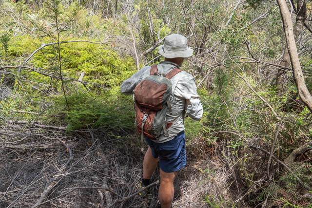
Bob and myself did a very interesting walk at Faulconbridge. Growing up in Springwood, I had visited Peggys Pool as a kid, but had never been back. It is a very short walk to he pool – only 400 m or so. But I had never been beyond – to the Blue Gum Forest or to Meeks Falls, further downstream. We planned to visit these places, and then do a second trip to try and locate some nearby Aboriginal art caves.
I can recall, on a local history excursion at School (Springwood High School) and on it being told that “Peggy” used to operate an illicit still in the area, and that the pool had been named after her. I have not been able to find any primary supporting evidence for this so far. What I did find, was from the Blue Mountains Geographical Encyclopaedia and from old newspapers. The land the pool is on, was once part of John Meeks’ estate – Everton.John Meeks was a MLA as well as a Sydney alderman, and Meeks Crescent is named after him. According to the Encyclopaedia, a walking track was constructed to the Pool sometime around 1886-99. A second, deeper pool was located a short distance downstream. The Encyclopaedia refers to this as the “Freezing Hole”. Searching for “Peggys Pool Faulconbridge” on Trove reveals a lot of identical Newspaper advertisements for blocks of land at Faulconbridge. As part of the sales pitch, the adds say the land is a short distance from both “Peggys Pool” and “Freeza Pool” The Encyclopaedia has the second one spelt “Fresia Pool” (this seems to be an error). I think the land sales people may have thought the name “Freezing Hole” would detract from sales, and so changed it to “Freeza Hole”.
This webpage written by Bob Tucker, seems to contain reminiscences of a visit to Australia in 1975. An acquaintance at Faulconbridge, Marea took him to the pool.
At the very bottom of the canyon was a superb waterfall and Peggy’s Pool, filled with icy water from that fall. Marea said that in the olden days when the nearby railroad was being built, a moonshiner named Peggy erected a still there, tapping the waters of the fall, and manufactured joy juice for the hardbitten gentlemen putting down the railroad. The railroad management were a bunch of puritans, insisting on a Clean and Dry work crew, but Peggy knew the men better than the managers
It seems to support what I was told a few years earlier at Springwood High School.
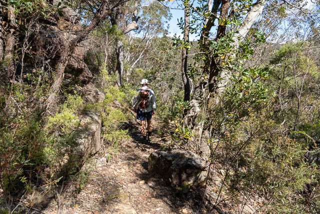
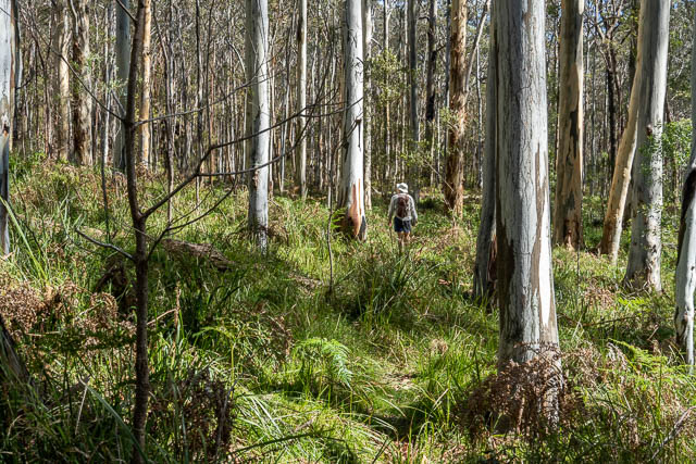
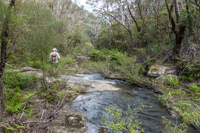
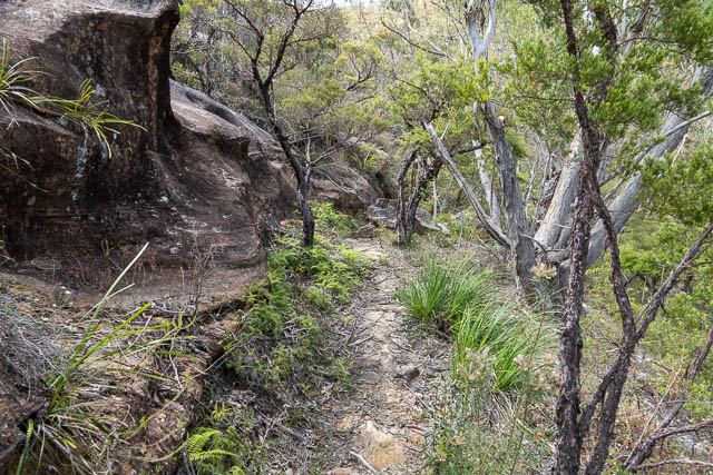
So Bob and myself arrived at Faulconbridge. Bob parked in Grose Road and we walked down Meeks Crescent behind the primary school. The start of the track is not obvious at all. There is no signpost. It starts opposite a child minding centre, and goes a few metres through weeds before becoming much clearer. In fact the rest of the track is quite good.
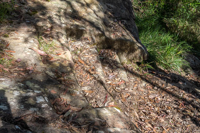
in some places we found old chiseled steps.
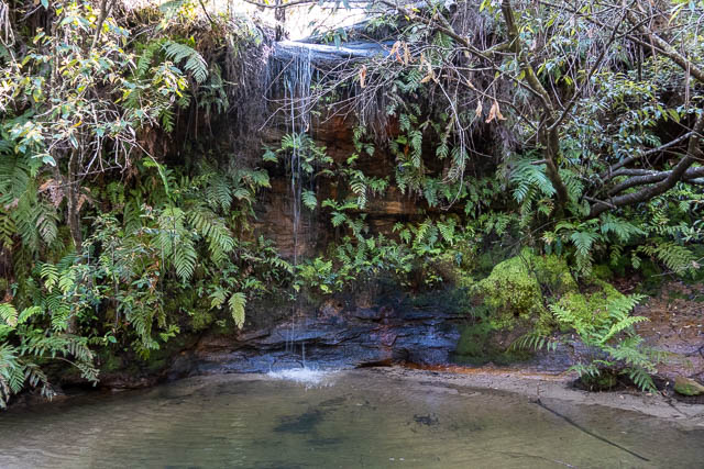
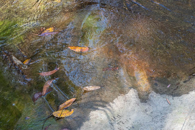
It did not take long to reach Peggys Pool.
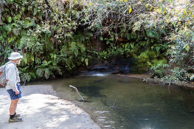
The pool is not deep and would be great on hot day for young kids to play in. Water enters via a waterfall about 5m high.
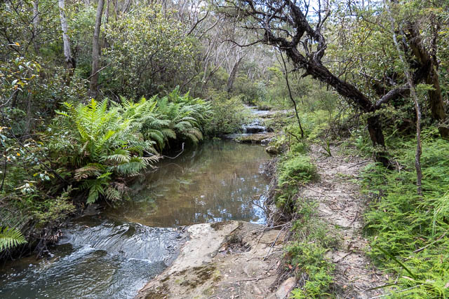
A short distance downstream, in the creekbed, are some Aboriginal sharpening grooves.
And near the grooves are some chiselled initials.
I can recall seeing another pool nearby. A deeper pool – which is probably the Freezing Hole. But I don’t remember if it was above or below the grooves.
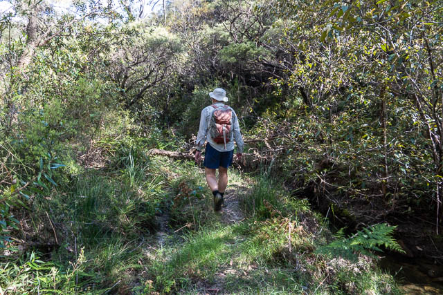
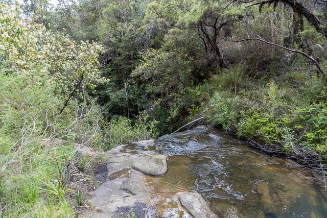
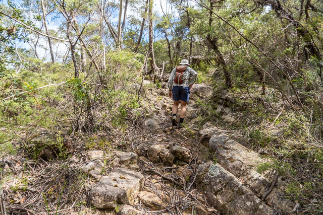
We continued downstream, along a rough track.
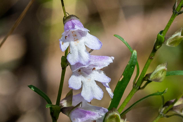
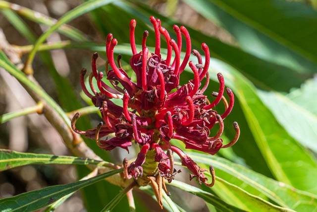
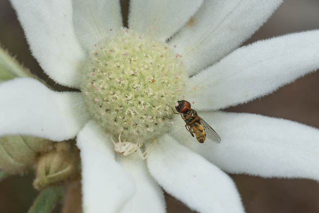
We passed many wild flowers. Here are some –
Bauera rubioides
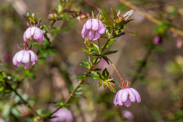
Prosanthera sp.
The Waratah was looking a bit past its prime –
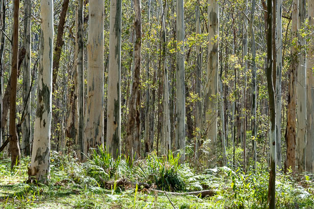
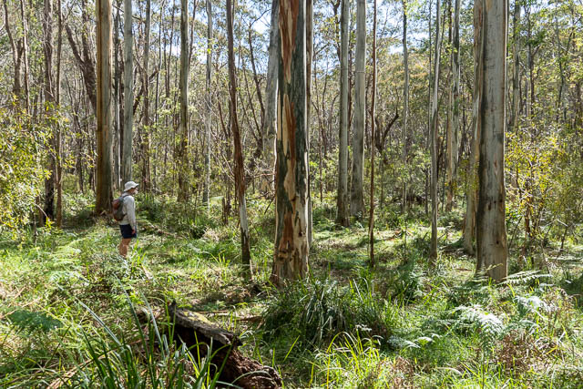
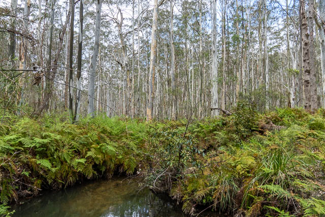
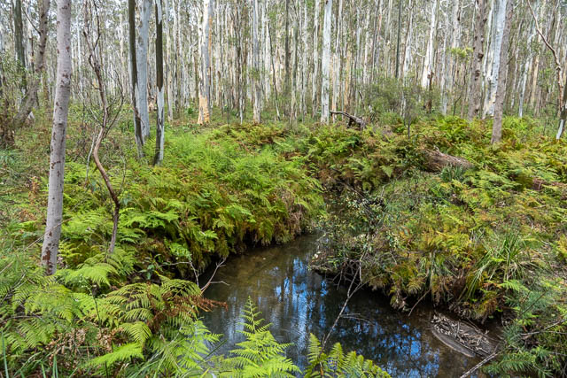
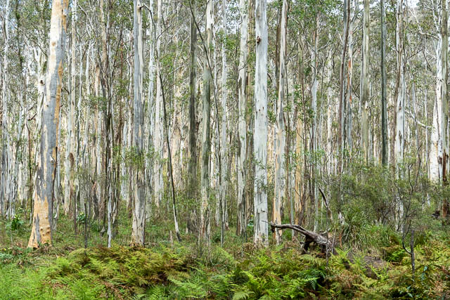
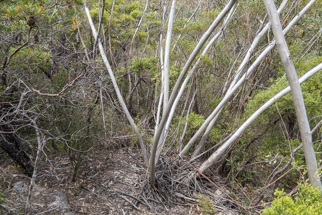
We soon arrived at the Blue Gum Forest.
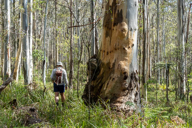
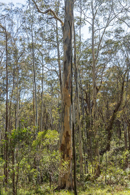
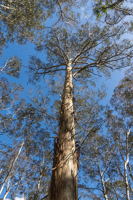
The trees are Mountain Blue Gums – Eucalyptus deanei, and the stand is truly magnificent.
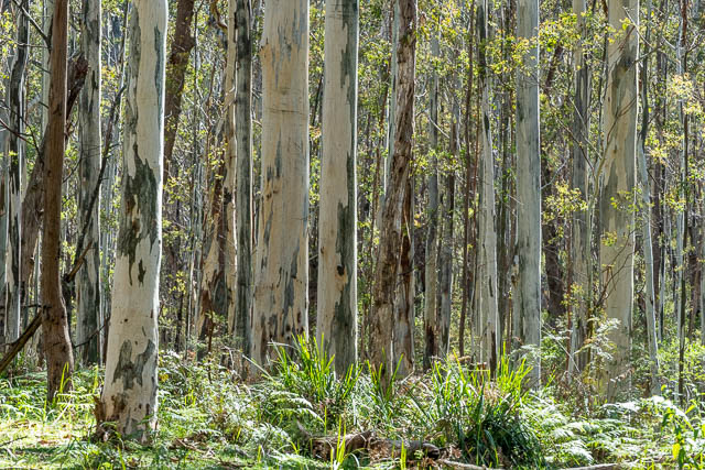
One would think that these trees would have once been logged. There is plenty of evidence of logging being carried out in nearby valleys – with old logging roads being found in the very upper section of Glenbrook Creek near Linden, and another valley that was logged and the logs taken out by a funicular railway further to the west in Faulconbridge. Perhaps it was logged and these trees are all new growth?
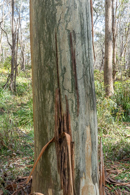
On the tree below you can see the characteristic marks on the bark made by Red Triangle Slugs –
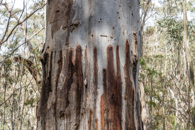
And this tree has a series of holes – a feeding station made by sap eating gliders –
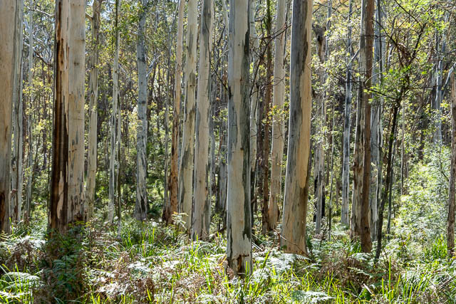
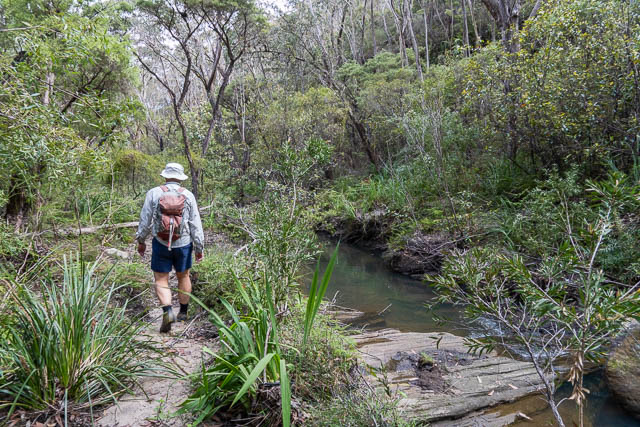
We took our time walking through this impressive forest. We then followed the same rough track downstream.
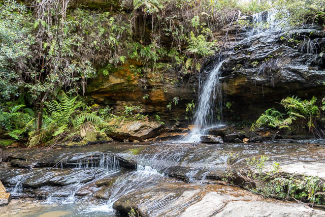
We soon arrived at the top of Meeks Falls.
To get to the bottom of the falls, we followed the track, it went along a cliffline in a westerly direction, and then descended via a small side gully. It was here that we found evidence of old stonework. The original track must have gone down at least this far.
Meeks Falls are nice, and would be worth visiting after heavy rain. The whole waterfall would be about 6 – 8 m high.
We then headed back upstream, along the same track, back to the Blue Gum Forest. From there we planned to exit up to Grose Road near the Quarry, via a track on Open Street Maps.
We found the track, and then crossed the creek.
A last look back down the forest. The track started looking more like an “old road” than a track. This supports the idea that the valley was once logged.
When we reached Grose Road, we passed a sign saying it was private land. Checking on the Blue Mountains Council online map – it seems that the whole walk was on private land – the pools, the forest and the waterfalls. I do not know what the current status of the land is. I would think it would have development caveats at the very least. I know the Blue Mountains Conservation Society have proposed the land be added to Blue Mountains National Park. I would certainly endorse this.
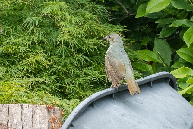
Walking back along Grose Road, Bob spotted a Satin Bowerbird in a front yard –
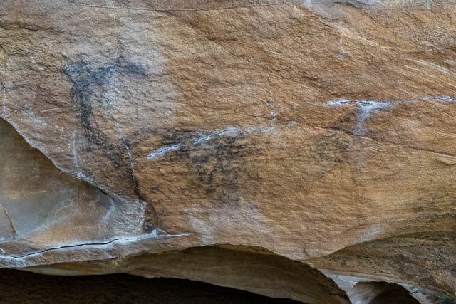
Back at Bob’s car, we had plenty of time for another short walk. This was to reach for some Aboriginal art caves. The sites had been recorded by an amateur archeologist, Warren Bluff, back around 1993, and featured charcoal art.
Bob had researched these sites and had a good idea where they were.
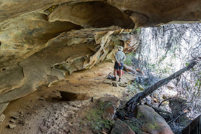
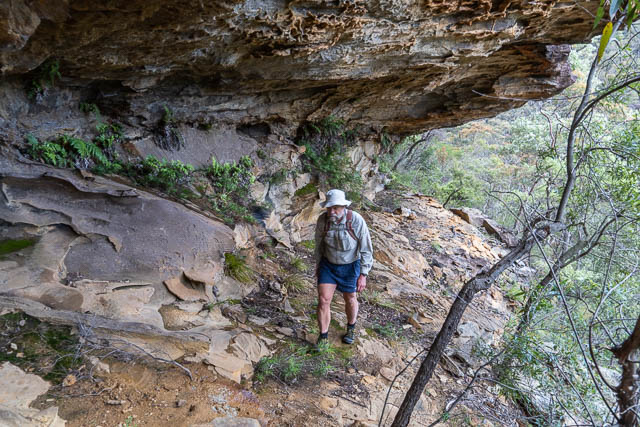
So we walked to along an old fire road, then down into a valley, across a swampy creek, then we could start searching for overhangs and checking them out for art.
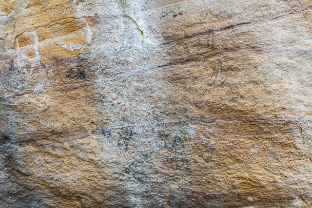
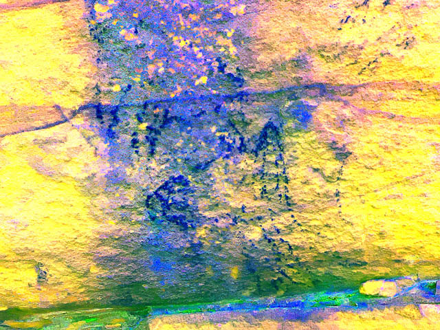
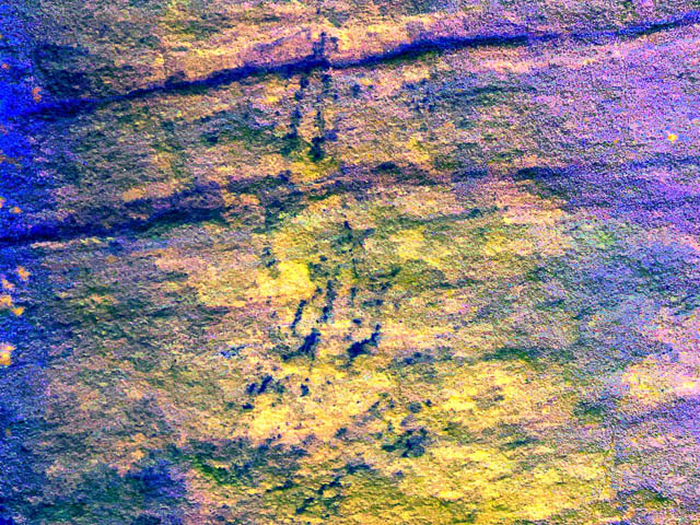
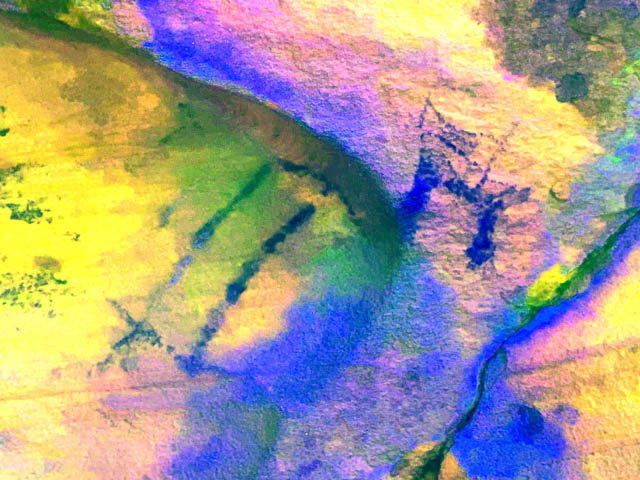
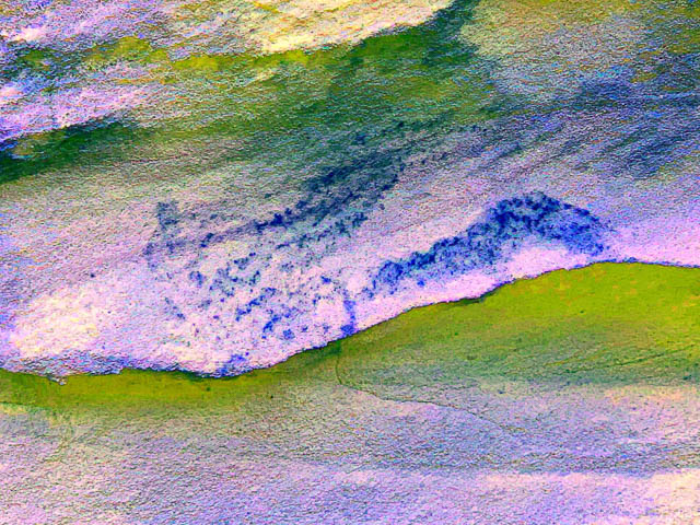
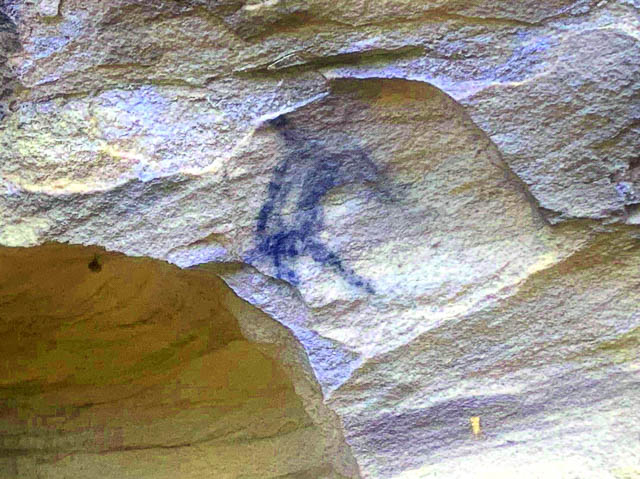
We located the first cave, just below a waterfall in the small creek. It had several charcoal artworks.
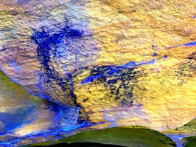
I used a phone app – iDStretch to enhance the art –
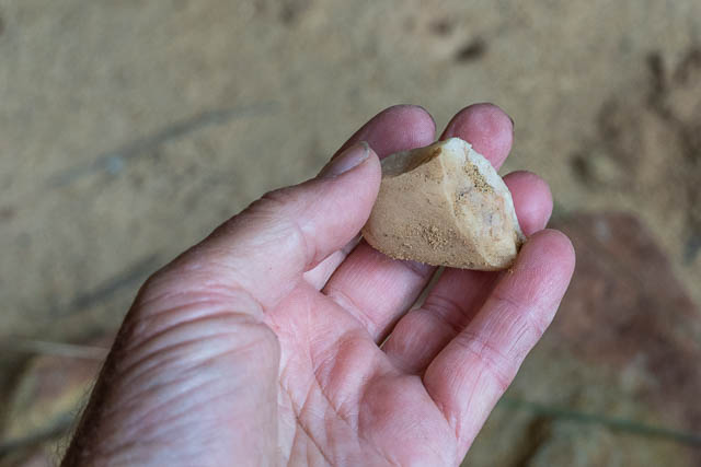
We also found this possible stone tool –
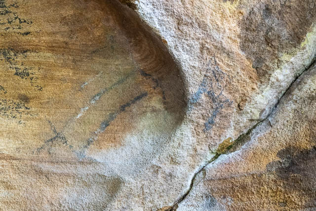
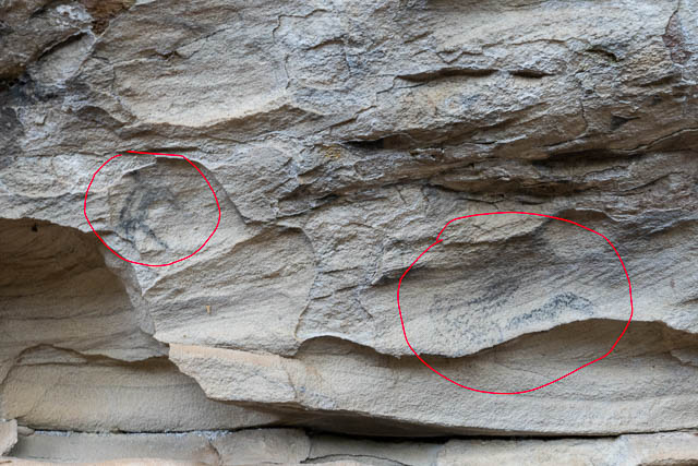
We then looked for the second cave, which was not too far away from the first. It had two small charcoal art drawings –
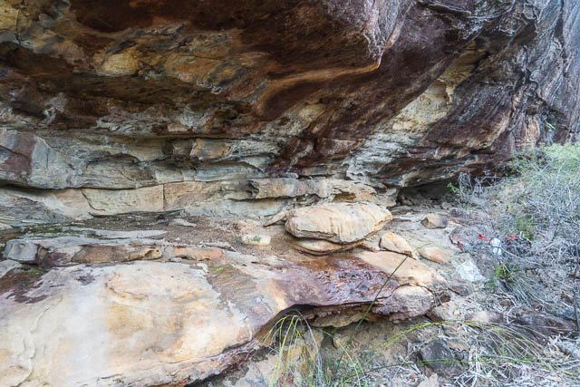
And on the way out, we checked out a few more caves, but found no more art.
This had certainly been a very interesting walk. Neither of us had visited the “Faulconbridge Blue Gum Forest” before, and it was certainly both very beautiful and also quite remarkable.
I stumbled across this walk myself a few weeks ago and that Blue Gum forest is just magical.
Some of the old real estate ads refer to a “Fresia Pool” – “https://trove.nla.gov.au/newspaper/article/16767769. Nice work finding the Bob Tucker article!
It seems your photos are missing? – I came to this page after doing a walk yesterday (March 6th, 2024) from the Shirlow Ave firetrail to Peggy’s Pool/Meeks Cres. There was a track marked on OpenStreetMaps but I could only discern a path at the ends, although some trees had been marked with pink ribbons on the descent from the firetrail and for a little way into the valley. I was keen on trying the route from Peggy’s to Grose Road next, hence my visit. Thanks for the info/description, but it’d be nice if the photo links were fixed. Cheers!
The photos are there – but there is a problem with them not loading for some browsers (eg Chrome). You could try a different browser – or change your browser’s security settings.
Wonderful, blog post and collection of images that capture this special place . David are you aware this land has recently been listed for sale by the private owner and is being marketed for its development potential (several blocks). In this brief window between listing and auction on 18 June 2024, the community are campaigning for it to be acquired by NPWS. Our Facebook page with links to the petition is here https://www.facebook.com/groups/faulcomalleeridge/
Thank you again for documenting this place and its incredible natural and cultural assets. This site is deeply loved and respected by the community of people who live around it.