
Bob and myself were keen to revisit Bonnie Doon at Katoomba for a better look. We had both visited the area twice recently – the first trip being a reconnaissance to see if we could find the old tracks, and then a follow-up trip when Nellies Glen was reopened and that allowed us to do a through trip on the old tracks from the bottom to the top. This new trip would give us an opportunity to look a bit more carefully.

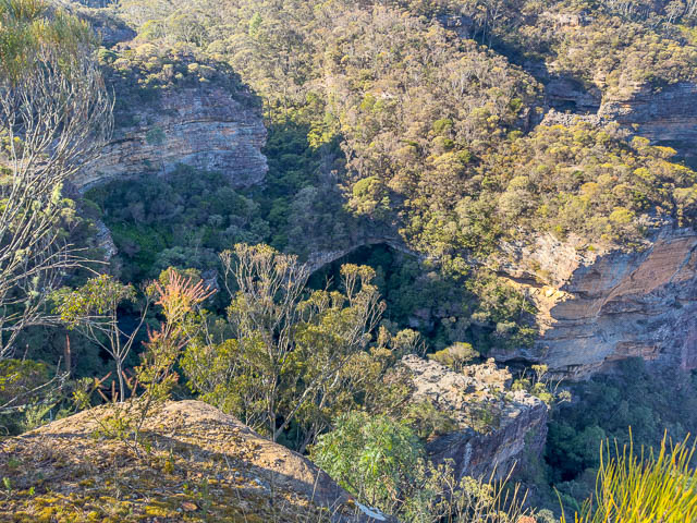
We first walked out to North Lookout and admired the fine views. Looking down we could see Bonnie Doon –
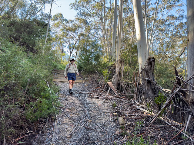
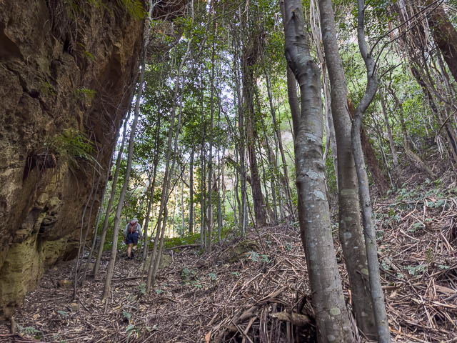
We then walked down the Six Foot Track into Nellies Glen (Megalong Cleft).
We first went all the way down to the last waterfall in the series of waterfalls known as Bonnie Doon Falls. This one seems to be called Ethel Falls –
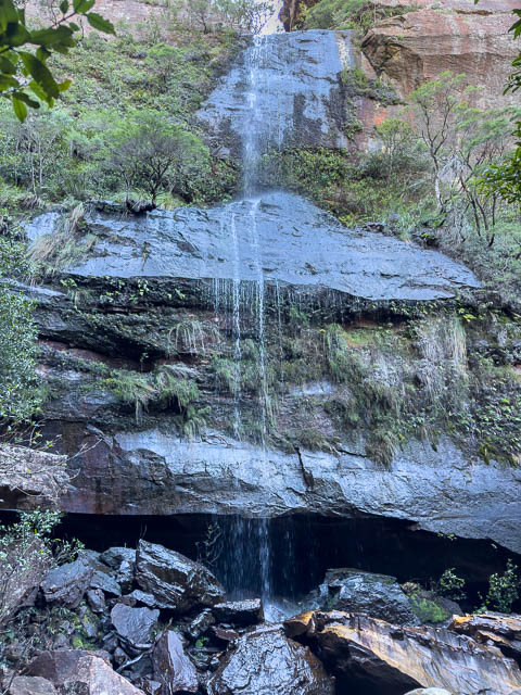
It would be worth returning to see this waterfall in high flow. We then walked back up the track and started looking for the ledge that has the route of the old Bonnie Doon Track. But we started off on a ledge a little too low. It didn’t connect up with anything.
Then we found annoyed ledge that looked like the right one.
But this took us to a tricky exposed section that we did not remember.
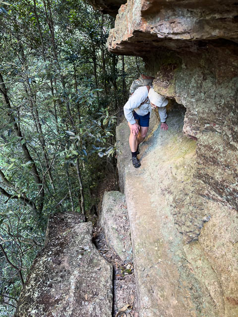
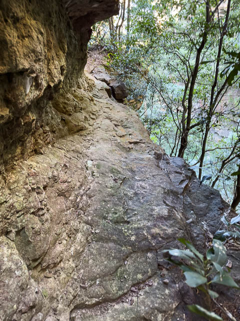
And that ledge stopped around the corner. On out third attempt we found the correct ledge. We had to cross a bit of swampy ground and then there was the ledge. Once on it – it is very easy.
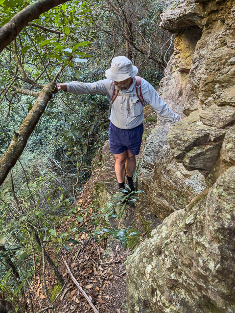
And around the corner it leads to easier ground, about level with the top of Ethel Falls.
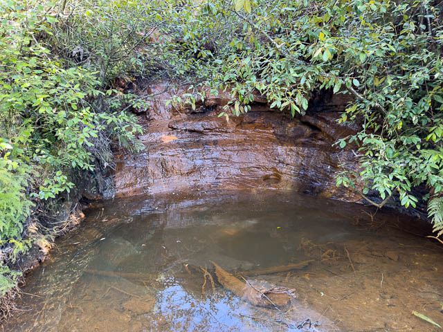
We then scrambled down to the creek. This gave us a good view of the next waterfall upstream of Ethel Falls. This is Brides Veil Falls.

Next to it is large cave –
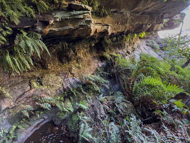
The proximity of the cave fits in with the description of the waterfall published in 1898 (see the Blue Mountains Geographic Encyclopaedia for the reference).
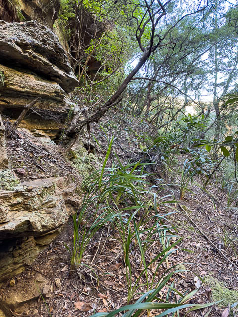
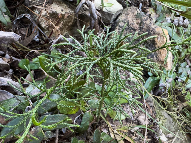
There are supposed to be some Blue Mountains Dwarf Pines in this area, and we ddi spot some small pine looking vegetation. But I think they may be Lycopodium.
We then scrambled up the creek to the base of the next waterfall. This is more of a cascade than a waterfall – and is formed when two creek join.
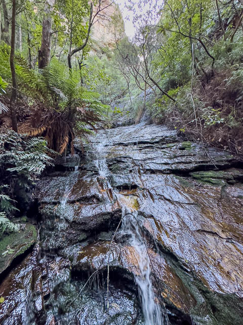
A short way up, you can see the two individual creeks –

The creek on the left – looking up has another waterfall further upstream and you cannot climb out via that creek. But the key to the route – is going up part way – then crossing the cascade at mid level and then traversing around to the right hand creek that does off a passage.
But does this waterfall have a name? Could it be the actual “Ethel Falls”. This description from 1894 describes –
Ethel Fall, a lovely cascade formed by the union of two mountain streams. There is a remarkable echo here, the word shouted being distinctly repeated three times.
So Ethel Falls is described as a “cascade” – which this waterfall is. The lowest waterfall is more of a waterfall than a cascade. And this upper waterfall is at the union of two mountain streams. So could it be Ethel Falls? Perhaps, but I think the most likely Ethel Falls is the lower waterfall near the Six Foot Track. The reference has “by” rather than “at” the union of the streams.
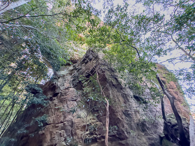
We then climbed up to the base of large detached pinnacle.
The pinnacle has a rope hanging down –

It looks quite tricky to climb –
In this area we found some old bottles and cans. Probably thrown down from North Lookout which lies directly above.
We then traversed back to the gully and reached the cascade crossing point.

This is the spot where there is an old curved metal spike embedded into the rock. It is about 1m to the right of Bob in the photo below –
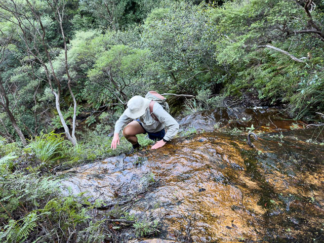
This crossing could be dangerous, and great care is needed. But it is OK in low flow, and there are old cut steps to use.
On this branch of the creek is another waterfall higher up –

On the previous trip, we had to force our passage through a section of ferns. It looked like others had been this way since out previous trip – as there was a lot of scuffle marks and a more defined route than the one we had made.
We knew the way from here to the top – following short way up the second creek – on ledges, and without crossing it, to reach an easy ramp that provides passage through the cliffs to reach the track above.
One on the track, we followed the site track up to the old brickworks. This took us past the swamp we had found on the first walk –

We wondered if this had been a water supply dam, or perhaps a clay quarry that had become flooded?
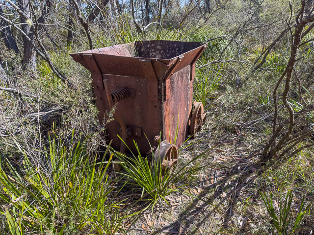
A little further along is this old skip –
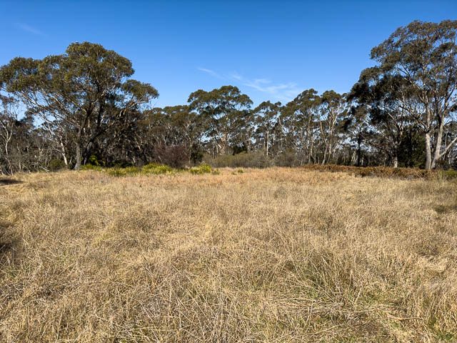
And this nice sunny open area, probably the location of the brickwork, was a good place to stop for lunch.
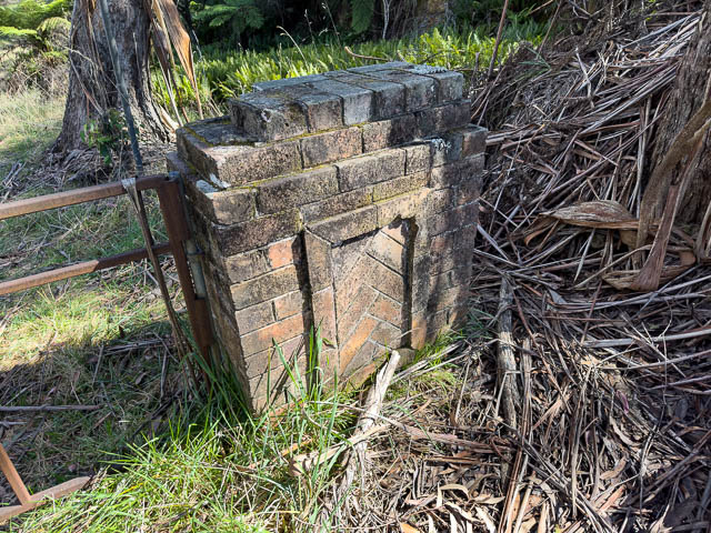
And on the highway are these old brick gateposts –
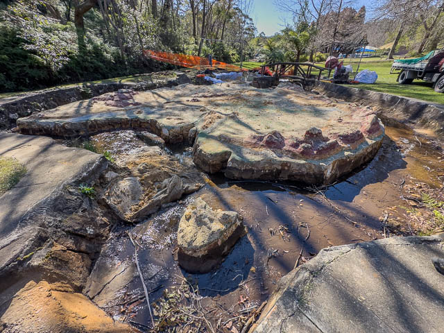
Having plenty of time, we stopped off at Lawson Pool – to look at the model of Australia –

There were workers here fixing up the stones.
Further up the valley is a waterfall – known as “Tom Tit Falls” (or sometimes “Tom Thumb Falls”). It would be impressive after rain –
And lastly we stopped off at the old castellated tower ruin near the station.
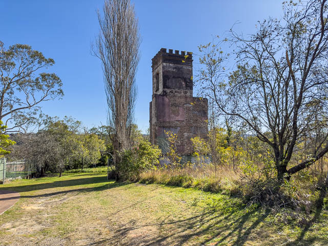
Some of its history can be found in this article.
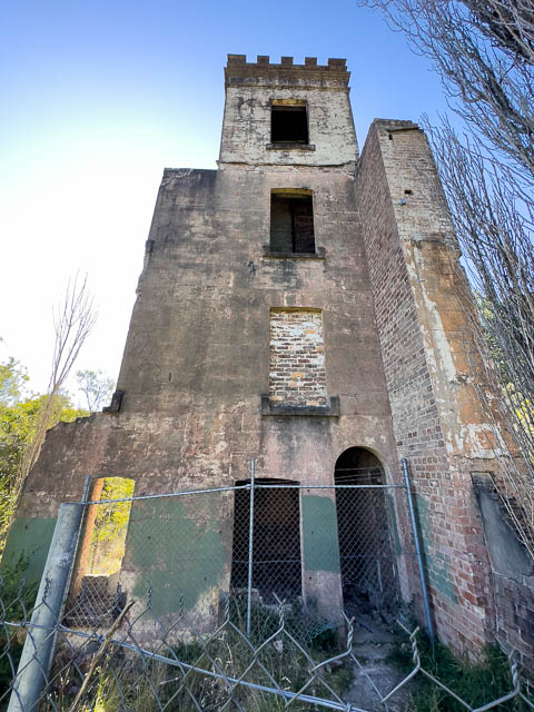

The tower is on the site of Jose Hay’s cottage. It was part of a larger building. Once a Mechanics Institute and then a girls school until a fire. The building was demolished except for the tower.
Hi Dave.
A wild theory, but the freestanding pinnacle with the abandoned rope you found, could be the “Dry Sherry Pinnacle” climbed by the Rhum Dhu of the SRC in the 1950’s. In Bryden Allen’s 1963 guide it has a description. Bryden had it marked further south, but he clearly hadn’t done it, and likely had 2nd hand information.
“A short climb and probably not worth the walk. Details are forgotten.”
Standard: V Diff (this is long before Ewbank!)
Start: On the right of a nose just before the waterfall (could be describing almost anywhere in this area!)
1. 50′ Start on a block and up to a tree belay
2. 70′ Climb diagonally to the right up a small groove through an overhang (crux) to the top
Hi Dave,
On March 23rd, we were able to climb the pinnacle. It is indeed quite tricky – a chossy and poorly protected trad lead of grade 17/18 if free climbed. I can provide information for anyone who wants to climb it.
After some inquiries, the owner of the rope has been discovered. Unfortunately it is not a historical relic – but from a modern climber about 10 years ago! The route is almost certainly not not “Dry Sherry Pinnacle” either. The previous party didn’t actually go to the summit, so we might have been the first. We found no cairns or other evidence on top – except some more glass likely thrown from the lookout.
Cheers.