
I caught an early train to Blackheath. My goal was to walk down to the bottom of Govetts Leap and then around the Rodriguez Pass circuit via Junction Rock and back up to Evans Lookout and back to Blackheath.
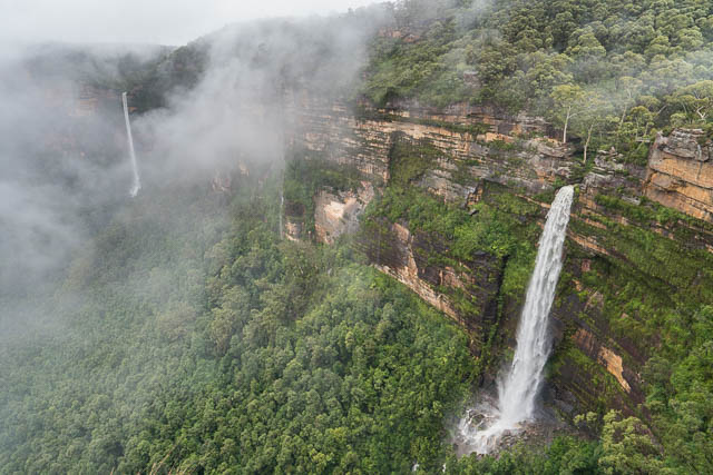
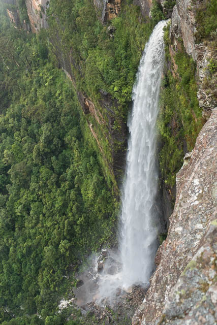
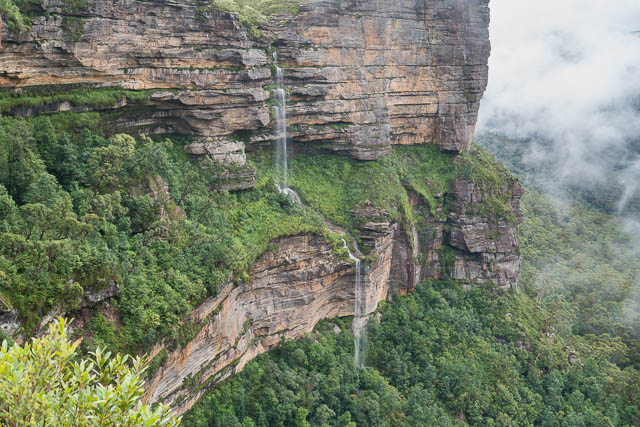
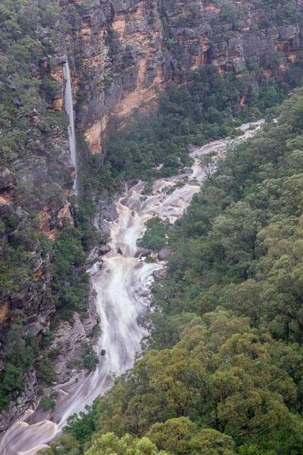
When I arrived at Blackheath at 8:30 I noticed that it had been quite wet. I was also greeted by light rain. I walked from the station down to Govetts Leap Lookout and sought refuge for a while in one of the shelter sheds. It was wet and foggy and I could not see a view, let along any of the waterfalls. I continued down the track to the base of Govetts Leap. On the descent, it did clear and I was able to get some photos of Govetts Leap. The flow was quite high, which made for spectacular photos of the waterfall, but it could present problems lower down with all the creek crossings needed for my intended walk.
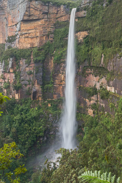
Govetts Leap
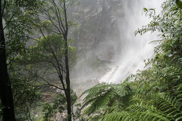
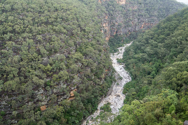
At the base of the falls, it was like a hurricane. I could have crossed the stream, but thought that lower down may present some problems. Also, one of the crossings at Campbell Falls on the way up to Evans Lookout is also tricky and dangerous in high water. So I retraced my steps back up to the lookout.
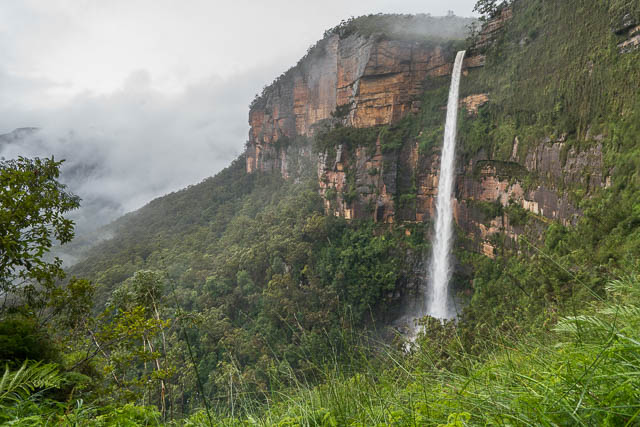
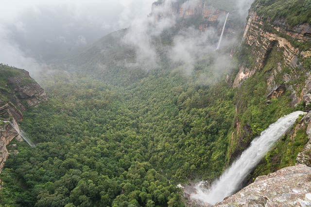
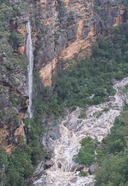
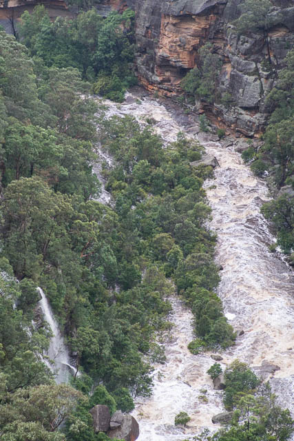
I next continued along to the top of Horseshoe Falls. These falls, along with Govetts Leap must be the highest in the Central Blue Mountains. Both fall from the top of the cliffs right to the bottom without interruption. Most of the other waterfalls like Katoomba Falls, Leura Falls and Wentworth Falls do the drop in two stages, with cascades on the half way ledge.
Horseshoe Falls
I took a few photos of Horseshoe Falls, then walked upstream the short distance to Taylors Falls. This waterfall on Popes Glen Creek is only a metre or two high.
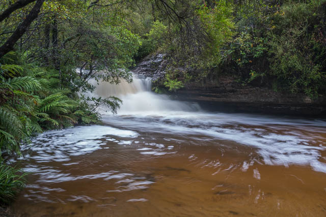
Taylor Falls
I crossed Popes Glen Creek with some difficulty (I had to wade across) and continued on the track towards Pulpit Rock for a few hundred metres to some more lookouts for more views of the large torrent going over Horseshoe Falls. In the past these falls have also been known as Left Hand Falls and also have been called Piguenits Falls.
Govetts Leap have also been called Bridal Veil Falls, and are signposted to state that, but I think Govetts Leap is the correct name. Note that “Leap” here means waterfall, not to any rash action made by William Govett, the early surveyor of the area.
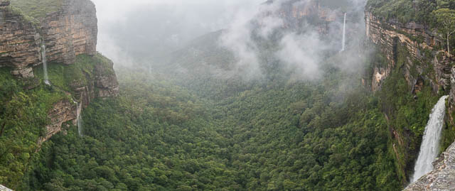
The lookouts to the west of Popes Glen Creek provide a good view of both Horseshoe Falls and Govetts Leap. They are very similar both in height and flow. Further west along the cliffs were another set of waterfalls – unnamed.
Most of the time on my walk, it had been raining. This made photography challenging and also the track was a bit wet underfoot to say the least!
I headed back to Govetts Leap Lookout. I then walk to the top of Govetts Leap and back to the town via the Braeside Track.
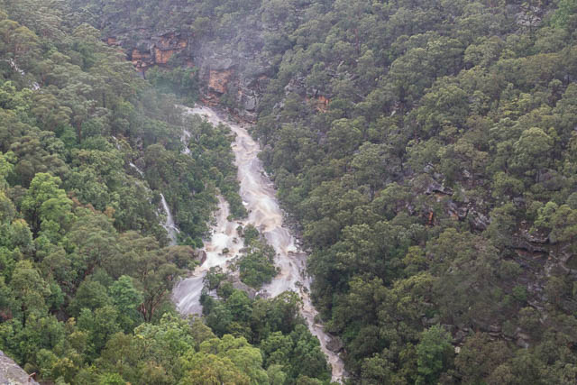
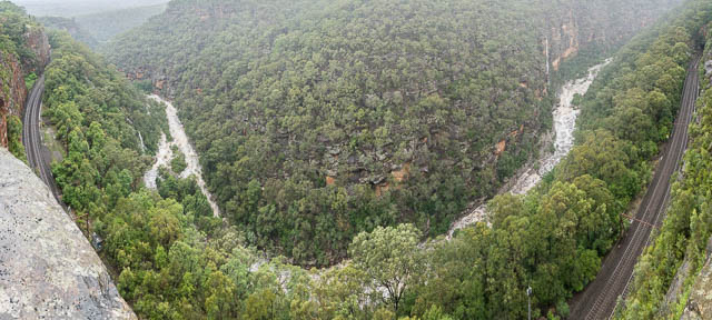
Back at the town, I got changed out of my wet clothes and waited for the next train towards the city. On the train home, I noticed just before the Glenbrook Tunnel that Glenbrook Creek was very high, so after the tunnel I look down into Glenbrook Gorge. It looked very spectacular. The creek was in flood and also Moorakoo Falls were flowing. Usually these falls are dry, so to see them like this was quite special.
Glenbrook Gorge
I considered getting off at Lapstone and walking back up to one of the lookouts overlooking the Gorge. I was a little slow however, and was still checking the rain radar on my phone. It was raining outside. But but he time the train got to Emu Plains I had checked the rain, it should soon pass over, and seen that there was a train in 20 minutes back up the mountains. So I got off the train, and caught the next one back up to Lapstone. Then I quickly walked up the back streets of Lapstone and then on the track to the lookouts. On the way I had to wade across a normally small creek – this was tricky. Then I had to push through a lot of wet bushes to the lookouts above. It was worth doing all this – the view was spectacular and Moorakoo Falls were still flowing quite nicely.
Moorakoo Falls
Rather than return the shorter distance to Lapstone station, I was not too keen on all the wet bushes and that creek crossing again, so I continued to Glenbrook shops and down to the station. Then back on the train once more.
More photos from the day are online on my website here for Blackheath Waterfalls and here for Glenbrook Gorge.
Great photos and scenery !! Makes me want to go down for a visit !
Awesome. Thanks for sharing.
Sitting looking at parched grass here is so contrasting to those conditions.
The mist adds to the beauty.
David,
I am the discoverer and namer of Moorakoo Falls. 🙂
This occurred in 1982. I used to commute by train between Springwood and Central and was returning home one evening when I glanced out the window of the train and there, across the gorge, was the waterfall, which had appeared after several days of rain.
I reported same to the Lands Dept. in Sydney, received a reply which advised that it would have to be surveyed and verified. This subsequently happened and I was asked to suggest a name. My response was to the effect that perhaps something in the local Aboriginal dialect “by the rain” or similar might be the most appropriate.
It wasn’t until 1984 that I received advice from the Geographical Names Board that approval had been granted and the naming gazetted. It had taken several checks of the location over a year or so to make sure that the waterfall always turned up after a couple of rainy days.
I was also advised (in face-to-face conversation a little later) that, although my name was not made public, I joined a small group of still-living people who had discovered a natural feature in the Blue Mountains.
Yours are the only photographs which I have ever seen of “my” waterfall!
(I came across your blog whilst searching for information for my life story, a project which my daughter prompted me to write several years ago.)
Thanks for that information on the origin of the name of the falls. I would dispute that you were the “discoverer” of the falls – as they would have been seen by many commuters on the Blue Mountains trains and also be the railway workers who constructed the tunnel and deviation. But only during periods of very high rainfall. I can recall a friend remarking to me about a huge waterfall falling into Glenbrook Gorge after an extremely heavy rain event back in March 1978 when 12 inches of rain fell in three hours over that area. Also – the waterfall is very close to the Glenbrook Gorge rock climbing area – and climbers knew they couldn’t climb in that area after rain as too much water would still weep down the cliffs. This was told to me by climbers who climbed at the gorge in the 1960’s and 70’s. As well – there are Aboriginal sites close to that area and they certainly would have known of the falls too. For thousands of years. But I certainly would not dispute that by naming the waterfall that you helped to bring it to the public’s attention – as the name is on the current topographic maps. The waterfall name is not well known however – because it is only evident after heavy rain – and then it certainly becomes very spectacular indeed. There are lots of other waterfall that fit into this category in the Blue Mountains – especially on the big cliffs above the Jamison and Grose Valleys. Some of these waterfalls are named, but many are not.
Sorry, David…..you can’t rain on my parade, mate.
Many others may have seen them over the years but nobody got off their backsides and contacted either Lands Dept. or the GNB. If they had done so then a name would have been on maps a long time before I did anything about following it up.
Hey Bruce. That’s actually a helpful reply from David, giving the historical context and not at all disputing you gave the name on the current maps. Might be worth thinking about the context for your memoirs, just so they sound informed. Thanks, David, for all this interesting background and the very useful analysis of ‘discovery’.
So using that definition of “discover”, then from the time that the Dutch hit Western Australia and Cook later sailed up the eastern coast, nothing has been “discovered” because the Aboriginals had seen it all before.
Thanks, Molly. I understand it now.